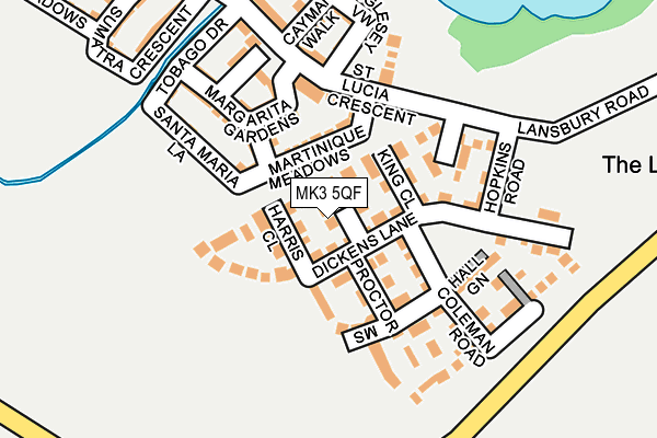
MK3 5QF is located in the Great Brickhill electoral ward, within the unitary authority of Buckinghamshire and the English Parliamentary constituency of Buckingham. The Sub Integrated Care Board (ICB) Location is NHS Bedfordshire, Luton and Milton Keynes ICB - M1J4Y and the police force is Thames Valley. This postcode has been in use since August 2014.


GetTheData
Source: OS OpenMap – Local (Ordnance Survey)
Source: OS VectorMap District (Ordnance Survey)
Licence: Open Government Licence (requires attribution)
| Easting | 486714 |
| Northing | 230889 |
| Latitude | 51.969720 |
| Longitude | -0.739152 |
GetTheData
Source: Open Postcode Geo
Licence: Open Government Licence
| Country | England |
| Postcode District | MK3 |
➜ See where MK3 is on a map ➜ Where is Bletchley? | |
GetTheData
Source: Land Registry Price Paid Data
Licence: Open Government Licence
Elevation or altitude of MK3 5QF as distance above sea level:
| Metres | Feet | |
|---|---|---|
| Elevation | 90m | 295ft |
Elevation is measured from the approximate centre of the postcode, to the nearest point on an OS contour line from OS Terrain 50, which has contour spacing of ten vertical metres.
➜ How high above sea level am I? Find the elevation of your current position using your device's GPS.
GetTheData
Source: Open Postcode Elevation
Licence: Open Government Licence
| Ward | Great Brickhill |
| Constituency | Buckingham |
GetTheData
Source: ONS Postcode Database
Licence: Open Government Licence
| St Helena Avenue | Newton Leys | 573m |
| Lomond Drive | Bletchley | 999m |
| Tulla Court (Fern Grove) | Bletchley | 1,128m |
| Fern Grove | Bletchley | 1,478m |
| Arrow Place (Lomond Drive) | Bletchley | 1,489m |
| Bletchley Station | 2.9km |
| Fenny Stratford Station | 3.7km |
| Bow Brickhill Station | 4.9km |
GetTheData
Source: NaPTAN
Licence: Open Government Licence
| Percentage of properties with Next Generation Access | 100.0% |
| Percentage of properties with Superfast Broadband | 100.0% |
| Percentage of properties with Ultrafast Broadband | 100.0% |
| Percentage of properties with Full Fibre Broadband | 100.0% |
Superfast Broadband is between 30Mbps and 300Mbps
Ultrafast Broadband is > 300Mbps
| Percentage of properties unable to receive 2Mbps | 0.0% |
| Percentage of properties unable to receive 5Mbps | 0.0% |
| Percentage of properties unable to receive 10Mbps | 0.0% |
| Percentage of properties unable to receive 30Mbps | 0.0% |
GetTheData
Source: Ofcom
Licence: Ofcom Terms of Use (requires attribution)
Estimated total energy consumption in MK3 5QF by fuel type, 2015.
| Consumption (kWh) | 71,186 |
|---|---|
| Meter count | 8 |
| Mean (kWh/meter) | 8,898 |
| Median (kWh/meter) | 9,115 |
| Consumption (kWh) | 27,569 |
|---|---|
| Meter count | 8 |
| Mean (kWh/meter) | 3,446 |
| Median (kWh/meter) | 2,752 |
GetTheData
Source: Postcode level gas estimates: 2015 (experimental)
Source: Postcode level electricity estimates: 2015 (experimental)
Licence: Open Government Licence
GetTheData
Source: ONS Postcode Database
Licence: Open Government Licence


➜ Get more ratings from the Food Standards Agency
GetTheData
Source: Food Standards Agency
Licence: FSA terms & conditions
| Last Collection | |||
|---|---|---|---|
| Location | Mon-Fri | Sat | Distance |
| St. Lucia Crescent | 17:30 | 12:00 | 382m |
| Serpentine Court | 17:30 | 12:00 | 1,507m |
| Laidon Close | 17:15 | 12:00 | 1,692m |
GetTheData
Source: Dracos
Licence: Creative Commons Attribution-ShareAlike
The below table lists the International Territorial Level (ITL) codes (formerly Nomenclature of Territorial Units for Statistics (NUTS) codes) and Local Administrative Units (LAU) codes for MK3 5QF:
| ITL 1 Code | Name |
|---|---|
| TLJ | South East (England) |
| ITL 2 Code | Name |
| TLJ1 | Berkshire, Buckinghamshire and Oxfordshire |
| ITL 3 Code | Name |
| TLJ13 | Buckinghamshire |
| LAU 1 Code | Name |
| E06000060 | Buckinghamshire |
GetTheData
Source: ONS Postcode Directory
Licence: Open Government Licence
The below table lists the Census Output Area (OA), Lower Layer Super Output Area (LSOA), and Middle Layer Super Output Area (MSOA) for MK3 5QF:
| Code | Name | |
|---|---|---|
| OA | E00089194 | |
| LSOA | E01017669 | Aylesbury Vale 006A |
| MSOA | E02003657 | Aylesbury Vale 006 |
GetTheData
Source: ONS Postcode Directory
Licence: Open Government Licence
| MK3 5QE | Dickens Lane | 38m |
| MK3 5QH | Harris Close | 56m |
| MK3 5QN | King Close | 60m |
| MK3 5FN | Martinique Meadows | 75m |
| MK3 5QS | Proctor Mews | 77m |
| MK3 5QB | Clarke Mews | 108m |
| MK3 5QQ | Larner Close | 120m |
| MK3 5FS | Santa Maria Lane | 127m |
| MK3 5FP | Margarita Gardens | 134m |
| MK3 5FQ | St Lucia Crescent | 144m |
GetTheData
Source: Open Postcode Geo; Land Registry Price Paid Data
Licence: Open Government Licence