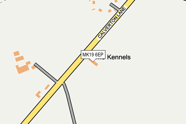
MK19 6EP is located in the Stony Stratford electoral ward, within the unitary authority of Milton Keynes and the English Parliamentary constituency of Milton Keynes South. The Sub Integrated Care Board (ICB) Location is NHS Bedfordshire, Luton and Milton Keynes ICB - M1J4Y and the police force is Thames Valley. This postcode has been in use since January 1980.


GetTheData
Source: OS OpenMap – Local (Ordnance Survey)
Source: OS VectorMap District (Ordnance Survey)
Licence: Open Government Licence (requires attribution)
| Easting | 480850 |
| Northing | 238420 |
| Latitude | 52.038297 |
| Longitude | -0.822717 |
GetTheData
Source: Open Postcode Geo
Licence: Open Government Licence
| Country | England |
| Postcode District | MK19 |
➜ See where MK19 is on a map | |
GetTheData
Source: Land Registry Price Paid Data
Licence: Open Government Licence
Elevation or altitude of MK19 6EP as distance above sea level:
| Metres | Feet | |
|---|---|---|
| Elevation | 90m | 295ft |
Elevation is measured from the approximate centre of the postcode, to the nearest point on an OS contour line from OS Terrain 50, which has contour spacing of ten vertical metres.
➜ How high above sea level am I? Find the elevation of your current position using your device's GPS.
GetTheData
Source: Open Postcode Elevation
Licence: Open Government Licence
| Ward | Stony Stratford |
| Constituency | Milton Keynes South |
GetTheData
Source: ONS Postcode Database
Licence: Open Government Licence
| Fairways Roundabout South (Watling Street V4) | Two Mile Ash | 415m |
| Fairways Roundabout South (Watling Street V4) | Two Mile Ash | 425m |
| Fairways | Two Mile Ash | 513m |
| Fairways | Two Mile Ash | 522m |
| Brick Close (Pitfield) | Kiln Farm | 581m |
| Wolverton Station | 3.3km |
| Milton Keynes Central Station | 3.4km |
GetTheData
Source: NaPTAN
Licence: Open Government Licence
| Percentage of properties with Next Generation Access | 100.0% |
| Percentage of properties with Superfast Broadband | 100.0% |
| Percentage of properties with Ultrafast Broadband | 0.0% |
| Percentage of properties with Full Fibre Broadband | 0.0% |
Superfast Broadband is between 30Mbps and 300Mbps
Ultrafast Broadband is > 300Mbps
| Percentage of properties unable to receive 2Mbps | 0.0% |
| Percentage of properties unable to receive 5Mbps | 0.0% |
| Percentage of properties unable to receive 10Mbps | 0.0% |
| Percentage of properties unable to receive 30Mbps | 0.0% |
GetTheData
Source: Ofcom
Licence: Ofcom Terms of Use (requires attribution)
GetTheData
Source: ONS Postcode Database
Licence: Open Government Licence


➜ Get more ratings from the Food Standards Agency
GetTheData
Source: Food Standards Agency
Licence: FSA terms & conditions
| Last Collection | |||
|---|---|---|---|
| Location | Mon-Fri | Sat | Distance |
| Badgemore Court | 17:15 | 12:00 | 530m |
| Pitfield | 18:30 | 792m | |
| High Street | 17:30 | 12:00 | 887m |
GetTheData
Source: Dracos
Licence: Creative Commons Attribution-ShareAlike
The below table lists the International Territorial Level (ITL) codes (formerly Nomenclature of Territorial Units for Statistics (NUTS) codes) and Local Administrative Units (LAU) codes for MK19 6EP:
| ITL 1 Code | Name |
|---|---|
| TLJ | South East (England) |
| ITL 2 Code | Name |
| TLJ1 | Berkshire, Buckinghamshire and Oxfordshire |
| ITL 3 Code | Name |
| TLJ12 | Milton Keynes |
| LAU 1 Code | Name |
| E06000042 | Milton Keynes |
GetTheData
Source: ONS Postcode Directory
Licence: Open Government Licence
The below table lists the Census Output Area (OA), Lower Layer Super Output Area (LSOA), and Middle Layer Super Output Area (MSOA) for MK19 6EP:
| Code | Name | |
|---|---|---|
| OA | E00084835 | |
| LSOA | E01016814 | Milton Keynes 019D |
| MSOA | E02003477 | Milton Keynes 019 |
GetTheData
Source: ONS Postcode Directory
Licence: Open Government Licence
| MK19 6ET | Calverton Lane | 170m |
| MK19 6EU | Calverton Lane | 206m |
| MK8 8AQ | Sandwell Court | 465m |
| MK11 3LL | Keller Close | 486m |
| MK8 8AH | Harborne Court | 505m |
| MK8 8AJ | Fairways | 531m |
| MK8 8AL | Fairways | 544m |
| MK8 8AG | Belmont Court | 584m |
| MK8 8AE | Atherstone Court | 601m |
| MK8 8AF | Badgemore Court | 604m |
GetTheData
Source: Open Postcode Geo; Land Registry Price Paid Data
Licence: Open Government Licence