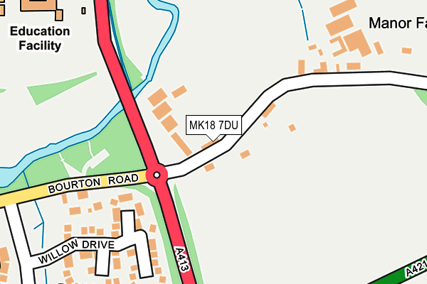
MK18 7DU is located in the Buckingham West electoral ward, within the unitary authority of Buckinghamshire and the English Parliamentary constituency of Buckingham. The Sub Integrated Care Board (ICB) Location is NHS Buckinghamshire, Oxfordshire and Berkshire West ICB - 14Y and the police force is Thames Valley. This postcode has been in use since January 1983.


GetTheData
Source: OS OpenMap – Local (Ordnance Survey)
Source: OS VectorMap District (Ordnance Survey)
Licence: Open Government Licence (requires attribution)
| Easting | 470927 |
| Northing | 233405 |
| Latitude | 51.994583 |
| Longitude | -0.968373 |
GetTheData
Source: Open Postcode Geo
Licence: Open Government Licence
| Country | England |
| Postcode District | MK18 |
➜ See where MK18 is on a map | |
GetTheData
Source: Land Registry Price Paid Data
Licence: Open Government Licence
Elevation or altitude of MK18 7DU as distance above sea level:
| Metres | Feet | |
|---|---|---|
| Elevation | 80m | 262ft |
Elevation is measured from the approximate centre of the postcode, to the nearest point on an OS contour line from OS Terrain 50, which has contour spacing of ten vertical metres.
➜ How high above sea level am I? Find the elevation of your current position using your device's GPS.
GetTheData
Source: Open Postcode Elevation
Licence: Open Government Licence
| Ward | Buckingham West |
| Constituency | Buckingham |
GetTheData
Source: ONS Postcode Database
Licence: Open Government Licence
| Bourton Meadow School (A413/Bridge Street) | Buckingham | 278m |
| Bourton Meadow School (A413/Bridge Street) | Buckingham | 347m |
| Bourton Mill (Bourton Road) | Buckingham | 410m |
| Bourton Mill (Bourton Road) | Buckingham | 425m |
| Badgers Way | Buckingham | 618m |
GetTheData
Source: NaPTAN
Licence: Open Government Licence
GetTheData
Source: ONS Postcode Database
Licence: Open Government Licence


➜ Get more ratings from the Food Standards Agency
GetTheData
Source: Food Standards Agency
Licence: FSA terms & conditions
| Last Collection | |||
|---|---|---|---|
| Location | Mon-Fri | Sat | Distance |
| Badgers Way | 17:45 | 12:00 | 565m |
| Badgers Way The Holt | 17:45 | 08:30 | 699m |
| Burleigh Piece | 17:40 | 12:00 | 862m |
GetTheData
Source: Dracos
Licence: Creative Commons Attribution-ShareAlike
The below table lists the International Territorial Level (ITL) codes (formerly Nomenclature of Territorial Units for Statistics (NUTS) codes) and Local Administrative Units (LAU) codes for MK18 7DU:
| ITL 1 Code | Name |
|---|---|
| TLJ | South East (England) |
| ITL 2 Code | Name |
| TLJ1 | Berkshire, Buckinghamshire and Oxfordshire |
| ITL 3 Code | Name |
| TLJ13 | Buckinghamshire |
| LAU 1 Code | Name |
| E06000060 | Buckinghamshire |
GetTheData
Source: ONS Postcode Directory
Licence: Open Government Licence
The below table lists the Census Output Area (OA), Lower Layer Super Output Area (LSOA), and Middle Layer Super Output Area (MSOA) for MK18 7DU:
| Code | Name | |
|---|---|---|
| OA | E00089084 | |
| LSOA | E01017648 | Aylesbury Vale 001A |
| MSOA | E02003652 | Aylesbury Vale 001 |
GetTheData
Source: ONS Postcode Directory
Licence: Open Government Licence
| MK18 7DR | 128m | |
| MK18 7DP | 147m | |
| MK18 7JH | Willow Drive | 178m |
| MK18 7JL | Sycamore Close | 262m |
| MK18 7HH | Partridge Close | 316m |
| MK18 7JJ | Lime Avenue | 317m |
| MK18 7JB | Badgers Way | 372m |
| MK18 7DE | Small Crescent | 372m |
| MK18 7EY | Kingfisher Road | 375m |
| MK18 7AB | Jarman Close | 380m |
GetTheData
Source: Open Postcode Geo; Land Registry Price Paid Data
Licence: Open Government Licence