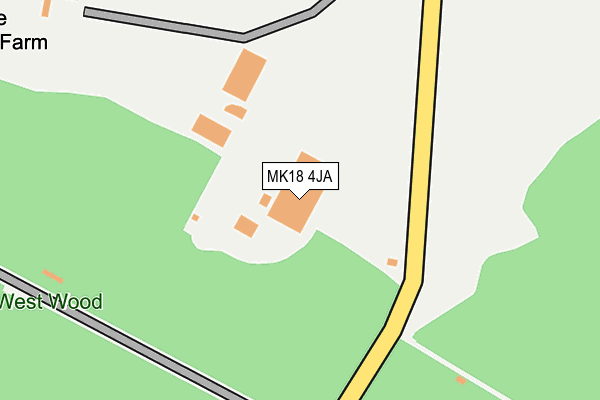
MK18 4JA is located in the Buckingham West electoral ward, within the unitary authority of Buckinghamshire and the English Parliamentary constituency of Buckingham. The Sub Integrated Care Board (ICB) Location is NHS Buckinghamshire, Oxfordshire and Berkshire West ICB - 14Y and the police force is Thames Valley. This postcode has been in use since November 2005.


GetTheData
Source: OS OpenMap – Local (Ordnance Survey)
Source: OS VectorMap District (Ordnance Survey)
Licence: Open Government Licence (requires attribution)
| Easting | 465116 |
| Northing | 231910 |
| Latitude | 51.981853 |
| Longitude | -1.053278 |
GetTheData
Source: Open Postcode Geo
Licence: Open Government Licence
| Country | England |
| Postcode District | MK18 |
➜ See where MK18 is on a map | |
GetTheData
Source: Land Registry Price Paid Data
Licence: Open Government Licence
Elevation or altitude of MK18 4JA as distance above sea level:
| Metres | Feet | |
|---|---|---|
| Elevation | 120m | 394ft |
Elevation is measured from the approximate centre of the postcode, to the nearest point on an OS contour line from OS Terrain 50, which has contour spacing of ten vertical metres.
➜ How high above sea level am I? Find the elevation of your current position using your device's GPS.
GetTheData
Source: Open Postcode Elevation
Licence: Open Government Licence
| Ward | Buckingham West |
| Constituency | Buckingham |
GetTheData
Source: ONS Postcode Database
Licence: Open Government Licence
| Strangers Lane (Main Street) | Tingewick | 978m |
| Strangers Lane (Main Street) | Tingewick | 983m |
| Village Hall (Main Street) | Tingewick | 1,019m |
| Cemetery (Water Stratford Road) | Tingewick | 1,060m |
| Cemetery (Water Stratford Road) | Tingewick | 1,066m |
GetTheData
Source: NaPTAN
Licence: Open Government Licence
GetTheData
Source: ONS Postcode Database
Licence: Open Government Licence


➜ Get more ratings from the Food Standards Agency
GetTheData
Source: Food Standards Agency
Licence: FSA terms & conditions
| Last Collection | |||
|---|---|---|---|
| Location | Mon-Fri | Sat | Distance |
| High Street | 16:45 | 09:45 | 1,013m |
| Post Office Main Street | 16:45 | 09:45 | 1,094m |
| High Street | 16:45 | 09:45 | 1,212m |
GetTheData
Source: Dracos
Licence: Creative Commons Attribution-ShareAlike
The below table lists the International Territorial Level (ITL) codes (formerly Nomenclature of Territorial Units for Statistics (NUTS) codes) and Local Administrative Units (LAU) codes for MK18 4JA:
| ITL 1 Code | Name |
|---|---|
| TLJ | South East (England) |
| ITL 2 Code | Name |
| TLJ1 | Berkshire, Buckinghamshire and Oxfordshire |
| ITL 3 Code | Name |
| TLJ13 | Buckinghamshire |
| LAU 1 Code | Name |
| E06000060 | Buckinghamshire |
GetTheData
Source: ONS Postcode Directory
Licence: Open Government Licence
The below table lists the Census Output Area (OA), Lower Layer Super Output Area (LSOA), and Middle Layer Super Output Area (MSOA) for MK18 4JA:
| Code | Name | |
|---|---|---|
| OA | E00089406 | |
| LSOA | E01017718 | Aylesbury Vale 004F |
| MSOA | E02003655 | Aylesbury Vale 004 |
GetTheData
Source: ONS Postcode Directory
Licence: Open Government Licence
| MK18 4JT | 471m | |
| MK18 4BD | West Well Lane | 588m |
| MK18 4RL | Back Lane | 812m |
| MK18 4QQ | Upper Street | 869m |
| MK18 4QB | Barton Road | 881m |
| MK18 4QA | West Well Lane | 891m |
| MK18 4PZ | West Well Lane | 898m |
| MK18 4PT | Strangers Lane | 906m |
| MK18 4QF | Upper Street | 925m |
| MK18 4QJ | Upper Street | 945m |
GetTheData
Source: Open Postcode Geo; Land Registry Price Paid Data
Licence: Open Government Licence