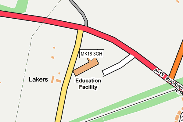
MK18 3GH is located in the Winslow electoral ward, within the unitary authority of Buckinghamshire and the English Parliamentary constituency of Buckingham. The Sub Integrated Care Board (ICB) Location is NHS Buckinghamshire, Oxfordshire and Berkshire West ICB - 14Y and the police force is Thames Valley. This postcode has been in use since July 2017.


GetTheData
Source: OS OpenMap – Local (Ordnance Survey)
Source: OS VectorMap District (Ordnance Survey)
Licence: Open Government Licence (requires attribution)
| Easting | 476400 |
| Northing | 228431 |
| Latitude | 51.949145 |
| Longitude | -0.889781 |
GetTheData
Source: Open Postcode Geo
Licence: Open Government Licence
| Country | England |
| Postcode District | MK18 |
➜ See where MK18 is on a map | |
GetTheData
Source: Land Registry Price Paid Data
Licence: Open Government Licence
| Ward | Winslow |
| Constituency | Buckingham |
GetTheData
Source: ONS Postcode Database
Licence: Open Government Licence
| Redfield Farm (Buckingham Road) | Winslow | 117m |
| Redfield Farm (Buckingham Road) | Winslow | 140m |
| Station Road (Buckingham Road) | Winslow | 404m |
| Station Road (Buckingham Road) | Winslow | 497m |
| Seven Gables (Buckingham Road) | Winslow | 506m |
GetTheData
Source: NaPTAN
Licence: Open Government Licence
GetTheData
Source: ONS Postcode Database
Licence: Open Government Licence


➜ Get more ratings from the Food Standards Agency
GetTheData
Source: Food Standards Agency
Licence: FSA terms & conditions
| Last Collection | |||
|---|---|---|---|
| Location | Mon-Fri | Sat | Distance |
| Buckingham Road | 17:00 | 11:45 | 548m |
| Winslow Delivery Office | 17:45 | 12:45 | 837m |
| Lowndes Way | 17:45 | 12:00 | 897m |
GetTheData
Source: Dracos
Licence: Creative Commons Attribution-ShareAlike
The below table lists the International Territorial Level (ITL) codes (formerly Nomenclature of Territorial Units for Statistics (NUTS) codes) and Local Administrative Units (LAU) codes for MK18 3GH:
| ITL 1 Code | Name |
|---|---|
| TLJ | South East (England) |
| ITL 2 Code | Name |
| TLJ1 | Berkshire, Buckinghamshire and Oxfordshire |
| ITL 3 Code | Name |
| TLJ13 | Buckinghamshire |
| LAU 1 Code | Name |
| E06000060 | Buckinghamshire |
GetTheData
Source: ONS Postcode Directory
Licence: Open Government Licence
The below table lists the Census Output Area (OA), Lower Layer Super Output Area (LSOA), and Middle Layer Super Output Area (MSOA) for MK18 3GH:
| Code | Name | |
|---|---|---|
| OA | E00089493 | |
| LSOA | E01017738 | Aylesbury Vale 005D |
| MSOA | E02003656 | Aylesbury Vale 005 |
GetTheData
Source: ONS Postcode Directory
Licence: Open Government Licence
| MK18 3NB | Furze Lane | 129m |
| MK18 3DX | Buckingham Road | 326m |
| MK18 3DU | Highfield Road | 377m |
| MK18 3LY | Great Horwood Road | 405m |
| MK18 3DE | Mill Close | 456m |
| MK18 3FP | Stocks Lane | 459m |
| MK18 3DY | Buckingham Road | 467m |
| MK18 3BW | Furze Lane | 475m |
| MK18 3DT | Buckingham Road | 480m |
| MK18 3FZ | Featherbed Close | 526m |
GetTheData
Source: Open Postcode Geo; Land Registry Price Paid Data
Licence: Open Government Licence