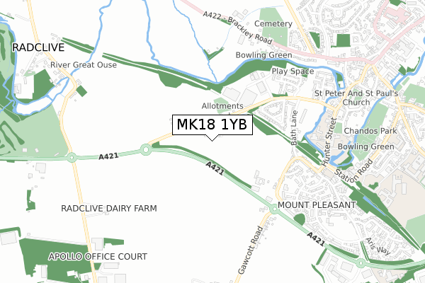
MK18 1YB is located in the Buckingham West electoral ward, within the unitary authority of Buckinghamshire and the English Parliamentary constituency of Buckingham. The Sub Integrated Care Board (ICB) Location is NHS Buckinghamshire, Oxfordshire and Berkshire West ICB - 14Y and the police force is Thames Valley. This postcode has been in use since April 2020.


GetTheData
Source: OS Open Zoomstack (Ordnance Survey)
Licence: Open Government Licence (requires attribution)
Attribution: Contains OS data © Crown copyright and database right 2025
Source: Open Postcode Geo
Licence: Open Government Licence (requires attribution)
Attribution: Contains OS data © Crown copyright and database right 2025; Contains Royal Mail data © Royal Mail copyright and database right 2025; Source: Office for National Statistics licensed under the Open Government Licence v.3.0
| Easting | 468641 |
| Northing | 233543 |
| Latitude | 51.996110 |
| Longitude | -1.001635 |
GetTheData
Source: Open Postcode Geo
Licence: Open Government Licence
| Country | England |
| Postcode District | MK18 |
➜ See where MK18 is on a map ➜ Where is Buckingham? | |
GetTheData
Source: Land Registry Price Paid Data
Licence: Open Government Licence
| Ward | Buckingham West |
| Constituency | Buckingham |
GetTheData
Source: ONS Postcode Database
Licence: Open Government Licence
| Westfields Estate (Westfields) | Buckingham | 348m |
| Westfields (Tingewick Road) | Buckingham | 440m |
| Westfields (Tingewick Road) | Buckingham | 530m |
| Primrose Way (Embleton Way) | Mount Pleasant | 584m |
| Primrose Way (Embleton Way) | Mount Pleasant | 664m |
GetTheData
Source: NaPTAN
Licence: Open Government Licence
GetTheData
Source: ONS Postcode Database
Licence: Open Government Licence


➜ Get more ratings from the Food Standards Agency
GetTheData
Source: Food Standards Agency
Licence: FSA terms & conditions
| Last Collection | |||
|---|---|---|---|
| Location | Mon-Fri | Sat | Distance |
| Gawcott Road | 17:45 | 12:00 | 502m |
| Bath Lane | 17:45 | 12:00 | 562m |
| Embleton Way | 16:30 | 10:00 | 662m |
GetTheData
Source: Dracos
Licence: Creative Commons Attribution-ShareAlike
The below table lists the International Territorial Level (ITL) codes (formerly Nomenclature of Territorial Units for Statistics (NUTS) codes) and Local Administrative Units (LAU) codes for MK18 1YB:
| ITL 1 Code | Name |
|---|---|
| TLJ | South East (England) |
| ITL 2 Code | Name |
| TLJ1 | Berkshire, Buckinghamshire and Oxfordshire |
| ITL 3 Code | Name |
| TLJ13 | Buckinghamshire |
| LAU 1 Code | Name |
| E06000060 | Buckinghamshire |
GetTheData
Source: ONS Postcode Directory
Licence: Open Government Licence
The below table lists the Census Output Area (OA), Lower Layer Super Output Area (LSOA), and Middle Layer Super Output Area (MSOA) for MK18 1YB:
| Code | Name | |
|---|---|---|
| OA | E00089089 | |
| LSOA | E01017649 | Aylesbury Vale 001B |
| MSOA | E02003652 | Aylesbury Vale 001 |
GetTheData
Source: ONS Postcode Directory
Licence: Open Government Licence
| MK18 1ST | Tingewick Road | 103m |
| MK18 1DZ | Westfields | 398m |
| MK18 1DU | Bath Lane | 468m |
| MK18 1DS | Gawcott Road | 480m |
| MK18 1DR | Gawcott Road | 483m |
| MK18 1DY | Bath Lane Terrace | 490m |
| MK18 1DX | Bath Lane | 495m |
| MK18 1DT | Sandhurst Drive | 518m |
| MK18 1RU | Mitre Street | 546m |
| MK18 1FR | Primrose Way | 588m |
GetTheData
Source: Open Postcode Geo; Land Registry Price Paid Data
Licence: Open Government Licence