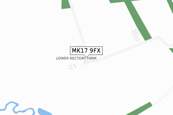
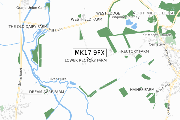
MK17 9FX is located in the Great Brickhill electoral ward, within the unitary authority of Buckinghamshire and the English Parliamentary constituency of Buckingham. The Sub Integrated Care Board (ICB) Location is NHS Bedfordshire, Luton and Milton Keynes ICB - M1J4Y and the police force is Thames Valley. This postcode has been in use since January 2020.


GetTheData
Source: OS Open Zoomstack (Ordnance Survey)
Licence: Open Government Licence (requires attribution)
Attribution: Contains OS data © Crown copyright and database right 2025
Source: Open Postcode Geo
Licence: Open Government Licence (requires attribution)
Attribution: Contains OS data © Crown copyright and database right 2025; Contains Royal Mail data © Royal Mail copyright and database right 2025; Source: Office for National Statistics licensed under the Open Government Licence v.3.0
| Easting | 489179 |
| Northing | 230438 |
| Latitude | 51.965286 |
| Longitude | -0.703374 |
GetTheData
Source: Open Postcode Geo
Licence: Open Government Licence
| Country | England |
| Postcode District | MK17 |
➜ See where MK17 is on a map | |
GetTheData
Source: Land Registry Price Paid Data
Licence: Open Government Licence
| Ward | Great Brickhill |
| Constituency | Buckingham |
GetTheData
Source: ONS Postcode Database
Licence: Open Government Licence
| Mill Lane (Galley Lane) | Great Brickhill | 1,091m |
| Mill Lane (Galley Lane) | Great Brickhill | 1,101m |
| The Lindens (Stoke Road) | Stoke Hammond | 1,160m |
| The Lindens (Stoke Road) | Stoke Hammond | 1,169m |
| Tyrells Road (Fenny Road) | Stoke Hammond | 1,233m |
| Fenny Stratford Station | 4km |
| Bletchley Station | 4km |
| Bow Brickhill Station | 4.4km |
GetTheData
Source: NaPTAN
Licence: Open Government Licence
GetTheData
Source: ONS Postcode Database
Licence: Open Government Licence


➜ Get more ratings from the Food Standards Agency
GetTheData
Source: Food Standards Agency
Licence: FSA terms & conditions
| Last Collection | |||
|---|---|---|---|
| Location | Mon-Fri | Sat | Distance |
| Church End | 16:15 | 10:00 | 1,018m |
| Cross End | 16:15 | 10:00 | 1,235m |
| Post Office Stoke Road | 16:30 | 08:15 | 1,442m |
GetTheData
Source: Dracos
Licence: Creative Commons Attribution-ShareAlike
The below table lists the International Territorial Level (ITL) codes (formerly Nomenclature of Territorial Units for Statistics (NUTS) codes) and Local Administrative Units (LAU) codes for MK17 9FX:
| ITL 1 Code | Name |
|---|---|
| TLJ | South East (England) |
| ITL 2 Code | Name |
| TLJ1 | Berkshire, Buckinghamshire and Oxfordshire |
| ITL 3 Code | Name |
| TLJ13 | Buckinghamshire |
| LAU 1 Code | Name |
| E06000060 | Buckinghamshire |
GetTheData
Source: ONS Postcode Directory
Licence: Open Government Licence
The below table lists the Census Output Area (OA), Lower Layer Super Output Area (LSOA), and Middle Layer Super Output Area (MSOA) for MK17 9FX:
| Code | Name | |
|---|---|---|
| OA | E00089188 | |
| LSOA | E01017669 | Aylesbury Vale 006A |
| MSOA | E02003657 | Aylesbury Vale 006 |
GetTheData
Source: ONS Postcode Directory
Licence: Open Government Licence
| MK17 9DG | 691m | |
| MK17 9BD | Mill Lane | 742m |
| MK17 9AE | Church Lane | 810m |
| MK17 9BS | Tyrells Road | 1106m |
| MK17 9AQ | Stoke Lane | 1110m |
| MK17 9AG | Lower Way | 1117m |
| MK17 9RT | Horsepond | 1142m |
| MK17 9AZ | Upper Way | 1177m |
| MK17 9BL | Naisby Drive | 1183m |
| MK17 9DF | Tyrells Gardens | 1199m |
GetTheData
Source: Open Postcode Geo; Land Registry Price Paid Data
Licence: Open Government Licence