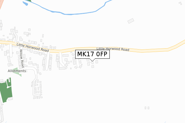
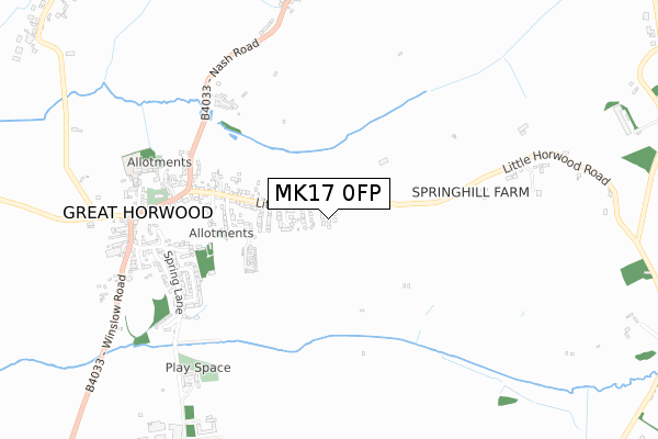
MK17 0FP is located in the Winslow electoral ward, within the unitary authority of Buckinghamshire and the English Parliamentary constituency of Buckingham. The Sub Integrated Care Board (ICB) Location is NHS Buckinghamshire, Oxfordshire and Berkshire West ICB - 14Y and the police force is Thames Valley. This postcode has been in use since January 2020.


GetTheData
Source: OS Open Zoomstack (Ordnance Survey)
Licence: Open Government Licence (requires attribution)
Attribution: Contains OS data © Crown copyright and database right 2025
Source: Open Postcode Geo
Licence: Open Government Licence (requires attribution)
Attribution: Contains OS data © Crown copyright and database right 2025; Contains Royal Mail data © Royal Mail copyright and database right 2025; Source: Office for National Statistics licensed under the Open Government Licence v.3.0
| Easting | 477743 |
| Northing | 231117 |
| Latitude | 51.973105 |
| Longitude | -0.869638 |
GetTheData
Source: Open Postcode Geo
Licence: Open Government Licence
| Country | England |
| Postcode District | MK17 |
➜ See where MK17 is on a map ➜ Where is Great Horwood? | |
GetTheData
Source: Land Registry Price Paid Data
Licence: Open Government Licence
| Ward | Winslow |
| Constituency | Buckingham |
GetTheData
Source: ONS Postcode Database
Licence: Open Government Licence
| Townsend Cottages (Little Horwood Road) | Great Horwood | 152m |
| Townsend Cottages (Little Horwood Road) | Great Horwood | 155m |
| The Green (Little Horwood Road) | Great Horwood | 536m |
| The Green (Little Horwood Road) | Great Horwood | 537m |
| High Street | Great Horwood | 698m |
GetTheData
Source: NaPTAN
Licence: Open Government Licence
GetTheData
Source: ONS Postcode Database
Licence: Open Government Licence


➜ Get more ratings from the Food Standards Agency
GetTheData
Source: Food Standards Agency
Licence: FSA terms & conditions
| Last Collection | |||
|---|---|---|---|
| Location | Mon-Fri | Sat | Distance |
| Post Office Great Horwood | 16:30 | 09:30 | 559m |
| Spring Lane | 16:00 | 09:15 | 637m |
| The Common | 16:00 | 09:15 | 904m |
GetTheData
Source: Dracos
Licence: Creative Commons Attribution-ShareAlike
The below table lists the International Territorial Level (ITL) codes (formerly Nomenclature of Territorial Units for Statistics (NUTS) codes) and Local Administrative Units (LAU) codes for MK17 0FP:
| ITL 1 Code | Name |
|---|---|
| TLJ | South East (England) |
| ITL 2 Code | Name |
| TLJ1 | Berkshire, Buckinghamshire and Oxfordshire |
| ITL 3 Code | Name |
| TLJ13 | Buckinghamshire |
| LAU 1 Code | Name |
| E06000060 | Buckinghamshire |
GetTheData
Source: ONS Postcode Directory
Licence: Open Government Licence
The below table lists the Census Output Area (OA), Lower Layer Super Output Area (LSOA), and Middle Layer Super Output Area (MSOA) for MK17 0FP:
| Code | Name | |
|---|---|---|
| OA | E00089196 | |
| LSOA | E01017672 | Aylesbury Vale 003B |
| MSOA | E02003654 | Aylesbury Vale 003 |
GetTheData
Source: ONS Postcode Directory
Licence: Open Government Licence
| MK17 0QF | Townsend Cottages | 119m |
| MK17 0QG | The Close | 210m |
| MK17 0QQ | Weston Road | 253m |
| MK17 0QE | Little Horwood Road | 348m |
| MK17 0QH | Willow Road | 386m |
| MK17 0QS | Wheathouse Copse | 473m |
| MK17 0QR | Greenway | 604m |
| MK17 0RH | The Green | 608m |
| MK17 0QP | Spring Lane | 628m |
| MK17 0QW | Spring Lane | 656m |
GetTheData
Source: Open Postcode Geo; Land Registry Price Paid Data
Licence: Open Government Licence