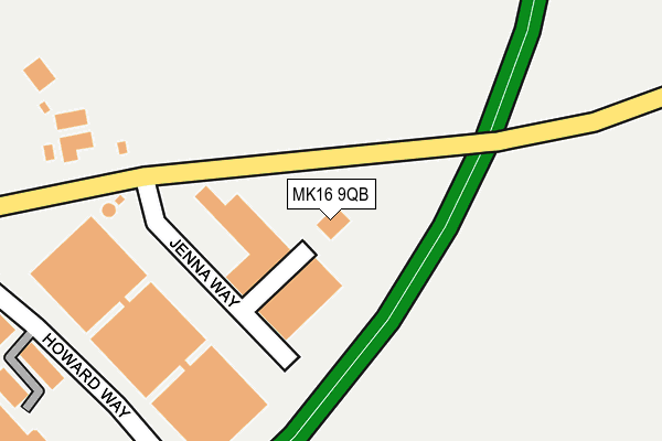
MK16 9QB is located in the Newport Pagnell South electoral ward, within the unitary authority of Milton Keynes and the English Parliamentary constituency of Milton Keynes North. The Sub Integrated Care Board (ICB) Location is NHS Bedfordshire, Luton and Milton Keynes ICB - M1J4Y and the police force is Thames Valley. This postcode has been in use since September 1991.


GetTheData
Source: OS OpenMap – Local (Ordnance Survey)
Source: OS VectorMap District (Ordnance Survey)
Licence: Open Government Licence (requires attribution)
| Easting | 489243 |
| Northing | 243356 |
| Latitude | 52.081378 |
| Longitude | -0.699101 |
GetTheData
Source: Open Postcode Geo
Licence: Open Government Licence
| Country | England |
| Postcode District | MK16 |
➜ See where MK16 is on a map ➜ Where is Newport Pagnell? | |
GetTheData
Source: Land Registry Price Paid Data
Licence: Open Government Licence
Elevation or altitude of MK16 9QB as distance above sea level:
| Metres | Feet | |
|---|---|---|
| Elevation | 60m | 197ft |
Elevation is measured from the approximate centre of the postcode, to the nearest point on an OS contour line from OS Terrain 50, which has contour spacing of ten vertical metres.
➜ How high above sea level am I? Find the elevation of your current position using your device's GPS.
GetTheData
Source: Open Postcode Elevation
Licence: Open Government Licence
| Ward | Newport Pagnell South |
| Constituency | Milton Keynes North |
GetTheData
Source: ONS Postcode Database
Licence: Open Government Licence
| North Crawley Road | Newport Pagnell | 216m |
| North Crawley Road | Newport Pagnell | 231m |
| Renny Lodge (Tickford Street) | Newport Pagnell | 675m |
| Renny Lodge (Tickford Street) | Newport Pagnell | 692m |
| The Canons (Tickford Street) | Tickford End | 816m |
GetTheData
Source: NaPTAN
Licence: Open Government Licence
GetTheData
Source: ONS Postcode Database
Licence: Open Government Licence


➜ Get more ratings from the Food Standards Agency
GetTheData
Source: Food Standards Agency
Licence: FSA terms & conditions
| Last Collection | |||
|---|---|---|---|
| Location | Mon-Fri | Sat | Distance |
| Howards Way Interchange Park | 18:30 | 275m | |
| Royal Mail Newport Pagnell | 18:00 | 12:00 | 417m |
| London Road | 17:15 | 12:00 | 753m |
GetTheData
Source: Dracos
Licence: Creative Commons Attribution-ShareAlike
The below table lists the International Territorial Level (ITL) codes (formerly Nomenclature of Territorial Units for Statistics (NUTS) codes) and Local Administrative Units (LAU) codes for MK16 9QB:
| ITL 1 Code | Name |
|---|---|
| TLJ | South East (England) |
| ITL 2 Code | Name |
| TLJ1 | Berkshire, Buckinghamshire and Oxfordshire |
| ITL 3 Code | Name |
| TLJ12 | Milton Keynes |
| LAU 1 Code | Name |
| E06000042 | Milton Keynes |
GetTheData
Source: ONS Postcode Directory
Licence: Open Government Licence
The below table lists the Census Output Area (OA), Lower Layer Super Output Area (LSOA), and Middle Layer Super Output Area (MSOA) for MK16 9QB:
| Code | Name | |
|---|---|---|
| OA | E00175411 | |
| LSOA | E01016793 | Milton Keynes 004C |
| MSOA | E02003462 | Milton Keynes 004 |
GetTheData
Source: ONS Postcode Directory
Licence: Open Government Licence
| MK16 9HG | North Crawley Road | 551m |
| MK16 9FB | Papworth Close | 599m |
| MK16 0DW | Hopton Grove | 609m |
| MK16 9FD | Addenbrookes Road | 630m |
| MK16 0DZ | Hopton Grove | 632m |
| MK16 9FE | North Crawley Road | 661m |
| MK16 0DA | Samuel Close | 669m |
| MK16 0HA | London Road | 681m |
| MK16 9GF | The Canons | 702m |
| MK16 0AE | London Road | 707m |
GetTheData
Source: Open Postcode Geo; Land Registry Price Paid Data
Licence: Open Government Licence