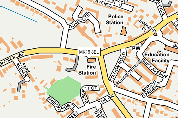
MK16 8EL is located in the Newport Pagnell South electoral ward, within the unitary authority of Milton Keynes and the English Parliamentary constituency of Milton Keynes North. The Sub Integrated Care Board (ICB) Location is NHS Bedfordshire, Luton and Milton Keynes ICB - M1J4Y and the police force is Thames Valley. This postcode has been in use since January 1980.


GetTheData
Source: OS OpenMap – Local (Ordnance Survey)
Source: OS VectorMap District (Ordnance Survey)
Licence: Open Government Licence (requires attribution)
| Easting | 487169 |
| Northing | 243723 |
| Latitude | 52.085007 |
| Longitude | -0.729265 |
GetTheData
Source: Open Postcode Geo
Licence: Open Government Licence
| Country | England |
| Postcode District | MK16 |
➜ See where MK16 is on a map ➜ Where is Newport Pagnell? | |
GetTheData
Source: Land Registry Price Paid Data
Licence: Open Government Licence
Elevation or altitude of MK16 8EL as distance above sea level:
| Metres | Feet | |
|---|---|---|
| Elevation | 60m | 197ft |
Elevation is measured from the approximate centre of the postcode, to the nearest point on an OS contour line from OS Terrain 50, which has contour spacing of ten vertical metres.
➜ How high above sea level am I? Find the elevation of your current position using your device's GPS.
GetTheData
Source: Open Postcode Elevation
Licence: Open Government Licence
| Ward | Newport Pagnell South |
| Constituency | Milton Keynes North |
GetTheData
Source: ONS Postcode Database
Licence: Open Government Licence
| Newport Pagnell Medical Centre (Marsh End Road) | Newport Pagnell | 57m |
| Newport Pagnell Medical Centre (Marsh End Road) | Newport Pagnell | 62m |
| Lakes Lane (Wolverton Road) | Newport Pagnell | 116m |
| Lakes Lane (Wolverton Road) | Newport Pagnell | 141m |
| The Green | The Green | 151m |
GetTheData
Source: NaPTAN
Licence: Open Government Licence
GetTheData
Source: ONS Postcode Database
Licence: Open Government Licence


➜ Get more ratings from the Food Standards Agency
GetTheData
Source: Food Standards Agency
Licence: FSA terms & conditions
| Last Collection | |||
|---|---|---|---|
| Location | Mon-Fri | Sat | Distance |
| High Street | 17:15 | 12:00 | 268m |
| Lakes Lane | 17:15 | 12:00 | 319m |
| High Street | 17:45 | 328m | |
GetTheData
Source: Dracos
Licence: Creative Commons Attribution-ShareAlike
| Risk of MK16 8EL flooding from rivers and sea | Low |
| ➜ MK16 8EL flood map | |
GetTheData
Source: Open Flood Risk by Postcode
Licence: Open Government Licence
The below table lists the International Territorial Level (ITL) codes (formerly Nomenclature of Territorial Units for Statistics (NUTS) codes) and Local Administrative Units (LAU) codes for MK16 8EL:
| ITL 1 Code | Name |
|---|---|
| TLJ | South East (England) |
| ITL 2 Code | Name |
| TLJ1 | Berkshire, Buckinghamshire and Oxfordshire |
| ITL 3 Code | Name |
| TLJ12 | Milton Keynes |
| LAU 1 Code | Name |
| E06000042 | Milton Keynes |
GetTheData
Source: ONS Postcode Directory
Licence: Open Government Licence
The below table lists the Census Output Area (OA), Lower Layer Super Output Area (LSOA), and Middle Layer Super Output Area (MSOA) for MK16 8EL:
| Code | Name | |
|---|---|---|
| OA | E00084698 | |
| LSOA | E01016787 | Milton Keynes 003B |
| MSOA | E02003461 | Milton Keynes 003 |
GetTheData
Source: ONS Postcode Directory
Licence: Open Government Licence
| MK16 8JR | Courthouse Mews | 98m |
| MK16 8BD | The Lodge Park | 110m |
| MK16 0JN | Bassett Court | 112m |
| MK16 0JW | The Green | 125m |
| MK16 0DY | Beaconsfield Place | 133m |
| MK16 0DX | Beaconsfield Place | 139m |
| MK16 8EH | High Street | 144m |
| MK16 0QW | Sheppards Close | 148m |
| MK16 8EG | Dovecote | 167m |
| MK16 0BU | Caldecote Street | 170m |
GetTheData
Source: Open Postcode Geo; Land Registry Price Paid Data
Licence: Open Government Licence