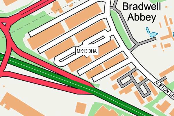
MK13 9HA is located in the Bradwell electoral ward, within the unitary authority of Milton Keynes and the English Parliamentary constituency of Milton Keynes North. The Sub Integrated Care Board (ICB) Location is NHS Bedfordshire, Luton and Milton Keynes ICB - M1J4Y and the police force is Thames Valley. This postcode has been in use since June 1981.


GetTheData
Source: OS OpenMap – Local (Ordnance Survey)
Source: OS VectorMap District (Ordnance Survey)
Licence: Open Government Licence (requires attribution)
| Easting | 482434 |
| Northing | 239397 |
| Latitude | 52.046857 |
| Longitude | -0.799374 |
GetTheData
Source: Open Postcode Geo
Licence: Open Government Licence
| Country | England |
| Postcode District | MK13 |
➜ See where MK13 is on a map ➜ Where is Milton Keynes? | |
GetTheData
Source: Land Registry Price Paid Data
Licence: Open Government Licence
Elevation or altitude of MK13 9HA as distance above sea level:
| Metres | Feet | |
|---|---|---|
| Elevation | 80m | 262ft |
Elevation is measured from the approximate centre of the postcode, to the nearest point on an OS contour line from OS Terrain 50, which has contour spacing of ten vertical metres.
➜ How high above sea level am I? Find the elevation of your current position using your device's GPS.
GetTheData
Source: Open Postcode Elevation
Licence: Open Government Licence
| Ward | Bradwell |
| Constituency | Milton Keynes North |
GetTheData
Source: ONS Postcode Database
Licence: Open Government Licence
| Abbey Hill Roundabout East (Monks Way H3) | Bradwell Abbey | 237m |
| Abbey Hill Roundabout East (Monks Way H3) | Bradwell Abbey | 265m |
| Erica Road | Stacey Bushes | 400m |
| Garamonde Drive (Great Monks Street V5) | Wymbush | 409m |
| Garamonde Drive (Great Monks Street V5) | Wymbush | 415m |
| Wolverton Station | 2.1km |
| Milton Keynes Central Station | 2.2km |
GetTheData
Source: NaPTAN
Licence: Open Government Licence
| Median download speed | 79.8Mbps |
| Average download speed | 62.9Mbps |
| Maximum download speed | 80.00Mbps |
| Median upload speed | 20.0Mbps |
| Average upload speed | 15.7Mbps |
| Maximum upload speed | 20.00Mbps |
GetTheData
Source: Ofcom
Licence: Ofcom Terms of Use (requires attribution)
Estimated total energy consumption in MK13 9HA by fuel type, 2015.
| Consumption (kWh) | 908,821 |
|---|---|
| Meter count | 34 |
| Mean (kWh/meter) | 26,730 |
| Median (kWh/meter) | 27,089 |
GetTheData
Source: Postcode level gas estimates: 2015 (experimental)
Source: Postcode level electricity estimates: 2015 (experimental)
Licence: Open Government Licence
GetTheData
Source: ONS Postcode Database
Licence: Open Government Licence


➜ Get more ratings from the Food Standards Agency
GetTheData
Source: Food Standards Agency
Licence: FSA terms & conditions
| Last Collection | |||
|---|---|---|---|
| Location | Mon-Fri | Sat | Distance |
| Alston Drive | 18:30 | 142m | |
| Alston Drive | 18:30 | 12:00 | 164m |
| Garamonde Drive | 18:30 | 12:00 | 237m |
GetTheData
Source: Dracos
Licence: Creative Commons Attribution-ShareAlike
The below table lists the International Territorial Level (ITL) codes (formerly Nomenclature of Territorial Units for Statistics (NUTS) codes) and Local Administrative Units (LAU) codes for MK13 9HA:
| ITL 1 Code | Name |
|---|---|
| TLJ | South East (England) |
| ITL 2 Code | Name |
| TLJ1 | Berkshire, Buckinghamshire and Oxfordshire |
| ITL 3 Code | Name |
| TLJ12 | Milton Keynes |
| LAU 1 Code | Name |
| E06000042 | Milton Keynes |
GetTheData
Source: ONS Postcode Directory
Licence: Open Government Licence
The below table lists the Census Output Area (OA), Lower Layer Super Output Area (LSOA), and Middle Layer Super Output Area (MSOA) for MK13 9HA:
| Code | Name | |
|---|---|---|
| OA | E00084819 | |
| LSOA | E01016813 | Milton Keynes 015B |
| MSOA | E02003473 | Milton Keynes 015 |
GetTheData
Source: ONS Postcode Directory
Licence: Open Government Licence
| MK13 9HF | Alston Drive | 353m |
| MK13 9HG | Alston Drive | 380m |
| MK8 8HS | Haldene | 445m |
| MK8 8PB | The Hythe | 462m |
| MK8 8JH | Haslow Court | 463m |
| MK8 8HP | Clay Hill | 468m |
| MK8 8PD | Langton Drive | 474m |
| MK8 8HR | Downland | 500m |
| MK8 8HT | Haldene | 500m |
| MK8 8PQ | Pyke Hayes | 509m |
GetTheData
Source: Open Postcode Geo; Land Registry Price Paid Data
Licence: Open Government Licence