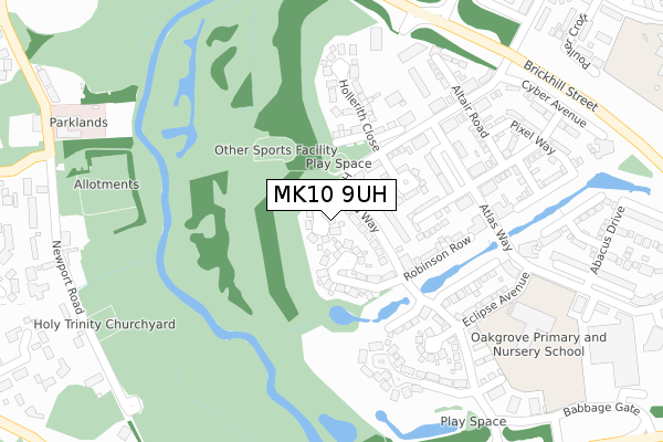
MK10 9UH is located in the Broughton electoral ward, within the unitary authority of Milton Keynes and the English Parliamentary constituency of Milton Keynes North. The Sub Integrated Care Board (ICB) Location is NHS Bedfordshire, Luton and Milton Keynes ICB - M1J4Y and the police force is Thames Valley. This postcode has been in use since October 2018.


GetTheData
Source: OS Open Zoomstack (Ordnance Survey)
Licence: Open Government Licence (requires attribution)
Attribution: Contains OS data © Crown copyright and database right 2024
Source: Open Postcode Geo
Licence: Open Government Licence (requires attribution)
Attribution: Contains OS data © Crown copyright and database right 2024; Contains Royal Mail data © Royal Mail copyright and database right 2024; Source: Office for National Statistics licensed under the Open Government Licence v.3.0
| Easting | 487851 |
| Northing | 238781 |
| Latitude | 52.040489 |
| Longitude | -0.720564 |
GetTheData
Source: Open Postcode Geo
Licence: Open Government Licence
| Country | England |
| Postcode District | MK10 |
➜ See where MK10 is on a map ➜ Where is Milton Keynes? | |
GetTheData
Source: Land Registry Price Paid Data
Licence: Open Government Licence
| Ward | Broughton |
| Constituency | Milton Keynes North |
GetTheData
Source: ONS Postcode Database
Licence: Open Government Licence
2022 27 MAY £415,000 |
6, FENSOM PLACE, OAKGROVE, MILTON KEYNES, MK10 9UH 2019 18 DEC £760,000 |
5, FENSOM PLACE, OAKGROVE, MILTON KEYNES, MK10 9UH 2019 3 OCT £635,000 |
8, FENSOM PLACE, OAKGROVE, MILTON KEYNES, MK10 9UH 2019 2 OCT £950,000 |
4, FENSOM PLACE, OAKGROVE, MILTON KEYNES, MK10 9UH 2019 2 AUG £599,000 |
10, FENSOM PLACE, OAKGROVE, MILTON KEYNES, MK10 9UH 2019 30 APR £825,000 |
7, FENSOM PLACE, OAKGROVE, MILTON KEYNES, MK10 9UH 2018 1 NOV £713,000 |
9, FENSOM PLACE, OAKGROVE, MILTON KEYNES, MK10 9UH 2018 31 OCT £765,000 |
2018 19 OCT £412,600 |
3, FENSOM PLACE, OAKGROVE, MILTON KEYNES, MK10 9UH 2018 15 OCT £425,000 |
GetTheData
Source: HM Land Registry Price Paid Data
Licence: Contains HM Land Registry data © Crown copyright and database right 2024. This data is licensed under the Open Government Licence v3.0.
| Noon Layer Drive (Brickhill Street) | Middleton | 346m |
| Noon Layer Drive (Brickhill Street) | Middleton | 400m |
| Atlas Way | Oakgrove | 436m |
| Atlas Way | Oakgrove | 486m |
| Marshalls Lane (Pattison Lane) | Woolstone | 564m |
| Milton Keynes Central Station | 3.7km |
| Bow Brickhill Station | 4.4km |
| Fenny Stratford Station | 4.5km |
GetTheData
Source: NaPTAN
Licence: Open Government Licence
| Percentage of properties with Next Generation Access | 100.0% |
| Percentage of properties with Superfast Broadband | 100.0% |
| Percentage of properties with Ultrafast Broadband | 100.0% |
| Percentage of properties with Full Fibre Broadband | 100.0% |
Superfast Broadband is between 30Mbps and 300Mbps
Ultrafast Broadband is > 300Mbps
| Percentage of properties unable to receive 2Mbps | 0.0% |
| Percentage of properties unable to receive 5Mbps | 0.0% |
| Percentage of properties unable to receive 10Mbps | 0.0% |
| Percentage of properties unable to receive 30Mbps | 0.0% |
GetTheData
Source: Ofcom
Licence: Ofcom Terms of Use (requires attribution)
GetTheData
Source: ONS Postcode Database
Licence: Open Government Licence


➜ Get more ratings from the Food Standards Agency
GetTheData
Source: Food Standards Agency
Licence: FSA terms & conditions
| Last Collection | |||
|---|---|---|---|
| Location | Mon-Fri | Sat | Distance |
| Mk15 Pattison Lane Woolstone | 17:30 | 12:00 | 602m |
| Mk15 Newport Road Little Woolstone | 17:30 | 12:00 | 711m |
| Billingwell Place | 16:45 | 12:00 | 917m |
GetTheData
Source: Dracos
Licence: Creative Commons Attribution-ShareAlike
The below table lists the International Territorial Level (ITL) codes (formerly Nomenclature of Territorial Units for Statistics (NUTS) codes) and Local Administrative Units (LAU) codes for MK10 9UH:
| ITL 1 Code | Name |
|---|---|
| TLJ | South East (England) |
| ITL 2 Code | Name |
| TLJ1 | Berkshire, Buckinghamshire and Oxfordshire |
| ITL 3 Code | Name |
| TLJ12 | Milton Keynes |
| LAU 1 Code | Name |
| E06000042 | Milton Keynes |
GetTheData
Source: ONS Postcode Directory
Licence: Open Government Licence
The below table lists the Census Output Area (OA), Lower Layer Super Output Area (LSOA), and Middle Layer Super Output Area (MSOA) for MK10 9UH:
| Code | Name | |
|---|---|---|
| OA | E00084675 | |
| LSOA | E01033512 | Milton Keynes 017J |
| MSOA | E02003475 | Milton Keynes 017 |
GetTheData
Source: ONS Postcode Directory
Licence: Open Government Licence
| MK10 9TF | Harvard Way | 109m |
| MK10 9TH | Marconi Close | 241m |
| MK10 9TN | Forrester Walk | 247m |
| MK10 9UB | Gambit Avenue | 266m |
| MK10 9SG | Atlas Way | 267m |
| MK10 9UA | Altair Road | 268m |
| MK10 9TW | Wizard Way | 269m |
| MK10 9TD | Ferranti Place | 270m |
| MK10 9TJ | Eclipse Avenue | 274m |
| MK10 9TR | Vector Way | 303m |
GetTheData
Source: Open Postcode Geo; Land Registry Price Paid Data
Licence: Open Government Licence