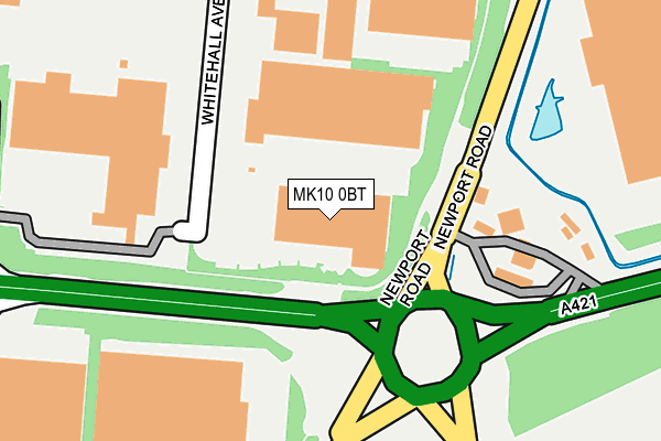
MK10 0BT is located in the Monkston electoral ward, within the unitary authority of Milton Keynes and the English Parliamentary constituency of Milton Keynes North. The Sub Integrated Care Board (ICB) Location is NHS Bedfordshire, Luton and Milton Keynes ICB - M1J4Y and the police force is Thames Valley. This postcode has been in use since June 2002.


GetTheData
Source: OS OpenMap – Local (Ordnance Survey)
Source: OS VectorMap District (Ordnance Survey)
Licence: Open Government Licence (requires attribution)
| Easting | 490684 |
| Northing | 238110 |
| Latitude | 52.033992 |
| Longitude | -0.679470 |
GetTheData
Source: Open Postcode Geo
Licence: Open Government Licence
| Country | England |
| Postcode District | MK10 |
➜ See where MK10 is on a map ➜ Where is Milton Keynes? | |
GetTheData
Source: Land Registry Price Paid Data
Licence: Open Government Licence
Elevation or altitude of MK10 0BT as distance above sea level:
| Metres | Feet | |
|---|---|---|
| Elevation | 70m | 230ft |
Elevation is measured from the approximate centre of the postcode, to the nearest point on an OS contour line from OS Terrain 50, which has contour spacing of ten vertical metres.
➜ How high above sea level am I? Find the elevation of your current position using your device's GPS.
GetTheData
Source: Open Postcode Elevation
Licence: Open Government Licence
| Ward | Monkston |
| Constituency | Milton Keynes North |
GetTheData
Source: ONS Postcode Database
Licence: Open Government Licence
| Kingston Roundabout West (Standing Way H8) | Kingston | 74m |
| Kingston Roundabout West (Standing Way H8) | Kingston | 103m |
| Lasborough Road (Standing Way H8) | Kingston | 432m |
| Lasborough Road (Standing Way H8) | Kingston | 490m |
| Brinklow Roundabout East (Standing Way H8) | Brinklow | 727m |
| Woburn Sands Station | 2.5km |
| Bow Brickhill Station | 3.5km |
| Aspley Guise Station | 3.5km |
GetTheData
Source: NaPTAN
Licence: Open Government Licence
GetTheData
Source: ONS Postcode Database
Licence: Open Government Licence


➜ Get more ratings from the Food Standards Agency
GetTheData
Source: Food Standards Agency
Licence: FSA terms & conditions
| Last Collection | |||
|---|---|---|---|
| Location | Mon-Fri | Sat | Distance |
| Chippenham Drive | 18:30 | 543m | |
| Tesco Stores | 18:30 | 12:00 | 611m |
| Brinklow Delivery Office | 19:15 | 12:30 | 855m |
GetTheData
Source: Dracos
Licence: Creative Commons Attribution-ShareAlike
The below table lists the International Territorial Level (ITL) codes (formerly Nomenclature of Territorial Units for Statistics (NUTS) codes) and Local Administrative Units (LAU) codes for MK10 0BT:
| ITL 1 Code | Name |
|---|---|
| TLJ | South East (England) |
| ITL 2 Code | Name |
| TLJ1 | Berkshire, Buckinghamshire and Oxfordshire |
| ITL 3 Code | Name |
| TLJ12 | Milton Keynes |
| LAU 1 Code | Name |
| E06000042 | Milton Keynes |
GetTheData
Source: ONS Postcode Directory
Licence: Open Government Licence
The below table lists the Census Output Area (OA), Lower Layer Super Output Area (LSOA), and Middle Layer Super Output Area (MSOA) for MK10 0BT:
| Code | Name | |
|---|---|---|
| OA | E00084688 | |
| LSOA | E01016783 | Milton Keynes 017A |
| MSOA | E02003475 | Milton Keynes 017 |
GetTheData
Source: ONS Postcode Directory
Licence: Open Government Licence
| MK17 8FF | Atkinson Way | 522m |
| MK17 8YX | High Street | 578m |
| MK10 0BA | Winchester Circle | 618m |
| MK10 0BD | Maidstone Road | 698m |
| MK7 6AU | 843m | |
| MK7 7SW | Coggeshall Grove | 868m |
| MK7 7SN | Coggeshall Grove | 884m |
| MK7 7SP | Isaacson Drive | 889m |
| MK7 7SL | Isaacson Drive | 902m |
| MK17 8LU | Stockwell Lane | 904m |
GetTheData
Source: Open Postcode Geo; Land Registry Price Paid Data
Licence: Open Government Licence