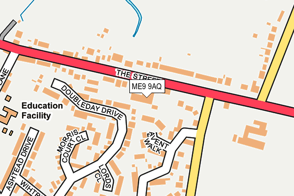
ME9 9AQ is located in the West Downs electoral ward, within the local authority district of Swale and the English Parliamentary constituency of Sittingbourne and Sheppey. The Sub Integrated Care Board (ICB) Location is NHS Kent and Medway ICB - 91Q and the police force is Kent. This postcode has been in use since January 1980.


GetTheData
Source: OS OpenMap – Local (Ordnance Survey)
Source: OS VectorMap District (Ordnance Survey)
Licence: Open Government Licence (requires attribution)
| Easting | 593102 |
| Northing | 163045 |
| Latitude | 51.333701 |
| Longitude | 0.770631 |
GetTheData
Source: Open Postcode Geo
Licence: Open Government Licence
| Country | England |
| Postcode District | ME9 |
➜ See where ME9 is on a map ➜ Where is Sittingbourne? | |
GetTheData
Source: Land Registry Price Paid Data
Licence: Open Government Licence
Elevation or altitude of ME9 9AQ as distance above sea level:
| Metres | Feet | |
|---|---|---|
| Elevation | 10m | 33ft |
Elevation is measured from the approximate centre of the postcode, to the nearest point on an OS contour line from OS Terrain 50, which has contour spacing of ten vertical metres.
➜ How high above sea level am I? Find the elevation of your current position using your device's GPS.
GetTheData
Source: Open Postcode Elevation
Licence: Open Government Licence
| Ward | West Downs |
| Constituency | Sittingbourne And Sheppey |
GetTheData
Source: ONS Postcode Database
Licence: Open Government Licence
| Pomphreys Garage (The Street) | Bapchild | 61m |
| Pomphreys Garage (The Street) | Bapchild | 106m |
| Hempstead Lane (The Street) | Bapchild | 231m |
| Hempstead Lane (London Road) | Bapchild | 259m |
| Fox And Goose (Fox Hill) | Bapchild | 360m |
| Teynham Station | 2.6km |
| Sittingbourne Station | 2.7km |
| Kemsley Station | 4km |
GetTheData
Source: NaPTAN
Licence: Open Government Licence
GetTheData
Source: ONS Postcode Database
Licence: Open Government Licence


➜ Get more ratings from the Food Standards Agency
GetTheData
Source: Food Standards Agency
Licence: FSA terms & conditions
| Last Collection | |||
|---|---|---|---|
| Location | Mon-Fri | Sat | Distance |
| Lansdown Road | 17:15 | 12:00 | 1,002m |
| Doddington Post Office | 16:15 | 09:00 | 1,154m |
| St Johns Avenue | 17:30 | 12:00 | 1,209m |
GetTheData
Source: Dracos
Licence: Creative Commons Attribution-ShareAlike
The below table lists the International Territorial Level (ITL) codes (formerly Nomenclature of Territorial Units for Statistics (NUTS) codes) and Local Administrative Units (LAU) codes for ME9 9AQ:
| ITL 1 Code | Name |
|---|---|
| TLJ | South East (England) |
| ITL 2 Code | Name |
| TLJ4 | Kent |
| ITL 3 Code | Name |
| TLJ43 | Kent Thames Gateway |
| LAU 1 Code | Name |
| E07000113 | Swale |
GetTheData
Source: ONS Postcode Directory
Licence: Open Government Licence
The below table lists the Census Output Area (OA), Lower Layer Super Output Area (LSOA), and Middle Layer Super Output Area (MSOA) for ME9 9AQ:
| Code | Name | |
|---|---|---|
| OA | E00124991 | |
| LSOA | E01024629 | Swale 013D |
| MSOA | E02005127 | Swale 013 |
GetTheData
Source: ONS Postcode Directory
Licence: Open Government Licence
| ME9 9AZ | Avent Walk | 75m |
| ME9 9JF | Randle Way | 95m |
| ME9 9PJ | Doubleday Drive | 111m |
| ME9 9AD | The Street | 111m |
| ME9 9AJ | The Street | 167m |
| ME9 9PW | Randle Way | 168m |
| ME9 9AF | The Street | 168m |
| ME9 9PL | Morris Court Close | 171m |
| ME9 9AH | The Street | 180m |
| ME9 9PH | Lords Close | 184m |
GetTheData
Source: Open Postcode Geo; Land Registry Price Paid Data
Licence: Open Government Licence