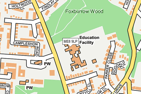
ME8 9LP is located in the Rainham South East electoral ward, within the unitary authority of Medway and the English Parliamentary constituency of Gillingham and Rainham. The Sub Integrated Care Board (ICB) Location is NHS Kent and Medway ICB - 91Q and the police force is Kent. This postcode has been in use since October 1984.


GetTheData
Source: OS OpenMap – Local (Ordnance Survey)
Source: OS VectorMap District (Ordnance Survey)
Licence: Open Government Licence (requires attribution)
| Easting | 581052 |
| Northing | 164323 |
| Latitude | 51.349142 |
| Longitude | 0.598526 |
GetTheData
Source: Open Postcode Geo
Licence: Open Government Licence
| Country | England |
| Postcode District | ME8 |
➜ See where ME8 is on a map ➜ Where is Gillingham? | |
GetTheData
Source: Land Registry Price Paid Data
Licence: Open Government Licence
Elevation or altitude of ME8 9LP as distance above sea level:
| Metres | Feet | |
|---|---|---|
| Elevation | 90m | 295ft |
Elevation is measured from the approximate centre of the postcode, to the nearest point on an OS contour line from OS Terrain 50, which has contour spacing of ten vertical metres.
➜ How high above sea level am I? Find the elevation of your current position using your device's GPS.
GetTheData
Source: Open Postcode Elevation
Licence: Open Government Licence
| Ward | Rainham South East |
| Constituency | Gillingham And Rainham |
GetTheData
Source: ONS Postcode Database
Licence: Open Government Licence
| Shopping Centre (Deanwood Drive) | Parkwood | 162m |
| Shopping Centre (Deanwood Drive) | Parkwood | 215m |
| Campleshon Road (Deanwood Drive) | Parkwood | 230m |
| Campleshon Road (Deanwood Drive) | Parkwood | 233m |
| Dolphin Drive | Parkwood | 283m |
| Rainham (Kent) Station | 2.1km |
| Newington Station | 4.9km |
| Gillingham (Kent) Station | 5.4km |
GetTheData
Source: NaPTAN
Licence: Open Government Licence
GetTheData
Source: ONS Postcode Database
Licence: Open Government Licence


➜ Get more ratings from the Food Standards Agency
GetTheData
Source: Food Standards Agency
Licence: FSA terms & conditions
| Last Collection | |||
|---|---|---|---|
| Location | Mon-Fri | Sat | Distance |
| Deanswood Post Office | 17:30 | 12:00 | 286m |
| Tanker Hill | 17:15 | 12:00 | 355m |
| Ploughmans Way | 17:30 | 12:00 | 395m |
GetTheData
Source: Dracos
Licence: Creative Commons Attribution-ShareAlike
The below table lists the International Territorial Level (ITL) codes (formerly Nomenclature of Territorial Units for Statistics (NUTS) codes) and Local Administrative Units (LAU) codes for ME8 9LP:
| ITL 1 Code | Name |
|---|---|
| TLJ | South East (England) |
| ITL 2 Code | Name |
| TLJ4 | Kent |
| ITL 3 Code | Name |
| TLJ41 | Medway |
| LAU 1 Code | Name |
| E06000035 | Medway |
GetTheData
Source: ONS Postcode Directory
Licence: Open Government Licence
The below table lists the Census Output Area (OA), Lower Layer Super Output Area (LSOA), and Middle Layer Super Output Area (MSOA) for ME8 9LP:
| Code | Name | |
|---|---|---|
| OA | E00081401 | |
| LSOA | E01016105 | Medway 036D |
| MSOA | E02003349 | Medway 036 |
GetTheData
Source: ONS Postcode Directory
Licence: Open Government Licence
| ME8 9LQ | Brackwood Close | 151m |
| ME8 9LF | Campleshon Road | 167m |
| ME8 9NE | Wyvill Close | 184m |
| ME8 9HA | Findlay Close | 189m |
| ME8 9NQ | Parker Close | 191m |
| ME8 9SR | Long Catlis Road | 200m |
| ME8 9LG | Whitegate Court | 212m |
| ME8 9LB | Glynne Close | 223m |
| ME8 9NF | Barlow Close | 224m |
| ME8 9NG | Goodall Close | 229m |
GetTheData
Source: Open Postcode Geo; Land Registry Price Paid Data
Licence: Open Government Licence