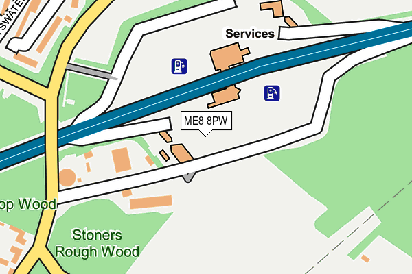
ME8 8PW is located in the Rainham South East electoral ward, within the unitary authority of Medway and the English Parliamentary constituency of Gillingham and Rainham. The Sub Integrated Care Board (ICB) Location is NHS Kent and Medway ICB - 91Q and the police force is Kent. This postcode has been in use since April 1987.


GetTheData
Source: OS OpenMap – Local (Ordnance Survey)
Source: OS VectorMap District (Ordnance Survey)
Licence: Open Government Licence (requires attribution)
| Easting | 581753 |
| Northing | 163505 |
| Latitude | 51.341571 |
| Longitude | 0.608165 |
GetTheData
Source: Open Postcode Geo
Licence: Open Government Licence
| Country | England |
| Postcode District | ME8 |
➜ See where ME8 is on a map | |
GetTheData
Source: Land Registry Price Paid Data
Licence: Open Government Licence
Elevation or altitude of ME8 8PW as distance above sea level:
| Metres | Feet | |
|---|---|---|
| Elevation | 110m | 361ft |
Elevation is measured from the approximate centre of the postcode, to the nearest point on an OS contour line from OS Terrain 50, which has contour spacing of ten vertical metres.
➜ How high above sea level am I? Find the elevation of your current position using your device's GPS.
GetTheData
Source: Open Postcode Elevation
Licence: Open Government Licence
| Ward | Rainham South East |
| Constituency | Gillingham And Rainham |
GetTheData
Source: ONS Postcode Database
Licence: Open Government Licence
| Medway Services | Meresborough | 55m |
| Medway Services | Meresborough | 100m |
| Tyler Drive (Miers Court Road) | Meresborough | 427m |
| Tyler Drive (Miers Court Road) | Meresborough | 432m |
| Middleton Close (Miers Court Road) | Meresborough | 544m |
| Rainham (Kent) Station | 2.8km |
| Newington Station | 4.4km |
| Gillingham (Kent) Station | 6.4km |
GetTheData
Source: NaPTAN
Licence: Open Government Licence
GetTheData
Source: ONS Postcode Database
Licence: Open Government Licence


➜ Get more ratings from the Food Standards Agency
GetTheData
Source: Food Standards Agency
Licence: FSA terms & conditions
| Last Collection | |||
|---|---|---|---|
| Location | Mon-Fri | Sat | Distance |
| Farthing Corner | 17:00 | 12:00 | 33m |
| Burnham Walk | 17:15 | 09:00 | 422m |
| Mierscourt Road | 17:15 | 09:00 | 574m |
GetTheData
Source: Dracos
Licence: Creative Commons Attribution-ShareAlike
The below table lists the International Territorial Level (ITL) codes (formerly Nomenclature of Territorial Units for Statistics (NUTS) codes) and Local Administrative Units (LAU) codes for ME8 8PW:
| ITL 1 Code | Name |
|---|---|
| TLJ | South East (England) |
| ITL 2 Code | Name |
| TLJ4 | Kent |
| ITL 3 Code | Name |
| TLJ41 | Medway |
| LAU 1 Code | Name |
| E06000035 | Medway |
GetTheData
Source: ONS Postcode Directory
Licence: Open Government Licence
The below table lists the Census Output Area (OA), Lower Layer Super Output Area (LSOA), and Middle Layer Super Output Area (MSOA) for ME8 8PW:
| Code | Name | |
|---|---|---|
| OA | E00081386 | |
| LSOA | E01016103 | Medway 032B |
| MSOA | E02003345 | Medway 032 |
GetTheData
Source: ONS Postcode Directory
Licence: Open Government Licence
| ME8 8SP | Meresborough Road | 237m |
| ME8 8SY | Bayswater Drive | 289m |
| ME8 8SL | Mierscourt Road | 300m |
| ME8 8SZ | Bayswater Drive | 320m |
| ME8 8TE | Bayswater Drive | 342m |
| ME8 8TA | Burlington Gardens | 362m |
| ME8 8TQ | Sandgate Court | 363m |
| ME8 8TB | Willowby Gardens | 366m |
| ME8 8RG | Mierscourt Road | 378m |
| ME8 8TF | Bayswater Drive | 382m |
GetTheData
Source: Open Postcode Geo; Land Registry Price Paid Data
Licence: Open Government Licence