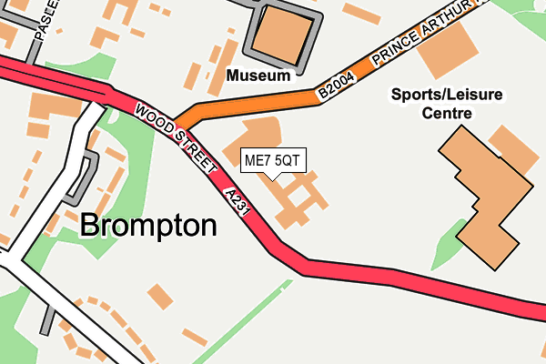
ME7 5QT is located in the Gillingham South electoral ward, within the unitary authority of Medway and the English Parliamentary constituency of Gillingham and Rainham. The Sub Integrated Care Board (ICB) Location is NHS Kent and Medway ICB - 91Q and the police force is Kent. This postcode has been in use since January 1980.


GetTheData
Source: OS OpenMap – Local (Ordnance Survey)
Source: OS VectorMap District (Ordnance Survey)
Licence: Open Government Licence (requires attribution)
| Easting | 576638 |
| Northing | 168810 |
| Latitude | 51.390836 |
| Longitude | 0.537409 |
GetTheData
Source: Open Postcode Geo
Licence: Open Government Licence
| Country | England |
| Postcode District | ME7 |
➜ See where ME7 is on a map ➜ Where is Gillingham? | |
GetTheData
Source: Land Registry Price Paid Data
Licence: Open Government Licence
Elevation or altitude of ME7 5QT as distance above sea level:
| Metres | Feet | |
|---|---|---|
| Elevation | 40m | 131ft |
Elevation is measured from the approximate centre of the postcode, to the nearest point on an OS contour line from OS Terrain 50, which has contour spacing of ten vertical metres.
➜ How high above sea level am I? Find the elevation of your current position using your device's GPS.
GetTheData
Source: Open Postcode Elevation
Licence: Open Government Licence
| Ward | Gillingham South |
| Constituency | Gillingham And Rainham |
GetTheData
Source: ONS Postcode Database
Licence: Open Government Licence
| King Charles Hotel (Brompton Road) | Brompton | 36m |
| King Charles Hotel (Brompton Road) | Brompton | 80m |
| Royal Engineers Museum (Prince Arthur Road) | Gillingham | 179m |
| Royal Engineers Museum (Prince Arthur Road) | Gillingham | 219m |
| Medway Park War Memorial (Brompton Road) | Gillingham | 309m |
| Gillingham (Kent) Station | 1km |
| Chatham Station | 1.6km |
| Rochester Station | 2km |
GetTheData
Source: NaPTAN
Licence: Open Government Licence
GetTheData
Source: ONS Postcode Database
Licence: Open Government Licence


➜ Get more ratings from the Food Standards Agency
GetTheData
Source: Food Standards Agency
Licence: FSA terms & conditions
| Last Collection | |||
|---|---|---|---|
| Location | Mon-Fri | Sat | Distance |
| Sallyport | 17:30 | 11:45 | 272m |
| Mansion Row | 17:30 | 11:45 | 383m |
| High Street | 17:30 | 11:30 | 386m |
GetTheData
Source: Dracos
Licence: Creative Commons Attribution-ShareAlike
The below table lists the International Territorial Level (ITL) codes (formerly Nomenclature of Territorial Units for Statistics (NUTS) codes) and Local Administrative Units (LAU) codes for ME7 5QT:
| ITL 1 Code | Name |
|---|---|
| TLJ | South East (England) |
| ITL 2 Code | Name |
| TLJ4 | Kent |
| ITL 3 Code | Name |
| TLJ41 | Medway |
| LAU 1 Code | Name |
| E06000035 | Medway |
GetTheData
Source: ONS Postcode Directory
Licence: Open Government Licence
The below table lists the Census Output Area (OA), Lower Layer Super Output Area (LSOA), and Middle Layer Super Output Area (MSOA) for ME7 5QT:
| Code | Name | |
|---|---|---|
| OA | E00081049 | |
| LSOA | E01016035 | Medway 007A |
| MSOA | E02003320 | Medway 007 |
GetTheData
Source: ONS Postcode Directory
Licence: Open Government Licence
| ME7 5SE | Mansion Row | 370m |
| ME7 1HL | Mill Road | 376m |
| ME7 1HN | Mill Road | 382m |
| ME7 5SD | Wood Street | 396m |
| ME7 5AW | Manor Street | 415m |
| ME7 1HW | Mill Road | 417m |
| ME7 5AS | Garden Street | 420m |
| ME7 5GB | Garden Street | 420m |
| ME7 5BD | Conway Mews | 433m |
| ME7 1BB | High Street | 433m |
GetTheData
Source: Open Postcode Geo; Land Registry Price Paid Data
Licence: Open Government Licence