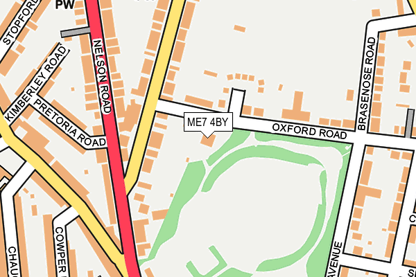
ME7 4BY is located in the Watling electoral ward, within the unitary authority of Medway and the English Parliamentary constituency of Gillingham and Rainham. The Sub Integrated Care Board (ICB) Location is NHS Kent and Medway ICB - 91Q and the police force is Kent. This postcode has been in use since June 2002.


GetTheData
Source: OS OpenMap – Local (Ordnance Survey)
Source: OS VectorMap District (Ordnance Survey)
Licence: Open Government Licence (requires attribution)
| Easting | 577790 |
| Northing | 167395 |
| Latitude | 51.377766 |
| Longitude | 0.553241 |
GetTheData
Source: Open Postcode Geo
Licence: Open Government Licence
| Country | England |
| Postcode District | ME7 |
➜ See where ME7 is on a map ➜ Where is Gillingham? | |
GetTheData
Source: Land Registry Price Paid Data
Licence: Open Government Licence
Elevation or altitude of ME7 4BY as distance above sea level:
| Metres | Feet | |
|---|---|---|
| Elevation | 70m | 230ft |
Elevation is measured from the approximate centre of the postcode, to the nearest point on an OS contour line from OS Terrain 50, which has contour spacing of ten vertical metres.
➜ How high above sea level am I? Find the elevation of your current position using your device's GPS.
GetTheData
Source: Open Postcode Elevation
Licence: Open Government Licence
| Ward | Watling |
| Constituency | Gillingham And Rainham |
GetTheData
Source: ONS Postcode Database
Licence: Open Government Licence
| Napier Road (Nelson Road) | Gillingham | 133m |
| Napier Road (Nelson Road) | Gillingham | 147m |
| Gillingham Park (Canterbury Street) | Gillingham | 226m |
| Byron Primary School (Canterbury Street) | Gillingham | 248m |
| Gillingham Park (Canterbury Street) | Gillingham | 264m |
| Gillingham (Kent) Station | 1km |
| Chatham Station | 2.3km |
| Rochester Station | 3.1km |
GetTheData
Source: NaPTAN
Licence: Open Government Licence
GetTheData
Source: ONS Postcode Database
Licence: Open Government Licence


➜ Get more ratings from the Food Standards Agency
GetTheData
Source: Food Standards Agency
Licence: FSA terms & conditions
| Last Collection | |||
|---|---|---|---|
| Location | Mon-Fri | Sat | Distance |
| Nelson Road | 17:30 | 11:30 | 165m |
| Municipal Offices | 17:30 | 11:30 | 289m |
| Rainham Road Post Office | 17:30 | 11:30 | 485m |
GetTheData
Source: Dracos
Licence: Creative Commons Attribution-ShareAlike
The below table lists the International Territorial Level (ITL) codes (formerly Nomenclature of Territorial Units for Statistics (NUTS) codes) and Local Administrative Units (LAU) codes for ME7 4BY:
| ITL 1 Code | Name |
|---|---|
| TLJ | South East (England) |
| ITL 2 Code | Name |
| TLJ4 | Kent |
| ITL 3 Code | Name |
| TLJ41 | Medway |
| LAU 1 Code | Name |
| E06000035 | Medway |
GetTheData
Source: ONS Postcode Directory
Licence: Open Government Licence
The below table lists the Census Output Area (OA), Lower Layer Super Output Area (LSOA), and Middle Layer Super Output Area (MSOA) for ME7 4BY:
| Code | Name | |
|---|---|---|
| OA | E00081749 | |
| LSOA | E01016178 | Medway 013E |
| MSOA | E02003326 | Medway 013 |
GetTheData
Source: ONS Postcode Directory
Licence: Open Government Licence
| ME7 4BX | Oxford Road | 58m |
| ME7 4LY | Napier Road | 86m |
| ME7 4BU | St Barnabas Close | 105m |
| ME7 4HN | Napier Road | 149m |
| ME7 4HL | Napier Road | 162m |
| ME7 4NB | Nelson Road | 163m |
| ME7 4BP | Oxford Road | 164m |
| ME7 4LU | Nelson Road | 172m |
| ME7 4NA | Nelson Road | 174m |
| ME7 4LT | Nelson Road | 192m |
GetTheData
Source: Open Postcode Geo; Land Registry Price Paid Data
Licence: Open Government Licence