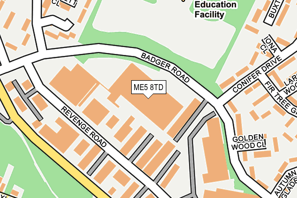
ME5 8TD is located in the Lordswood & Walderslade electoral ward, within the unitary authority of Medway and the English Parliamentary constituency of Chatham and Aylesford. The Sub Integrated Care Board (ICB) Location is NHS Kent and Medway ICB - 91Q and the police force is Kent. This postcode has been in use since January 1980.


GetTheData
Source: OS OpenMap – Local (Ordnance Survey)
Source: OS VectorMap District (Ordnance Survey)
Licence: Open Government Licence (requires attribution)
| Easting | 577384 |
| Northing | 162078 |
| Latitude | 51.330131 |
| Longitude | 0.544765 |
GetTheData
Source: Open Postcode Geo
Licence: Open Government Licence
| Country | England |
| Postcode District | ME5 |
➜ See where ME5 is on a map ➜ Where is Chatham? | |
GetTheData
Source: Land Registry Price Paid Data
Licence: Open Government Licence
Elevation or altitude of ME5 8TD as distance above sea level:
| Metres | Feet | |
|---|---|---|
| Elevation | 160m | 525ft |
Elevation is measured from the approximate centre of the postcode, to the nearest point on an OS contour line from OS Terrain 50, which has contour spacing of ten vertical metres.
➜ How high above sea level am I? Find the elevation of your current position using your device's GPS.
GetTheData
Source: Open Postcode Elevation
Licence: Open Government Licence
| Ward | Lordswood & Walderslade |
| Constituency | Chatham And Aylesford |
GetTheData
Source: ONS Postcode Database
Licence: Open Government Licence
| Copper Tree Walk (Badger Road) | Lordswood | 169m |
| Golden Wood Close (Badger Road) | Walderslade | 189m |
| Copper Tree Walk (Badger Road) | Lordswood | 189m |
| Boxley Road | Walderslade | 313m |
| Autumn Glade (Badger Road) | Walderslade | 318m |
| Rainham (Kent) Station | 6.1km |
GetTheData
Source: NaPTAN
Licence: Open Government Licence
GetTheData
Source: ONS Postcode Database
Licence: Open Government Licence


➜ Get more ratings from the Food Standards Agency
GetTheData
Source: Food Standards Agency
Licence: FSA terms & conditions
| Last Collection | |||
|---|---|---|---|
| Location | Mon-Fri | Sat | Distance |
| Revenge Road | 18:30 | 127m | |
| Tuscan Drive | 17:30 | 11:00 | 308m |
| Clandon Road | 16:00 | 10:45 | 435m |
GetTheData
Source: Dracos
Licence: Creative Commons Attribution-ShareAlike
The below table lists the International Territorial Level (ITL) codes (formerly Nomenclature of Territorial Units for Statistics (NUTS) codes) and Local Administrative Units (LAU) codes for ME5 8TD:
| ITL 1 Code | Name |
|---|---|
| TLJ | South East (England) |
| ITL 2 Code | Name |
| TLJ4 | Kent |
| ITL 3 Code | Name |
| TLJ41 | Medway |
| LAU 1 Code | Name |
| E06000035 | Medway |
GetTheData
Source: ONS Postcode Directory
Licence: Open Government Licence
The below table lists the Census Output Area (OA), Lower Layer Super Output Area (LSOA), and Middle Layer Super Output Area (MSOA) for ME5 8TD:
| Code | Name | |
|---|---|---|
| OA | E00081164 | |
| LSOA | E01016057 | Medway 038C |
| MSOA | E02003351 | Medway 038 |
GetTheData
Source: ONS Postcode Directory
Licence: Open Government Licence
| ME5 8UD | Lordswood Industrial Estate | 175m |
| ME5 8TY | Badger Road | 194m |
| ME5 8UU | Conifer Drive | 208m |
| ME5 8XJ | Conifer Drive | 213m |
| ME5 8TU | Badger Road | 220m |
| ME5 8TS | Coppertree Walk | 253m |
| ME5 8XA | Golden Wood Close | 262m |
| ME5 8XD | Fir Tree Grove | 271m |
| ME5 8XR | Badger Road | 276m |
| ME5 8TX | Bartlett Close | 282m |
GetTheData
Source: Open Postcode Geo; Land Registry Price Paid Data
Licence: Open Government Licence