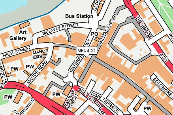
ME4 4DQ is located in the Chatham Central & Brompton electoral ward, within the unitary authority of Medway and the English Parliamentary constituency of Rochester and Strood. The Sub Integrated Care Board (ICB) Location is NHS Kent and Medway ICB - 91Q and the police force is Kent. This postcode has been in use since January 1980.


GetTheData
Source: OS OpenMap – Local (Ordnance Survey)
Source: OS VectorMap District (Ordnance Survey)
Licence: Open Government Licence (requires attribution)
| Easting | 575697 |
| Northing | 167932 |
| Latitude | 51.383241 |
| Longitude | 0.523464 |
GetTheData
Source: Open Postcode Geo
Licence: Open Government Licence
| Country | England |
| Postcode District | ME4 |
➜ See where ME4 is on a map ➜ Where is Chatham? | |
GetTheData
Source: Land Registry Price Paid Data
Licence: Open Government Licence
Elevation or altitude of ME4 4DQ as distance above sea level:
| Metres | Feet | |
|---|---|---|
| Elevation | 10m | 33ft |
Elevation is measured from the approximate centre of the postcode, to the nearest point on an OS contour line from OS Terrain 50, which has contour spacing of ten vertical metres.
➜ How high above sea level am I? Find the elevation of your current position using your device's GPS.
GetTheData
Source: Open Postcode Elevation
Licence: Open Government Licence
| Ward | Chatham Central & Brompton |
| Constituency | Rochester And Strood |
GetTheData
Source: ONS Postcode Database
Licence: Open Government Licence
| Fire Station (New Cut) | Chatham | 214m |
| Anchorage House (High Street) | Chatham | 268m |
| Anchorage House (High Street) | Chatham | 356m |
| The Brook Iceland (The Brook) | Chatham | 439m |
| Ordnance Street | Chatham | 480m |
| Chatham Station | 0.4km |
| Rochester Station | 1km |
| Gillingham (Kent) Station | 1.9km |
GetTheData
Source: NaPTAN
Licence: Open Government Licence
GetTheData
Source: ONS Postcode Database
Licence: Open Government Licence


➜ Get more ratings from the Food Standards Agency
GetTheData
Source: Food Standards Agency
Licence: FSA terms & conditions
| Last Collection | |||
|---|---|---|---|
| Location | Mon-Fri | Sat | Distance |
| Military Road | 18:30 | 11:45 | 120m |
| Manor Road | 18:30 | 11:30 | 227m |
| Meeting House Lane | 18:30 | 11:30 | 266m |
GetTheData
Source: Dracos
Licence: Creative Commons Attribution-ShareAlike
| Risk of ME4 4DQ flooding from rivers and sea | Low |
| ➜ ME4 4DQ flood map | |
GetTheData
Source: Open Flood Risk by Postcode
Licence: Open Government Licence
The below table lists the International Territorial Level (ITL) codes (formerly Nomenclature of Territorial Units for Statistics (NUTS) codes) and Local Administrative Units (LAU) codes for ME4 4DQ:
| ITL 1 Code | Name |
|---|---|
| TLJ | South East (England) |
| ITL 2 Code | Name |
| TLJ4 | Kent |
| ITL 3 Code | Name |
| TLJ41 | Medway |
| LAU 1 Code | Name |
| E06000035 | Medway |
GetTheData
Source: ONS Postcode Directory
Licence: Open Government Licence
The below table lists the Census Output Area (OA), Lower Layer Super Output Area (LSOA), and Middle Layer Super Output Area (MSOA) for ME4 4DQ:
| Code | Name | |
|---|---|---|
| OA | E00167383 | |
| LSOA | E01016110 | Medway 015D |
| MSOA | E02003328 | Medway 015 |
GetTheData
Source: ONS Postcode Directory
Licence: Open Government Licence
| ME4 4JL | Railway Street | 28m |
| ME4 4JG | Military Road | 66m |
| ME4 4BY | High Street | 68m |
| ME4 4HU | Railway Street | 72m |
| ME4 4RF | The Paddock | 100m |
| ME4 4BA | High Street | 102m |
| ME4 4RG | Cambridge Terrace | 118m |
| ME4 4RH | Railway Street | 143m |
| ME4 4RE | The Paddock | 152m |
| ME4 6AU | Manor Road | 173m |
GetTheData
Source: Open Postcode Geo; Land Registry Price Paid Data
Licence: Open Government Licence