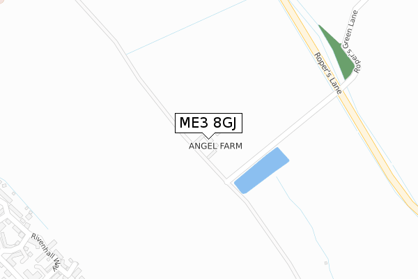
ME3 8GJ is located in the Hoo St Werburgh & High Halstow electoral ward, within the unitary authority of Medway and the English Parliamentary constituency of Rochester and Strood. The Sub Integrated Care Board (ICB) Location is NHS Kent and Medway ICB - 91Q and the police force is Kent. This postcode has been in use since February 2018.


GetTheData
Source: OS Open Zoomstack (Ordnance Survey)
Licence: Open Government Licence (requires attribution)
Attribution: Contains OS data © Crown copyright and database right 2024
Source: Open Postcode Geo
Licence: Open Government Licence (requires attribution)
Attribution: Contains OS data © Crown copyright and database right 2024; Contains Royal Mail data © Royal Mail copyright and database right 2024; Source: Office for National Statistics licensed under the Open Government Licence v.3.0
| Easting | 578662 |
| Northing | 173220 |
| Latitude | 51.429817 |
| Longitude | 0.568717 |
GetTheData
Source: Open Postcode Geo
Licence: Open Government Licence
| Country | England |
| Postcode District | ME3 |
➜ See where ME3 is on a map | |
GetTheData
Source: Land Registry Price Paid Data
Licence: Open Government Licence
| Ward | Hoo St Werburgh & High Halstow |
| Constituency | Rochester And Strood |
GetTheData
Source: ONS Postcode Database
Licence: Open Government Licence
| Sturdee Cottages (Stoke Road) | Hoo St Werburgh | 637m |
| Sturdee Cottages (Stoke Road) | Hoo St Werburgh | 650m |
| Bells Lane | Hoo St Werburgh | 710m |
| Bells Lane | Hoo St Werburgh | 723m |
| Kingsnorth Close (Bells Lane) | Hoo St Werburgh | 745m |
| Gillingham (Kent) Station | 5km |
| Strood Station | 6km |
GetTheData
Source: NaPTAN
Licence: Open Government Licence
GetTheData
Source: ONS Postcode Database
Licence: Open Government Licence


➜ Get more ratings from the Food Standards Agency
GetTheData
Source: Food Standards Agency
Licence: FSA terms & conditions
| Last Collection | |||
|---|---|---|---|
| Location | Mon-Fri | Sat | Distance |
| Hoo Schools | 17:00 | 10:00 | 543m |
| Moremont Road | 16:45 | 10:30 | 1,083m |
| Hoo Post Office | 17:15 | 11:15 | 1,183m |
GetTheData
Source: Dracos
Licence: Creative Commons Attribution-ShareAlike
The below table lists the International Territorial Level (ITL) codes (formerly Nomenclature of Territorial Units for Statistics (NUTS) codes) and Local Administrative Units (LAU) codes for ME3 8GJ:
| ITL 1 Code | Name |
|---|---|
| TLJ | South East (England) |
| ITL 2 Code | Name |
| TLJ4 | Kent |
| ITL 3 Code | Name |
| TLJ41 | Medway |
| LAU 1 Code | Name |
| E06000035 | Medway |
GetTheData
Source: ONS Postcode Directory
Licence: Open Government Licence
The below table lists the Census Output Area (OA), Lower Layer Super Output Area (LSOA), and Middle Layer Super Output Area (MSOA) for ME3 8GJ:
| Code | Name | |
|---|---|---|
| OA | E00081268 | |
| LSOA | E01016074 | Medway 001D |
| MSOA | E02003314 | Medway 001 |
GetTheData
Source: ONS Postcode Directory
Licence: Open Government Licence
| ME3 8PT | Ratcliffe Highway | 24m |
| ME3 9GN | Sanctus Court | 455m |
| ME3 9GE | Baryntyne Crescent | 481m |
| ME3 9LZ | Headstock Rise | 497m |
| ME3 9FL | Rivenhall Court | 502m |
| ME3 9GF | Rivenhall Way | 514m |
| ME3 9FH | Rivenhall Way | 546m |
| ME3 9GZ | Tenor Drive | 557m |
| ME3 9JQ | Carillon Close | 563m |
| ME3 9FB | Chorister Crescent | 566m |
GetTheData
Source: Open Postcode Geo; Land Registry Price Paid Data
Licence: Open Government Licence