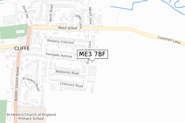
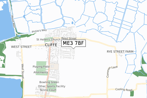
ME3 7BF is located in the Strood Rural electoral ward, within the unitary authority of Medway and the English Parliamentary constituency of Rochester and Strood. The Sub Integrated Care Board (ICB) Location is NHS Kent and Medway ICB - 91Q and the police force is Kent. This postcode has been in use since November 2019.


GetTheData
Source: OS Open Zoomstack (Ordnance Survey)
Licence: Open Government Licence (requires attribution)
Attribution: Contains OS data © Crown copyright and database right 2025
Source: Open Postcode Geo
Licence: Open Government Licence (requires attribution)
Attribution: Contains OS data © Crown copyright and database right 2025; Contains Royal Mail data © Royal Mail copyright and database right 2025; Source: Office for National Statistics licensed under the Open Government Licence v.3.0
| Easting | 573990 |
| Northing | 176466 |
| Latitude | 51.460428 |
| Longitude | 0.503174 |
GetTheData
Source: Open Postcode Geo
Licence: Open Government Licence
| Country | England |
| Postcode District | ME3 |
➜ See where ME3 is on a map ➜ Where is Cliffe? | |
GetTheData
Source: Land Registry Price Paid Data
Licence: Open Government Licence
| Ward | Strood Rural |
| Constituency | Rochester And Strood |
GetTheData
Source: ONS Postcode Database
Licence: Open Government Licence
| Six Bells (Church Street) | Cliffe | 396m |
| Village Club (Church Street) | Cliffe | 603m |
| Village Club (Church Street) | Cliffe | 608m |
| Norwood Close (Church Street) | Cliffe | 828m |
| Norwood Close (Church Street) | Cliffe | 903m |
| Higham Station | 4.6km |
GetTheData
Source: NaPTAN
Licence: Open Government Licence
GetTheData
Source: ONS Postcode Database
Licence: Open Government Licence


➜ Get more ratings from the Food Standards Agency
GetTheData
Source: Food Standards Agency
Licence: FSA terms & conditions
| Last Collection | |||
|---|---|---|---|
| Location | Mon-Fri | Sat | Distance |
| Thathers Lane | 17:00 | 09:30 | 16m |
| Cliffe (Former Post Office) | 17:00 | 09:30 | 375m |
| St Helens Terrace | 17:00 | 10:30 | 913m |
GetTheData
Source: Dracos
Licence: Creative Commons Attribution-ShareAlike
The below table lists the International Territorial Level (ITL) codes (formerly Nomenclature of Territorial Units for Statistics (NUTS) codes) and Local Administrative Units (LAU) codes for ME3 7BF:
| ITL 1 Code | Name |
|---|---|
| TLJ | South East (England) |
| ITL 2 Code | Name |
| TLJ4 | Kent |
| ITL 3 Code | Name |
| TLJ41 | Medway |
| LAU 1 Code | Name |
| E06000035 | Medway |
GetTheData
Source: ONS Postcode Directory
Licence: Open Government Licence
The below table lists the Census Output Area (OA), Lower Layer Super Output Area (LSOA), and Middle Layer Super Output Area (MSOA) for ME3 7BF:
| Code | Name | |
|---|---|---|
| OA | E00081597 | |
| LSOA | E01016149 | Medway 002D |
| MSOA | E02003315 | Medway 002 |
GetTheData
Source: ONS Postcode Directory
Licence: Open Government Licence
| ME3 7TN | Thatchers Lane | 66m |
| ME3 7RE | Thatchers Lane | 89m |
| ME3 7TW | Thatchers Lane | 129m |
| ME3 7QZ | Swingate Avenue | 132m |
| ME3 7RF | Ann Villas | 133m |
| ME3 7RD | Wadlands Road | 167m |
| ME3 7UJ | Reed Street | 198m |
| ME3 7RH | Rookery Crescent | 202m |
| ME3 7TL | Chancery Road | 204m |
| ME3 7UF | Green Lane | 255m |
GetTheData
Source: Open Postcode Geo; Land Registry Price Paid Data
Licence: Open Government Licence