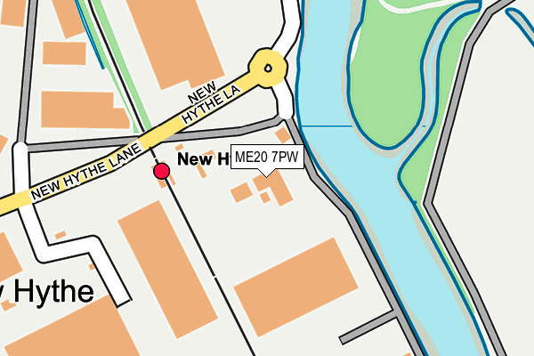
ME20 7PW is located in the Larkfield electoral ward, within the local authority district of Tonbridge and Malling and the English Parliamentary constituency of Chatham and Aylesford. The Sub Integrated Care Board (ICB) Location is NHS Kent and Medway ICB - 91Q and the police force is Kent. This postcode has been in use since November 2004.


GetTheData
Source: OS OpenMap – Local (Ordnance Survey)
Source: OS VectorMap District (Ordnance Survey)
Licence: Open Government Licence (requires attribution)
| Easting | 571336 |
| Northing | 159989 |
| Latitude | 51.313217 |
| Longitude | 0.457065 |
GetTheData
Source: Open Postcode Geo
Licence: Open Government Licence
| Country | England |
| Postcode District | ME20 |
➜ See where ME20 is on a map ➜ Where is New Hythe? | |
GetTheData
Source: Land Registry Price Paid Data
Licence: Open Government Licence
Elevation or altitude of ME20 7PW as distance above sea level:
| Metres | Feet | |
|---|---|---|
| Elevation | 10m | 33ft |
Elevation is measured from the approximate centre of the postcode, to the nearest point on an OS contour line from OS Terrain 50, which has contour spacing of ten vertical metres.
➜ How high above sea level am I? Find the elevation of your current position using your device's GPS.
GetTheData
Source: Open Postcode Elevation
Licence: Open Government Licence
| Ward | Larkfield |
| Constituency | Chatham And Aylesford |
GetTheData
Source: ONS Postcode Database
Licence: Open Government Licence
| Railway Station (New Hythe Lane) | New Hythe | 273m |
| Bricklayers Arms (New Hythe Lane) | Larkfield | 550m |
| Bricklayers Arms (New Hythe Lane) | Larkfield | 573m |
| Mercer Close (New Hythe Lane) | Larkfield | 867m |
| Mercer Close (New Hythe Lane) | Larkfield | 874m |
| New Hythe Station | 0.1km |
| Aylesford Station | 1.5km |
| Snodland Station | 2km |
GetTheData
Source: NaPTAN
Licence: Open Government Licence
GetTheData
Source: ONS Postcode Database
Licence: Open Government Licence


➜ Get more ratings from the Food Standards Agency
GetTheData
Source: Food Standards Agency
Licence: FSA terms & conditions
| Last Collection | |||
|---|---|---|---|
| Location | Mon-Fri | Sat | Distance |
| Lunsford Lane Lower | 16:15 | 09:00 | 658m |
| Brookland Estate | 16:00 | 09:00 | 988m |
| Chocolate Box | 16:00 | 10:45 | 1,184m |
GetTheData
Source: Dracos
Licence: Creative Commons Attribution-ShareAlike
| Risk of ME20 7PW flooding from rivers and sea | Low |
| ➜ ME20 7PW flood map | |
GetTheData
Source: Open Flood Risk by Postcode
Licence: Open Government Licence
The below table lists the International Territorial Level (ITL) codes (formerly Nomenclature of Territorial Units for Statistics (NUTS) codes) and Local Administrative Units (LAU) codes for ME20 7PW:
| ITL 1 Code | Name |
|---|---|
| TLJ | South East (England) |
| ITL 2 Code | Name |
| TLJ4 | Kent |
| ITL 3 Code | Name |
| TLJ46 | West Kent |
| LAU 1 Code | Name |
| E07000115 | Tonbridge and Malling |
GetTheData
Source: ONS Postcode Directory
Licence: Open Government Licence
The below table lists the Census Output Area (OA), Lower Layer Super Output Area (LSOA), and Middle Layer Super Output Area (MSOA) for ME20 7PW:
| Code | Name | |
|---|---|---|
| OA | E00125690 | |
| LSOA | E01024762 | Tonbridge and Malling 003C |
| MSOA | E02005151 | Tonbridge and Malling 003 |
GetTheData
Source: ONS Postcode Directory
Licence: Open Government Licence
| ME20 7FE | New Hythe Lane | 194m |
| ME20 7GJ | Sherwood Avenue | 442m |
| ME20 7GN | Sherwood Avenue | 482m |
| ME20 7GQ | Ingram Close | 512m |
| ME20 7GR | Ingram Close | 544m |
| ME20 7GP | Ingram Close | 557m |
| ME20 6US | New Hythe Lane | 624m |
| ME20 7GD | Abery Drive | 625m |
| ME20 6SA | New Hythe Lane | 661m |
| ME20 7GF | Eaton Place | 675m |
GetTheData
Source: Open Postcode Geo; Land Registry Price Paid Data
Licence: Open Government Licence