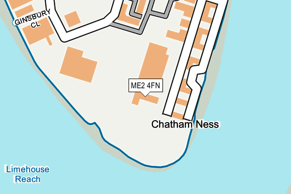
ME2 4FN is located in the Strood Rural electoral ward, within the unitary authority of Medway and the English Parliamentary constituency of Rochester and Strood. The Sub Integrated Care Board (ICB) Location is NHS Kent and Medway ICB - 91Q and the police force is Kent. This postcode has been in use since December 2001.


GetTheData
Source: OS OpenMap – Local (Ordnance Survey)
Source: OS VectorMap District (Ordnance Survey)
Licence: Open Government Licence (requires attribution)
| Easting | 575304 |
| Northing | 168468 |
| Latitude | 51.388177 |
| Longitude | 0.518115 |
GetTheData
Source: Open Postcode Geo
Licence: Open Government Licence
| Country | England |
| Postcode District | ME2 |
➜ See where ME2 is on a map ➜ Where is Rochester? | |
GetTheData
Source: Land Registry Price Paid Data
Licence: Open Government Licence
Elevation or altitude of ME2 4FN as distance above sea level:
| Metres | Feet | |
|---|---|---|
| Elevation | 10m | 33ft |
Elevation is measured from the approximate centre of the postcode, to the nearest point on an OS contour line from OS Terrain 50, which has contour spacing of ten vertical metres.
➜ How high above sea level am I? Find the elevation of your current position using your device's GPS.
GetTheData
Source: Open Postcode Elevation
Licence: Open Government Licence
| Ward | Strood Rural |
| Constituency | Rochester And Strood |
GetTheData
Source: ONS Postcode Database
Licence: Open Government Licence
| Riverside Estate Scotline (Sir Thomas Longley Road) | Medway City Estate | 189m |
| Sir Thomas Longley Road | Medway City Estate | 312m |
| Culpepper Close (Sir Thomas Longley Road) | Medway City Estate | 455m |
| Fort Amherst Council Offices (Dock Road) | Chatham | 478m |
| Fort Amherst Council Offices (Dock Road) | Chatham | 479m |
| Rochester Station | 0.6km |
| Chatham Station | 0.9km |
| Strood Station | 1.6km |
GetTheData
Source: NaPTAN
Licence: Open Government Licence
GetTheData
Source: ONS Postcode Database
Licence: Open Government Licence


➜ Get more ratings from the Food Standards Agency
GetTheData
Source: Food Standards Agency
Licence: FSA terms & conditions
| Last Collection | |||
|---|---|---|---|
| Location | Mon-Fri | Sat | Distance |
| Sir Thomas Longley Road | 18:30 | 11:00 | 242m |
| Hammond Hill | 18:30 | 11:30 | 552m |
| St Margarets Bank | 18:30 | 11:30 | 592m |
GetTheData
Source: Dracos
Licence: Creative Commons Attribution-ShareAlike
| Risk of ME2 4FN flooding from rivers and sea | Low |
| ➜ ME2 4FN flood map | |
GetTheData
Source: Open Flood Risk by Postcode
Licence: Open Government Licence
The below table lists the International Territorial Level (ITL) codes (formerly Nomenclature of Territorial Units for Statistics (NUTS) codes) and Local Administrative Units (LAU) codes for ME2 4FN:
| ITL 1 Code | Name |
|---|---|
| TLJ | South East (England) |
| ITL 2 Code | Name |
| TLJ4 | Kent |
| ITL 3 Code | Name |
| TLJ41 | Medway |
| LAU 1 Code | Name |
| E06000035 | Medway |
GetTheData
Source: ONS Postcode Directory
Licence: Open Government Licence
The below table lists the Census Output Area (OA), Lower Layer Super Output Area (LSOA), and Middle Layer Super Output Area (MSOA) for ME2 4FN:
| Code | Name | |
|---|---|---|
| OA | E00081615 | |
| LSOA | E01016147 | Medway 004B |
| MSOA | E02003317 | Medway 004 |
GetTheData
Source: ONS Postcode Directory
Licence: Open Government Licence
| ME2 4FA | Beaufort Court | 142m |
| ME2 4BH | Riverside Estate | 200m |
| ME2 4FX | Beaufort Court | 201m |
| ME2 4FE | Beaufort Court | 229m |
| ME2 4DP | Riverside Estate | 229m |
| ME2 4DU | Sir Thomas Longley Road | 384m |
| ME4 4EN | High Street | 480m |
| ME2 4NZ | Waterside Court | 504m |
| ME4 4EE | High Street | 520m |
| ME4 4DS | High Street | 547m |
GetTheData
Source: Open Postcode Geo; Land Registry Price Paid Data
Licence: Open Government Licence