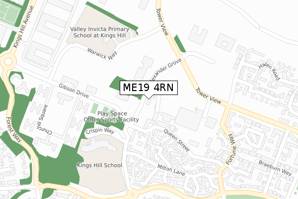
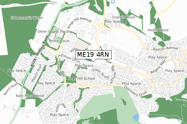
ME19 4RN is located in the Kings Hill electoral ward, within the local authority district of Tonbridge and Malling and the English Parliamentary constituency of Tonbridge and Malling. The Sub Integrated Care Board (ICB) Location is NHS Kent and Medway ICB - 91Q and the police force is Kent. This postcode has been in use since February 2018.


GetTheData
Source: OS Open Zoomstack (Ordnance Survey)
Licence: Open Government Licence (requires attribution)
Attribution: Contains OS data © Crown copyright and database right 2025
Source: Open Postcode Geo
Licence: Open Government Licence (requires attribution)
Attribution: Contains OS data © Crown copyright and database right 2025; Contains Royal Mail data © Royal Mail copyright and database right 2025; Source: Office for National Statistics licensed under the Open Government Licence v.3.0
| Easting | 567531 |
| Northing | 155394 |
| Latitude | 51.273067 |
| Longitude | 0.400366 |
GetTheData
Source: Open Postcode Geo
Licence: Open Government Licence
| Country | England |
| Postcode District | ME19 |
➜ See where ME19 is on a map ➜ Where is Kings Hill? | |
GetTheData
Source: Land Registry Price Paid Data
Licence: Open Government Licence
| Ward | Kings Hill |
| Constituency | Tonbridge And Malling |
GetTheData
Source: ONS Postcode Database
Licence: Open Government Licence
| Asda (Tower View) | Kings Hill | 147m |
| Asda (Tower View) | Kings Hill | 171m |
| Forest Way (Discovery Drive) | Kings Hill | 436m |
| Forest Way (Discovery Drive) | Kings Hill | 448m |
| Silver Ball Roundabout (Kings Hill Avenue) | Kings Hill | 468m |
| West Malling Station | 2.5km |
| Wateringbury Station | 3km |
| East Malling Station | 3.1km |
GetTheData
Source: NaPTAN
Licence: Open Government Licence
| Percentage of properties with Next Generation Access | 100.0% |
| Percentage of properties with Superfast Broadband | 100.0% |
| Percentage of properties with Ultrafast Broadband | 0.0% |
| Percentage of properties with Full Fibre Broadband | 0.0% |
Superfast Broadband is between 30Mbps and 300Mbps
Ultrafast Broadband is > 300Mbps
| Median download speed | 46.3Mbps |
| Average download speed | 40.5Mbps |
| Maximum download speed | 55.03Mbps |
| Median upload speed | 12.3Mbps |
| Average upload speed | 12.4Mbps |
| Maximum upload speed | 20.00Mbps |
| Percentage of properties unable to receive 2Mbps | 0.0% |
| Percentage of properties unable to receive 5Mbps | 0.0% |
| Percentage of properties unable to receive 10Mbps | 0.0% |
| Percentage of properties unable to receive 30Mbps | 0.0% |
GetTheData
Source: Ofcom
Licence: Ofcom Terms of Use (requires attribution)
GetTheData
Source: ONS Postcode Database
Licence: Open Government Licence


➜ Get more ratings from the Food Standards Agency
GetTheData
Source: Food Standards Agency
Licence: FSA terms & conditions
| Last Collection | |||
|---|---|---|---|
| Location | Mon-Fri | Sat | Distance |
| Asda | 18:30 | 11:45 | 114m |
| Kings Hill | 18:30 | 232m | |
| Pippin Way | 18:00 | 11:30 | 693m |
GetTheData
Source: Dracos
Licence: Creative Commons Attribution-ShareAlike
The below table lists the International Territorial Level (ITL) codes (formerly Nomenclature of Territorial Units for Statistics (NUTS) codes) and Local Administrative Units (LAU) codes for ME19 4RN:
| ITL 1 Code | Name |
|---|---|
| TLJ | South East (England) |
| ITL 2 Code | Name |
| TLJ4 | Kent |
| ITL 3 Code | Name |
| TLJ46 | West Kent |
| LAU 1 Code | Name |
| E07000115 | Tonbridge and Malling |
GetTheData
Source: ONS Postcode Directory
Licence: Open Government Licence
The below table lists the Census Output Area (OA), Lower Layer Super Output Area (LSOA), and Middle Layer Super Output Area (MSOA) for ME19 4RN:
| Code | Name | |
|---|---|---|
| OA | E00167616 | |
| LSOA | E01032826 | Tonbridge and Malling 007F |
| MSOA | E02005155 | Tonbridge and Malling 007 |
GetTheData
Source: ONS Postcode Directory
Licence: Open Government Licence
| ME19 4JD | Queen Street | 116m |
| ME19 4HZ | Laxton Walk | 179m |
| ME19 4HX | Milton Lane | 181m |
| ME19 4JS | Spencer Place | 191m |
| ME19 4JG | Laxton Walk | 198m |
| ME19 4HU | Ames Way | 209m |
| ME19 4JP | Queen Street | 211m |
| ME19 4HY | Alexander Grove | 212m |
| ME19 4HT | Ames Way | 216m |
| ME19 4JB | Hawkridge Grove | 225m |
GetTheData
Source: Open Postcode Geo; Land Registry Price Paid Data
Licence: Open Government Licence