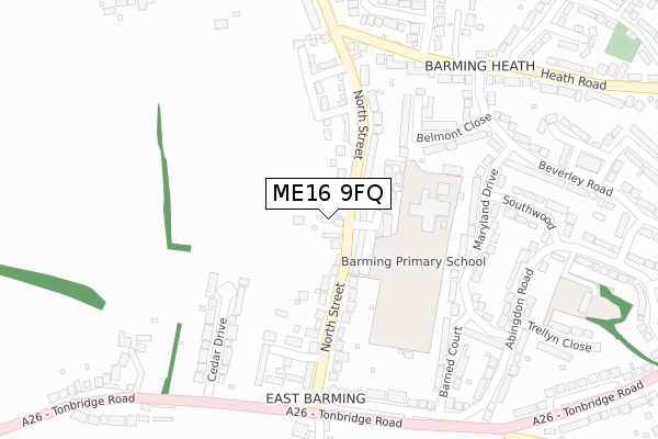
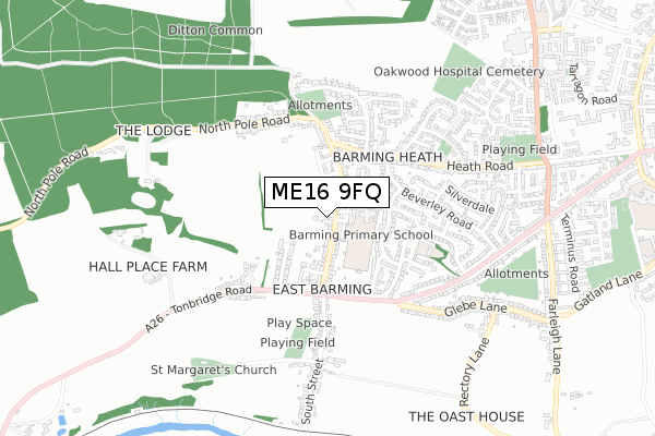
ME16 9FQ is located in the Barming and Teston electoral ward, within the local authority district of Maidstone and the English Parliamentary constituency of Maidstone and The Weald. The Sub Integrated Care Board (ICB) Location is NHS Kent and Medway ICB - 91Q and the police force is Kent. This postcode has been in use since September 2019.


GetTheData
Source: OS Open Zoomstack (Ordnance Survey)
Licence: Open Government Licence (requires attribution)
Attribution: Contains OS data © Crown copyright and database right 2025
Source: Open Postcode Geo
Licence: Open Government Licence (requires attribution)
Attribution: Contains OS data © Crown copyright and database right 2025; Contains Royal Mail data © Royal Mail copyright and database right 2025; Source: Office for National Statistics licensed under the Open Government Licence v.3.0
| Easting | 572479 |
| Northing | 154779 |
| Latitude | 51.266068 |
| Longitude | 0.470936 |
GetTheData
Source: Open Postcode Geo
Licence: Open Government Licence
| Country | England |
| Postcode District | ME16 |
➜ See where ME16 is on a map ➜ Where is Maidstone? | |
GetTheData
Source: Land Registry Price Paid Data
Licence: Open Government Licence
| Ward | Barming And Teston |
| Constituency | Maidstone And The Weald |
GetTheData
Source: ONS Postcode Database
Licence: Open Government Licence
2, CARPENTERS CLOSE, BARMING, MAIDSTONE, ME16 9FQ 2019 4 OCT £477,500 |
GetTheData
Source: HM Land Registry Price Paid Data
Licence: Contains HM Land Registry data © Crown copyright and database right 2025. This data is licensed under the Open Government Licence v3.0.
| The Redstart (North Street) | Barming | 186m |
| The Redstart (North Street) | Barming | 194m |
| The Bull (North Street) | Barming | 274m |
| The Bull (North Street) | Barming | 286m |
| The Bull (Tonbridge Road) | Barming | 310m |
| East Farleigh Station | 1.5km |
| Barming Station | 2.2km |
| East Malling Station | 3.1km |
GetTheData
Source: NaPTAN
Licence: Open Government Licence
GetTheData
Source: ONS Postcode Database
Licence: Open Government Licence


➜ Get more ratings from the Food Standards Agency
GetTheData
Source: Food Standards Agency
Licence: FSA terms & conditions
| Last Collection | |||
|---|---|---|---|
| Location | Mon-Fri | Sat | Distance |
| Barming Post Office | 17:15 | 12:15 | 259m |
| North Street | 17:00 | 12:15 | 299m |
| Beverley Road | 17:00 | 12:00 | 386m |
GetTheData
Source: Dracos
Licence: Creative Commons Attribution-ShareAlike
The below table lists the International Territorial Level (ITL) codes (formerly Nomenclature of Territorial Units for Statistics (NUTS) codes) and Local Administrative Units (LAU) codes for ME16 9FQ:
| ITL 1 Code | Name |
|---|---|
| TLJ | South East (England) |
| ITL 2 Code | Name |
| TLJ4 | Kent |
| ITL 3 Code | Name |
| TLJ45 | Mid Kent |
| LAU 1 Code | Name |
| E07000110 | Maidstone |
GetTheData
Source: ONS Postcode Directory
Licence: Open Government Licence
The below table lists the Census Output Area (OA), Lower Layer Super Output Area (LSOA), and Middle Layer Super Output Area (MSOA) for ME16 9FQ:
| Code | Name | |
|---|---|---|
| OA | E00123484 | |
| LSOA | E01024325 | Maidstone 014A |
| MSOA | E02005081 | Maidstone 014 |
GetTheData
Source: ONS Postcode Directory
Licence: Open Government Licence
| ME16 9QA | Bell Farm Gardens | 53m |
| ME16 9HF | North Street | 63m |
| ME16 9HE | North Street | 66m |
| ME16 9HQ | Apple Tree Close | 113m |
| ME16 9DY | Belmont Close | 206m |
| ME16 9EN | Maryland Drive | 211m |
| ME16 9HW | Matterdale Gardens | 230m |
| ME16 9HD | Cedar Drive | 233m |
| ME16 9EA | Maryland Drive | 246m |
| ME16 9EW | Maryland Drive | 249m |
GetTheData
Source: Open Postcode Geo; Land Registry Price Paid Data
Licence: Open Government Licence