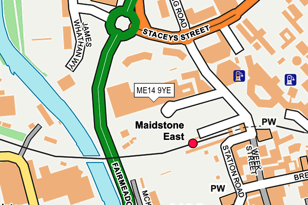
ME14 9YE is located in the North electoral ward, within the local authority district of Maidstone and the English Parliamentary constituency of Maidstone and The Weald. The Sub Integrated Care Board (ICB) Location is NHS Kent and Medway ICB - 91Q and the police force is Kent. This postcode has been in use since February 2017.


GetTheData
Source: OS OpenMap – Local (Ordnance Survey)
Source: OS VectorMap District (Ordnance Survey)
Licence: Open Government Licence (requires attribution)
| Easting | 575794 |
| Northing | 156256 |
| Latitude | 51.278324 |
| Longitude | 0.519129 |
GetTheData
Source: Open Postcode Geo
Licence: Open Government Licence
| Country | England |
| Postcode District | ME14 |
➜ See where ME14 is on a map | |
GetTheData
Source: Land Registry Price Paid Data
Licence: Open Government Licence
| Ward | North |
| Constituency | Maidstone And The Weald |
GetTheData
Source: ONS Postcode Database
Licence: Open Government Licence
| Maidstone East Railway Station (Station Road) | Maidstone | 149m |
| Maidstone East Railway Station (Sandling Road) | Maidstone | 151m |
| Maidstone East Railway Station (Sandling Road) | Maidstone | 167m |
| Staceys Street | Maidstone | 180m |
| Staceys Street | Maidstone | 240m |
| Maidstone East Station | 0.2km |
| Maidstone Barracks Station | 0.4km |
| Maidstone West Station | 0.9km |
GetTheData
Source: NaPTAN
Licence: Open Government Licence
GetTheData
Source: ONS Postcode Database
Licence: Open Government Licence


➜ Get more ratings from the Food Standards Agency
GetTheData
Source: Food Standards Agency
Licence: FSA terms & conditions
| Last Collection | |||
|---|---|---|---|
| Location | Mon-Fri | Sat | Distance |
| Maidstone Mail Centre | 19:30 | 13:30 | 109m |
| Maidstone Mail Centre | 19:30 | 13:30 | 110m |
| Maidstone Mail Centre | 116m | ||
GetTheData
Source: Dracos
Licence: Creative Commons Attribution-ShareAlike
The below table lists the International Territorial Level (ITL) codes (formerly Nomenclature of Territorial Units for Statistics (NUTS) codes) and Local Administrative Units (LAU) codes for ME14 9YE:
| ITL 1 Code | Name |
|---|---|
| TLJ | South East (England) |
| ITL 2 Code | Name |
| TLJ4 | Kent |
| ITL 3 Code | Name |
| TLJ45 | Mid Kent |
| LAU 1 Code | Name |
| E07000110 | Maidstone |
GetTheData
Source: ONS Postcode Directory
Licence: Open Government Licence
The below table lists the Census Output Area (OA), Lower Layer Super Output Area (LSOA), and Middle Layer Super Output Area (MSOA) for ME14 9YE:
| Code | Name | |
|---|---|---|
| OA | E00123775 | |
| LSOA | E01024383 | Maidstone 004D |
| MSOA | E02005071 | Maidstone 004 |
GetTheData
Source: ONS Postcode Directory
Licence: Open Government Licence
| ME14 2UY | Lower Boxley Road | 189m |
| ME14 1JU | Mckenzie Court | 208m |
| ME16 0GB | Waterside Gate | 214m |
| ME14 2RF | Sandling Road | 221m |
| ME14 1RB | Week Street | 232m |
| ME14 1QJ | Station Road | 268m |
| ME14 2RH | Sandling Road | 274m |
| ME16 0GR | St Peters Street | 289m |
| ME14 2TF | Hope Street | 292m |
| ME14 2UU | Lower Boxley Road | 297m |
GetTheData
Source: Open Postcode Geo; Land Registry Price Paid Data
Licence: Open Government Licence