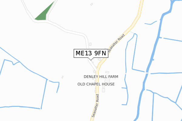
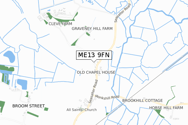
ME13 9FN is located in the Boughton and Courtenay electoral ward, within the local authority district of Swale and the English Parliamentary constituency of Faversham and Mid Kent. The Sub Integrated Care Board (ICB) Location is NHS Kent and Medway ICB - 91Q and the police force is Kent. This postcode has been in use since September 2018.


GetTheData
Source: OS Open Zoomstack (Ordnance Survey)
Licence: Open Government Licence (requires attribution)
Attribution: Contains OS data © Crown copyright and database right 2025
Source: Open Postcode Geo
Licence: Open Government Licence (requires attribution)
Attribution: Contains OS data © Crown copyright and database right 2025; Contains Royal Mail data © Royal Mail copyright and database right 2025; Source: Office for National Statistics licensed under the Open Government Licence v.3.0
| Easting | 605433 |
| Northing | 163311 |
| Latitude | 51.331775 |
| Longitude | 0.947586 |
GetTheData
Source: Open Postcode Geo
Licence: Open Government Licence
| Country | England |
| Postcode District | ME13 |
➜ See where ME13 is on a map | |
GetTheData
Source: Land Registry Price Paid Data
Licence: Open Government Licence
| Ward | Boughton And Courtenay |
| Constituency | Faversham And Mid Kent |
GetTheData
Source: ONS Postcode Database
Licence: Open Government Licence
| Murton Place (Seasalter Road) | Graveney | 1,019m |
| Murton Place (Seasalter Road) | Graveney | 1,045m |
| Four Horseshoes Park (Head Hill Road) | Graveney | 1,356m |
| Four Horseshoes Park (Head Hill Road) | Graveney | 1,358m |
| The Sportsman (Faversham Road) | Graveney | 1,575m |
| Faversham Station | 4.5km |
GetTheData
Source: NaPTAN
Licence: Open Government Licence
GetTheData
Source: ONS Postcode Database
Licence: Open Government Licence


➜ Get more ratings from the Food Standards Agency
GetTheData
Source: Food Standards Agency
Licence: FSA terms & conditions
| Last Collection | |||
|---|---|---|---|
| Location | Mon-Fri | Sat | Distance |
| Graveney Post Office | 17:00 | 09:45 | 1,183m |
| Waterham | 16:45 | 09:30 | 1,776m |
| Goodnestone | 17:00 | 09:45 | 1,924m |
GetTheData
Source: Dracos
Licence: Creative Commons Attribution-ShareAlike
The below table lists the International Territorial Level (ITL) codes (formerly Nomenclature of Territorial Units for Statistics (NUTS) codes) and Local Administrative Units (LAU) codes for ME13 9FN:
| ITL 1 Code | Name |
|---|---|
| TLJ | South East (England) |
| ITL 2 Code | Name |
| TLJ4 | Kent |
| ITL 3 Code | Name |
| TLJ43 | Kent Thames Gateway |
| LAU 1 Code | Name |
| E07000113 | Swale |
GetTheData
Source: ONS Postcode Directory
Licence: Open Government Licence
The below table lists the Census Output Area (OA), Lower Layer Super Output Area (LSOA), and Middle Layer Super Output Area (MSOA) for ME13 9FN:
| Code | Name | |
|---|---|---|
| OA | E00124652 | |
| LSOA | E01024556 | Swale 017B |
| MSOA | E02005131 | Swale 017 |
GetTheData
Source: ONS Postcode Directory
Licence: Open Government Licence
| ME13 9ED | Seasalter Road | 46m |
| ME13 9EB | All Saints View | 562m |
| ME13 9EE | Cleave Hill | 653m |
| ME13 9DU | Seasalter Road | 969m |
| ME13 9DX | Murton Place | 1016m |
| ME13 9DW | Broom Street | 1018m |
| ME13 9DN | Oast Houses | 1140m |
| ME13 9DQ | Sandbanks Lane | 1168m |
| ME13 9DG | Seasalter Road | 1256m |
| ME13 9DF | Seasalter Road | 1286m |
GetTheData
Source: Open Postcode Geo; Land Registry Price Paid Data
Licence: Open Government Licence