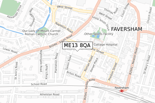
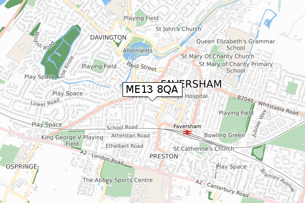
ME13 8QA lies on Saxon Road in Faversham. ME13 8QA is located in the St Ann's electoral ward, within the local authority district of Swale and the English Parliamentary constituency of Faversham and Mid Kent. The Sub Integrated Care Board (ICB) Location is NHS Kent and Medway ICB - 91Q and the police force is Kent. This postcode has been in use since March 2021.


GetTheData
Source: OS Open Zoomstack (Ordnance Survey)
Licence: Open Government Licence (requires attribution)
Attribution: Contains OS data © Crown copyright and database right 2025
Source: Open Postcode Geo
Licence: Open Government Licence (requires attribution)
Attribution: Contains OS data © Crown copyright and database right 2025; Contains Royal Mail data © Royal Mail copyright and database right 2025; Source: Office for National Statistics licensed under the Open Government Licence v.3.0
| Easting | 601343 |
| Northing | 161163 |
| Latitude | 51.313947 |
| Longitude | 0.887743 |
GetTheData
Source: Open Postcode Geo
Licence: Open Government Licence
| Street | Saxon Road |
| Town/City | Faversham |
| Country | England |
| Postcode District | ME13 |
➜ See where ME13 is on a map ➜ Where is Faversham? | |
GetTheData
Source: Land Registry Price Paid Data
Licence: Open Government Licence
| Ward | St Ann's |
| Constituency | Faversham And Mid Kent |
GetTheData
Source: ONS Postcode Database
Licence: Open Government Licence
2020 24 SEP £425,000 |
2014 27 MAY £280,000 |
1A, SAXON ROAD, FAVERSHAM, ME13 8QA 2014 27 MAY £280,000 |
1A, SAXON ROAD, FAVERSHAM, ME13 8QA 2007 12 JAN £400,000 |
GetTheData
Source: HM Land Registry Price Paid Data
Licence: Contains HM Land Registry data © Crown copyright and database right 2025. This data is licensed under the Open Government Licence v3.0.
| Saxon Road (Stone Street) | Faversham | 96m |
| Preston Street (Stone Street) | Faversham | 163m |
| Railway Station (Forbes Road) | Faversham | 210m |
| The Three Tuns (Napleton Road) | Faversham | 231m |
| Railway Station (Station Road) | Faversham | 309m |
| Faversham Station | 0.3km |
| Selling Station | 5.5km |
GetTheData
Source: NaPTAN
Licence: Open Government Licence
| Percentage of properties with Next Generation Access | 100.0% |
| Percentage of properties with Superfast Broadband | 100.0% |
| Percentage of properties with Ultrafast Broadband | 0.0% |
| Percentage of properties with Full Fibre Broadband | 0.0% |
Superfast Broadband is between 30Mbps and 300Mbps
Ultrafast Broadband is > 300Mbps
| Percentage of properties unable to receive 2Mbps | 0.0% |
| Percentage of properties unable to receive 5Mbps | 0.0% |
| Percentage of properties unable to receive 10Mbps | 0.0% |
| Percentage of properties unable to receive 30Mbps | 0.0% |
GetTheData
Source: Ofcom
Licence: Ofcom Terms of Use (requires attribution)
GetTheData
Source: ONS Postcode Database
Licence: Open Government Licence


➜ Get more ratings from the Food Standards Agency
GetTheData
Source: Food Standards Agency
Licence: FSA terms & conditions
| Last Collection | |||
|---|---|---|---|
| Location | Mon-Fri | Sat | Distance |
| Saxon Road | 17:30 | 12:00 | 90m |
| Athelstan Road | 17:30 | 12:00 | 304m |
| North Lane | 17:30 | 11:00 | 321m |
GetTheData
Source: Dracos
Licence: Creative Commons Attribution-ShareAlike
The below table lists the International Territorial Level (ITL) codes (formerly Nomenclature of Territorial Units for Statistics (NUTS) codes) and Local Administrative Units (LAU) codes for ME13 8QA:
| ITL 1 Code | Name |
|---|---|
| TLJ | South East (England) |
| ITL 2 Code | Name |
| TLJ4 | Kent |
| ITL 3 Code | Name |
| TLJ43 | Kent Thames Gateway |
| LAU 1 Code | Name |
| E07000113 | Swale |
GetTheData
Source: ONS Postcode Directory
Licence: Open Government Licence
The below table lists the Census Output Area (OA), Lower Layer Super Output Area (LSOA), and Middle Layer Super Output Area (MSOA) for ME13 8QA:
| Code | Name | |
|---|---|---|
| OA | E00124873 | |
| LSOA | E01024602 | Swale 015E |
| MSOA | E02005129 | Swale 015 |
GetTheData
Source: ONS Postcode Directory
Licence: Open Government Licence
| ME13 8PU | Stone Street | 34m |
| ME13 8PX | Norman Road | 40m |
| ME13 8PS | Stone Street | 68m |
| ME13 8PZ | Roman Road | 86m |
| ME13 8PP | Dorset Place | 98m |
| ME13 8PT | Stone Street | 117m |
| ME13 8QB | Saxon Road | 125m |
| ME13 7LS | South Road | 128m |
| ME13 8PR | Bank Street | 130m |
| ME13 8PH | Stone Street | 143m |
GetTheData
Source: Open Postcode Geo; Land Registry Price Paid Data
Licence: Open Government Licence