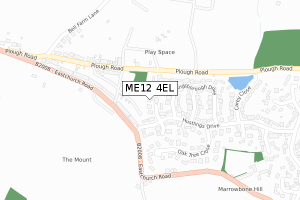
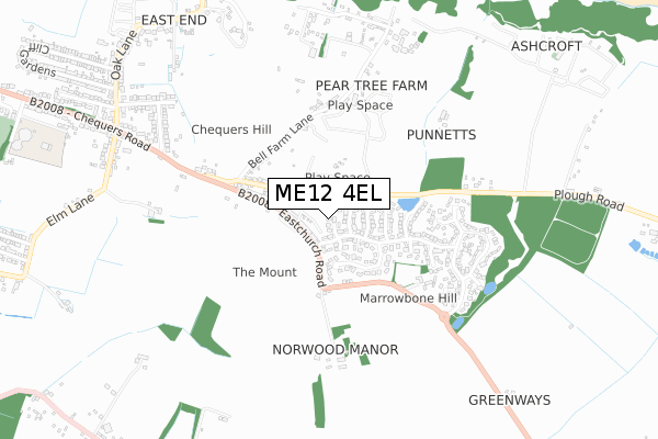
ME12 4EL is located in the Sheppey East electoral ward, within the local authority district of Swale and the English Parliamentary constituency of Sittingbourne and Sheppey. The Sub Integrated Care Board (ICB) Location is NHS Kent and Medway ICB - 91Q and the police force is Kent. This postcode has been in use since August 2019.


GetTheData
Source: OS Open Zoomstack (Ordnance Survey)
Licence: Open Government Licence (requires attribution)
Attribution: Contains OS data © Crown copyright and database right 2025
Source: Open Postcode Geo
Licence: Open Government Licence (requires attribution)
Attribution: Contains OS data © Crown copyright and database right 2025; Contains Royal Mail data © Royal Mail copyright and database right 2025; Source: Office for National Statistics licensed under the Open Government Licence v.3.0
| Easting | 597270 |
| Northing | 172359 |
| Latitude | 51.415921 |
| Longitude | 0.835582 |
GetTheData
Source: Open Postcode Geo
Licence: Open Government Licence
| Country | England |
| Postcode District | ME12 |
➜ See where ME12 is on a map ➜ Where is Minster? | |
GetTheData
Source: Land Registry Price Paid Data
Licence: Open Government Licence
| Ward | Sheppey East |
| Constituency | Sittingbourne And Sheppey |
GetTheData
Source: ONS Postcode Database
Licence: Open Government Licence
2, KETLEY CLOSE, EASTCHURCH, SHEERNESS, ME12 4EL 2020 18 DEC £565,000 |
5, KETLEY CLOSE, EASTCHURCH, SHEERNESS, ME12 4EL 2020 25 NOV £600,000 |
4, KETLEY CLOSE, EASTCHURCH, SHEERNESS, ME12 4EL 2020 7 FEB £580,000 |
1, KETLEY CLOSE, EASTCHURCH, SHEERNESS, ME12 4EL 2020 31 JAN £650,000 |
3, KETLEY CLOSE, EASTCHURCH, SHEERNESS, ME12 4EL 2019 30 APR £650,000 |
GetTheData
Source: HM Land Registry Price Paid Data
Licence: Contains HM Land Registry data © Crown copyright and database right 2025. This data is licensed under the Open Government Licence v3.0.
| Chequers Water Tower (Eastchurch Road) | Minster | 99m |
| Chequers Water Tower (Eastchurch Road) | Minster | 120m |
| Norwood Corner (Eastchurch Road) | Eastchurch | 238m |
| Norwood Corner (Eastchurch Road) | Eastchurch | 252m |
| Bell Farm Lane (Chequers Road) | Minster | 445m |
GetTheData
Source: NaPTAN
Licence: Open Government Licence
GetTheData
Source: ONS Postcode Database
Licence: Open Government Licence


➜ Get more ratings from the Food Standards Agency
GetTheData
Source: Food Standards Agency
Licence: FSA terms & conditions
| Last Collection | |||
|---|---|---|---|
| Location | Mon-Fri | Sat | Distance |
| Kingsborough Manor | 16:00 | 11:00 | 582m |
| Oak Lane | 16:00 | 08:00 | 936m |
| Minster On Sea Post Office | 16:30 | 11:30 | 1,646m |
GetTheData
Source: Dracos
Licence: Creative Commons Attribution-ShareAlike
The below table lists the International Territorial Level (ITL) codes (formerly Nomenclature of Territorial Units for Statistics (NUTS) codes) and Local Administrative Units (LAU) codes for ME12 4EL:
| ITL 1 Code | Name |
|---|---|
| TLJ | South East (England) |
| ITL 2 Code | Name |
| TLJ4 | Kent |
| ITL 3 Code | Name |
| TLJ43 | Kent Thames Gateway |
| LAU 1 Code | Name |
| E07000113 | Swale |
GetTheData
Source: ONS Postcode Directory
Licence: Open Government Licence
The below table lists the Census Output Area (OA), Lower Layer Super Output Area (LSOA), and Middle Layer Super Output Area (MSOA) for ME12 4EL:
| Code | Name | |
|---|---|---|
| OA | E00166802 | |
| LSOA | E01024618 | Swale 006D |
| MSOA | E02005120 | Swale 006 |
GetTheData
Source: ONS Postcode Directory
Licence: Open Government Licence
| ME12 4HR | Shoebury Terrace | 71m |
| ME12 4HT | Waterloo Terrace | 82m |
| ME12 4HS | Harty Terrace | 101m |
| ME12 4HU | Victoria Terrace | 143m |
| ME12 4JY | Oak Tree Close | 176m |
| ME12 4DN | Kingsborough Drive | 178m |
| ME12 4HX | Albert Terrace | 201m |
| ME12 4HP | Eastchurch Road | 225m |
| ME12 4JF | Seaview Terrace | 231m |
| ME12 4HY | Chequers Terrace | 248m |
GetTheData
Source: Open Postcode Geo; Land Registry Price Paid Data
Licence: Open Government Licence