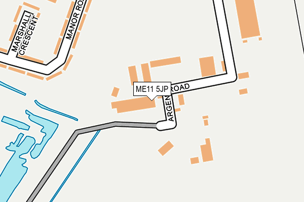
ME11 5JP is located in the Queenborough and Halfway electoral ward, within the local authority district of Swale and the English Parliamentary constituency of Sittingbourne and Sheppey. The Sub Integrated Care Board (ICB) Location is NHS Kent and Medway ICB - 91Q and the police force is Kent. This postcode has been in use since August 1992.


GetTheData
Source: OS OpenMap – Local (Ordnance Survey)
Source: OS VectorMap District (Ordnance Survey)
Licence: Open Government Licence (requires attribution)
| Easting | 591178 |
| Northing | 170954 |
| Latitude | 51.405386 |
| Longitude | 0.747326 |
GetTheData
Source: Open Postcode Geo
Licence: Open Government Licence
| Country | England |
| Postcode District | ME11 |
➜ See where ME11 is on a map ➜ Where is Queenborough? | |
GetTheData
Source: Land Registry Price Paid Data
Licence: Open Government Licence
Elevation or altitude of ME11 5JP as distance above sea level:
| Metres | Feet | |
|---|---|---|
| Elevation | 10m | 33ft |
Elevation is measured from the approximate centre of the postcode, to the nearest point on an OS contour line from OS Terrain 50, which has contour spacing of ten vertical metres.
➜ How high above sea level am I? Find the elevation of your current position using your device's GPS.
GetTheData
Source: Open Postcode Elevation
Licence: Open Government Licence
| Ward | Queenborough And Halfway |
| Constituency | Sittingbourne And Sheppey |
GetTheData
Source: ONS Postcode Database
Licence: Open Government Licence
| Ferry View (Rushenden Road) | Rushenden | 372m |
| First Avenue (Rushenden Road) | Rushenden | 470m |
| First Avenue (Rushenden Road) | Rushenden | 474m |
| Hillside Avenue | Rushenden | 523m |
| Cullet Drive (Rushenden Road) | Rushenden | 553m |
| Queenborough Station | 1.2km |
| Swale Station | 1.8km |
| Sheerness-on-Sea Station | 4km |
GetTheData
Source: NaPTAN
Licence: Open Government Licence
GetTheData
Source: ONS Postcode Database
Licence: Open Government Licence


➜ Get more ratings from the Food Standards Agency
GetTheData
Source: Food Standards Agency
Licence: FSA terms & conditions
| Last Collection | |||
|---|---|---|---|
| Location | Mon-Fri | Sat | Distance |
| Rushenden | 17:00 | 08:00 | 389m |
| Queenborough | 18:30 | 11:30 | 1,139m |
| Railway Terrace | 17:00 | 11:30 | 1,146m |
GetTheData
Source: Dracos
Licence: Creative Commons Attribution-ShareAlike
| Risk of ME11 5JP flooding from rivers and sea | Low |
| ➜ ME11 5JP flood map | |
GetTheData
Source: Open Flood Risk by Postcode
Licence: Open Government Licence
The below table lists the International Territorial Level (ITL) codes (formerly Nomenclature of Territorial Units for Statistics (NUTS) codes) and Local Administrative Units (LAU) codes for ME11 5JP:
| ITL 1 Code | Name |
|---|---|
| TLJ | South East (England) |
| ITL 2 Code | Name |
| TLJ4 | Kent |
| ITL 3 Code | Name |
| TLJ43 | Kent Thames Gateway |
| LAU 1 Code | Name |
| E07000113 | Swale |
GetTheData
Source: ONS Postcode Directory
Licence: Open Government Licence
The below table lists the Census Output Area (OA), Lower Layer Super Output Area (LSOA), and Middle Layer Super Output Area (MSOA) for ME11 5JP:
| Code | Name | |
|---|---|---|
| OA | E00124841 | |
| LSOA | E01024597 | Swale 005C |
| MSOA | E02005119 | Swale 005 |
GetTheData
Source: ONS Postcode Directory
Licence: Open Government Licence
| ME11 5LX | Manor Road | 197m |
| ME11 5LZ | Marshall Crescent | 258m |
| ME11 5JS | Cullet Drive | 311m |
| ME11 5LY | Manor Road | 312m |
| ME11 5NA | Manor Road | 317m |
| ME11 5ND | Manor Road | 385m |
| ME11 5LS | Rushenden Road | 391m |
| ME11 5JZ | Rushenden Road | 424m |
| ME11 5JY | Wykeham Close | 425m |
| ME11 5LP | Ferry View | 444m |
GetTheData
Source: Open Postcode Geo; Land Registry Price Paid Data
Licence: Open Government Licence