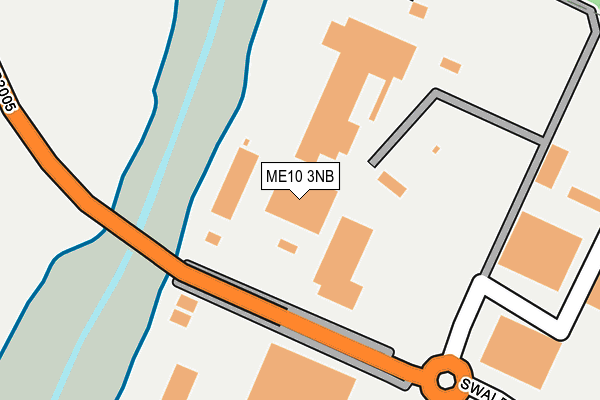
ME10 3NB is located in the Murston electoral ward, within the local authority district of Swale and the English Parliamentary constituency of Sittingbourne and Sheppey. The Sub Integrated Care Board (ICB) Location is NHS Kent and Medway ICB - 91Q and the police force is Kent. This postcode has been in use since June 1999.


GetTheData
Source: OS OpenMap – Local (Ordnance Survey)
Source: OS VectorMap District (Ordnance Survey)
Licence: Open Government Licence (requires attribution)
| Easting | 592163 |
| Northing | 165235 |
| Latitude | 51.353688 |
| Longitude | 0.758350 |
GetTheData
Source: Open Postcode Geo
Licence: Open Government Licence
| Country | England |
| Postcode District | ME10 |
➜ See where ME10 is on a map ➜ Where is Sittingbourne? | |
GetTheData
Source: Land Registry Price Paid Data
Licence: Open Government Licence
Elevation or altitude of ME10 3NB as distance above sea level:
| Metres | Feet | |
|---|---|---|
| Elevation | 0m | 0ft |
Elevation is measured from the approximate centre of the postcode, to the nearest point on an OS contour line from OS Terrain 50, which has contour spacing of ten vertical metres.
➜ How high above sea level am I? Find the elevation of your current position using your device's GPS.
GetTheData
Source: Open Postcode Elevation
Licence: Open Government Licence
| Ward | Murston |
| Constituency | Sittingbourne And Sheppey |
GetTheData
Source: ONS Postcode Database
Licence: Open Government Licence
| Chalkwell Depot (Church Road) | Murston | 726m |
| Newman Drive Pond (Newman Drive) | Kemsley | 1,043m |
| Newman Drive Pond (Newman Drive) | Kemsley | 1,078m |
| Mulberry Way | Great Easthall | 1,144m |
| Puttney Drive (Newman Drive) | Kemsley | 1,221m |
| Kemsley Station | 1.9km |
| Sittingbourne Station | 2.1km |
| Swale Station | 4km |
GetTheData
Source: NaPTAN
Licence: Open Government Licence
GetTheData
Source: ONS Postcode Database
Licence: Open Government Licence


➜ Get more ratings from the Food Standards Agency
GetTheData
Source: Food Standards Agency
Licence: FSA terms & conditions
| Last Collection | |||
|---|---|---|---|
| Location | Mon-Fri | Sat | Distance |
| Todd Crescent | 17:30 | 09:00 | 1,016m |
| Newman Drive | 17:30 | 11:45 | 1,227m |
| Trinity Estate Meter Box | 18:30 | 1,267m | |
GetTheData
Source: Dracos
Licence: Creative Commons Attribution-ShareAlike
The below table lists the International Territorial Level (ITL) codes (formerly Nomenclature of Territorial Units for Statistics (NUTS) codes) and Local Administrative Units (LAU) codes for ME10 3NB:
| ITL 1 Code | Name |
|---|---|
| TLJ | South East (England) |
| ITL 2 Code | Name |
| TLJ4 | Kent |
| ITL 3 Code | Name |
| TLJ43 | Kent Thames Gateway |
| LAU 1 Code | Name |
| E07000113 | Swale |
GetTheData
Source: ONS Postcode Directory
Licence: Open Government Licence
The below table lists the Census Output Area (OA), Lower Layer Super Output Area (LSOA), and Middle Layer Super Output Area (MSOA) for ME10 3NB:
| Code | Name | |
|---|---|---|
| OA | E00166799 | |
| LSOA | E01024591 | Swale 011A |
| MSOA | E02005125 | Swale 011 |
GetTheData
Source: ONS Postcode Directory
Licence: Open Government Licence
| ME10 3SQ | Castle Road | 278m |
| ME10 3SH | Gas Road | 325m |
| ME10 3EU | Castle Road | 368m |
| ME10 3AE | Anchor Business Park | 519m |
| ME10 3RW | Chapel Park | 544m |
| ME10 3RH | D2 Trading Estate | 587m |
| ME10 3RS | Church Road Business Centre | 634m |
| ME10 3JP | Castle Road | 669m |
| ME10 3RL | Brickmakers Industrial Estate | 677m |
| ME10 3RZ | Castleacres Industrial Park | 718m |
GetTheData
Source: Open Postcode Geo; Land Registry Price Paid Data
Licence: Open Government Licence