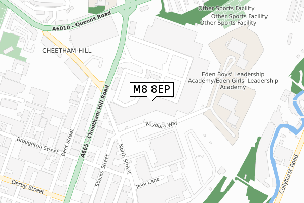
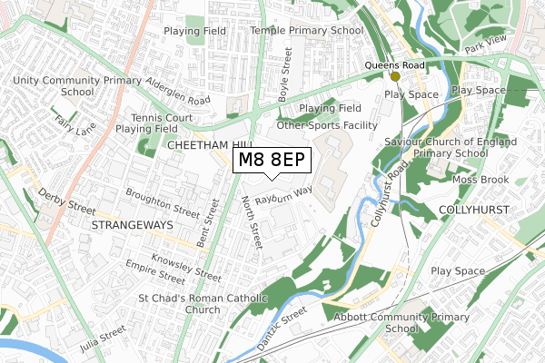
M8 8EP is located in the Cheetham electoral ward, within the metropolitan district of Manchester and the English Parliamentary constituency of Blackley and Broughton. The Sub Integrated Care Board (ICB) Location is NHS Greater Manchester ICB - 14L and the police force is Greater Manchester. This postcode has been in use since November 2004.


GetTheData
Source: OS Open Zoomstack (Ordnance Survey)
Licence: Open Government Licence (requires attribution)
Attribution: Contains OS data © Crown copyright and database right 2025
Source: Open Postcode Geo
Licence: Open Government Licence (requires attribution)
Attribution: Contains OS data © Crown copyright and database right 2025; Contains Royal Mail data © Royal Mail copyright and database right 2025; Source: Office for National Statistics licensed under the Open Government Licence v.3.0
| Easting | 384506 |
| Northing | 400083 |
| Latitude | 53.497216 |
| Longitude | -2.235028 |
GetTheData
Source: Open Postcode Geo
Licence: Open Government Licence
| Country | England |
| Postcode District | M8 |
➜ See where M8 is on a map ➜ Where is Manchester? | |
GetTheData
Source: Land Registry Price Paid Data
Licence: Open Government Licence
Elevation or altitude of M8 8EP as distance above sea level:
| Metres | Feet | |
|---|---|---|
| Elevation | 60m | 197ft |
Elevation is measured from the approximate centre of the postcode, to the nearest point on an OS contour line from OS Terrain 50, which has contour spacing of ten vertical metres.
➜ How high above sea level am I? Find the elevation of your current position using your device's GPS.
GetTheData
Source: Open Postcode Elevation
Licence: Open Government Licence
| Ward | Cheetham |
| Constituency | Blackley And Broughton |
GetTheData
Source: ONS Postcode Database
Licence: Open Government Licence
| Cheetham Hill Rd/Elizabeth St (Cheetham Hill R) | Cheetham | 202m |
| Cheetham Hill Rd/Elizabeth St (Cheetham Hill R) | Cheetham | 212m |
| Cheetham Hill Rd/Queens Rd (Cheetham Hill R) | Cheetham | 256m |
| Great Horrocks (North St) | Cheetham | 298m |
| Queens Rd/Cheetham Hill Rd (Queens Rd) | Cheetham | 323m |
| Queens Road (Manchester Metrolink) (Queens Road) | Smedley | 746m |
| Victoria (Manchester Metrolink) (Off Corporation Street) | Manchester City Centre | 1,195m |
| Woodlands Road (Manchester Metrolink) (Off Woodlands Road) | Cheetham Hill | 1,289m |
| Shudehill (Manchester Metrolink) (Shudehill) | Manchester City Centre | 1,393m |
| Abraham Moss (Manchester Metrolink) (Woodlands Road) | Cheetham Hill | 1,497m |
| Manchester Victoria Station | 1.2km |
| Salford Central Station | 2km |
| Manchester Piccadilly Station | 2.2km |
GetTheData
Source: NaPTAN
Licence: Open Government Licence
| Median download speed | 6.4Mbps |
| Average download speed | 6.1Mbps |
| Maximum download speed | 11.31Mbps |
| Median upload speed | 0.9Mbps |
| Average upload speed | 0.9Mbps |
| Maximum upload speed | 1.75Mbps |
GetTheData
Source: Ofcom
Licence: Ofcom Terms of Use (requires attribution)
GetTheData
Source: ONS Postcode Database
Licence: Open Government Licence


➜ Get more ratings from the Food Standards Agency
GetTheData
Source: Food Standards Agency
Licence: FSA terms & conditions
| Last Collection | |||
|---|---|---|---|
| Location | Mon-Fri | Sat | Distance |
| Smedley Lane P.o. | 17:30 | 12:00 | 714m |
| Roger Street | 19:00 | 12:00 | 724m |
| Waterloo Road | 17:30 | 11:45 | 849m |
GetTheData
Source: Dracos
Licence: Creative Commons Attribution-ShareAlike
The below table lists the International Territorial Level (ITL) codes (formerly Nomenclature of Territorial Units for Statistics (NUTS) codes) and Local Administrative Units (LAU) codes for M8 8EP:
| ITL 1 Code | Name |
|---|---|
| TLD | North West (England) |
| ITL 2 Code | Name |
| TLD3 | Greater Manchester |
| ITL 3 Code | Name |
| TLD33 | Manchester |
| LAU 1 Code | Name |
| E08000003 | Manchester |
GetTheData
Source: ONS Postcode Directory
Licence: Open Government Licence
The below table lists the Census Output Area (OA), Lower Layer Super Output Area (LSOA), and Middle Layer Super Output Area (MSOA) for M8 8EP:
| Code | Name | |
|---|---|---|
| OA | E00176085 | |
| LSOA | E01033665 | Manchester 056C |
| MSOA | E02006913 | Manchester 056 |
GetTheData
Source: ONS Postcode Directory
Licence: Open Government Licence
| M8 8LW | Cheetham Hill Road | 213m |
| M8 8LG | Cheetham Hill Road | 237m |
| M8 8RF | Broughton Street | 276m |
| M8 8NW | Bent Street | 277m |
| M8 8UH | Signet Walk | 324m |
| M8 8UR | Redwood Drive | 328m |
| M8 8SH | Stanley Street | 332m |
| M8 8LQ | Cheetham Hill Road | 338m |
| M8 8UQ | Queens Road | 354m |
| M8 8UF | Queens Road | 356m |
GetTheData
Source: Open Postcode Geo; Land Registry Price Paid Data
Licence: Open Government Licence