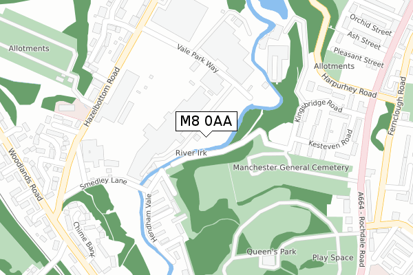
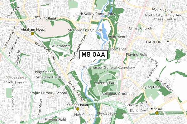
M8 0AA is located in the Crumpsall electoral ward, within the metropolitan district of Manchester and the English Parliamentary constituency of Blackley and Broughton. The Sub Integrated Care Board (ICB) Location is NHS Greater Manchester ICB - 14L and the police force is Greater Manchester. This postcode has been in use since February 2018.


GetTheData
Source: OS Open Zoomstack (Ordnance Survey)
Licence: Open Government Licence (requires attribution)
Attribution: Contains OS data © Crown copyright and database right 2025
Source: Open Postcode Geo
Licence: Open Government Licence (requires attribution)
Attribution: Contains OS data © Crown copyright and database right 2025; Contains Royal Mail data © Royal Mail copyright and database right 2025; Source: Office for National Statistics licensed under the Open Government Licence v.3.0
| Easting | 385281 |
| Northing | 401194 |
| Latitude | 53.507241 |
| Longitude | -2.223395 |
GetTheData
Source: Open Postcode Geo
Licence: Open Government Licence
| Country | England |
| Postcode District | M8 |
➜ See where M8 is on a map ➜ Where is Manchester? | |
GetTheData
Source: Land Registry Price Paid Data
Licence: Open Government Licence
| Ward | Crumpsall |
| Constituency | Blackley And Broughton |
GetTheData
Source: ONS Postcode Database
Licence: Open Government Licence
| Hazelbottom Rd/Amwell St (Hazelbottom Rd) | Smedley | 265m |
| Hazelbottom Rd/Amwell St (Hazelbottom Rd) | Smedley | 282m |
| Harpurhey Road | Harpurhey | 338m |
| Smedley Lane | Smedley | 341m |
| Hazelbottom Rd/Smedley Ln (Hazelbottom Rd) | Smedley | 347m |
| Queens Road (Manchester Metrolink) (Queens Road) | Smedley | 652m |
| Woodlands Road (Manchester Metrolink) (Off Woodlands Road) | Cheetham Hill | 663m |
| Abraham Moss (Manchester Metrolink) (Woodlands Road) | Cheetham Hill | 905m |
| Monsall (Manchester Metrolink) (Ruislip Avenue) | Monsall | 1,087m |
| Crumpsall (Manchester Metrolink) (Off Station Road) | Higher Crumpsall | 1,629m |
| Manchester Victoria Station | 2.5km |
| Manchester Piccadilly Station | 3.4km |
| Salford Central Station | 3.4km |
GetTheData
Source: NaPTAN
Licence: Open Government Licence
GetTheData
Source: ONS Postcode Database
Licence: Open Government Licence


➜ Get more ratings from the Food Standards Agency
GetTheData
Source: Food Standards Agency
Licence: FSA terms & conditions
| Last Collection | |||
|---|---|---|---|
| Location | Mon-Fri | Sat | Distance |
| Smedley Lane P.o. | 17:30 | 12:00 | 656m |
| Asda | 17:30 | 12:00 | 979m |
| Blackley Park | 17:30 | 11:45 | 1,271m |
GetTheData
Source: Dracos
Licence: Creative Commons Attribution-ShareAlike
| Risk of M8 0AA flooding from rivers and sea | High |
| ➜ M8 0AA flood map | |
GetTheData
Source: Open Flood Risk by Postcode
Licence: Open Government Licence
The below table lists the International Territorial Level (ITL) codes (formerly Nomenclature of Territorial Units for Statistics (NUTS) codes) and Local Administrative Units (LAU) codes for M8 0AA:
| ITL 1 Code | Name |
|---|---|
| TLD | North West (England) |
| ITL 2 Code | Name |
| TLD3 | Greater Manchester |
| ITL 3 Code | Name |
| TLD33 | Manchester |
| LAU 1 Code | Name |
| E08000003 | Manchester |
GetTheData
Source: ONS Postcode Directory
Licence: Open Government Licence
The below table lists the Census Output Area (OA), Lower Layer Super Output Area (LSOA), and Middle Layer Super Output Area (MSOA) for M8 0AA:
| Code | Name | |
|---|---|---|
| OA | E00175903 | |
| LSOA | E01005146 | Manchester 008B |
| MSOA | E02001052 | Manchester 008 |
GetTheData
Source: ONS Postcode Directory
Licence: Open Government Licence
| M8 0AD | Hendham Vale Industrial Park | 96m |
| M9 5TH | Calthorpe Avenue | 178m |
| M9 5SG | Delaware Walk | 268m |
| M8 0GQ | Hazelbottom Road | 296m |
| M8 0BX | Stoneyholme Avenue | 328m |
| M9 5SS | Kesteven Road | 342m |
| M8 0QG | Glenmore Drive | 361m |
| M8 0QL | Chime Bank | 362m |
| M8 0AJ | Brandforth Road | 365m |
| M9 5SR | Kesteven Road | 366m |
GetTheData
Source: Open Postcode Geo; Land Registry Price Paid Data
Licence: Open Government Licence