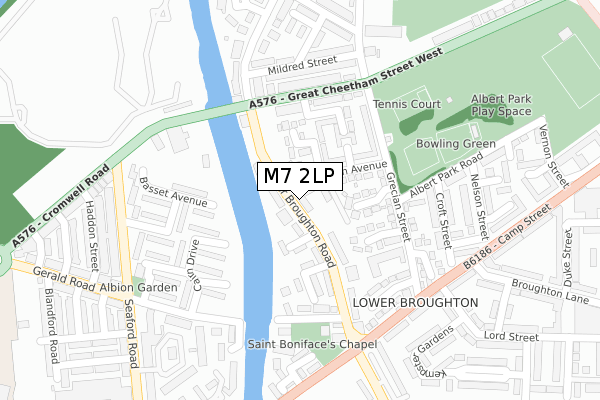
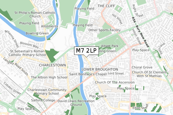
M7 2LP is located in the Broughton electoral ward, within the metropolitan district of Salford and the English Parliamentary constituency of Blackley and Broughton. The Sub Integrated Care Board (ICB) Location is NHS Greater Manchester ICB - 01G and the police force is Greater Manchester. This postcode has been in use since July 2018.


GetTheData
Source: OS Open Zoomstack (Ordnance Survey)
Licence: Open Government Licence (requires attribution)
Attribution: Contains OS data © Crown copyright and database right 2025
Source: Open Postcode Geo
Licence: Open Government Licence (requires attribution)
Attribution: Contains OS data © Crown copyright and database right 2025; Contains Royal Mail data © Royal Mail copyright and database right 2025; Source: Office for National Statistics licensed under the Open Government Licence v.3.0
| Easting | 382252 |
| Northing | 400172 |
| Latitude | 53.497961 |
| Longitude | -2.269007 |
GetTheData
Source: Open Postcode Geo
Licence: Open Government Licence
| Country | England |
| Postcode District | M7 |
➜ See where M7 is on a map ➜ Where is Salford? | |
GetTheData
Source: Land Registry Price Paid Data
Licence: Open Government Licence
| Ward | Broughton |
| Constituency | Blackley And Broughton |
GetTheData
Source: ONS Postcode Database
Licence: Open Government Licence
| Lower Broughton Rd/Victoria Lodge (Lr Broughton Rd) | Lower Broughton | 61m |
| Lower Broughton Rd/Frederick Rd (Lr Broughton Rd) | Lower Broughton | 197m |
| Cromwell Rd/Castle Irwell (Cromwell Rd) | Charlestown | 211m |
| Great Cheetham St West/Grecian St (Gt Che`ham St W) | Lower Broughton | 216m |
| Cromwell Rd/Castle Irwell (Cromwell Rd) | Charlestown | 235m |
| Salford Crescent Station | 1.3km |
| Salford Central Station | 1.9km |
| Manchester Victoria Station | 2.1km |
GetTheData
Source: NaPTAN
Licence: Open Government Licence
| Percentage of properties with Next Generation Access | 100.0% |
| Percentage of properties with Superfast Broadband | 100.0% |
| Percentage of properties with Ultrafast Broadband | 100.0% |
| Percentage of properties with Full Fibre Broadband | 100.0% |
Superfast Broadband is between 30Mbps and 300Mbps
Ultrafast Broadband is > 300Mbps
| Percentage of properties unable to receive 2Mbps | 0.0% |
| Percentage of properties unable to receive 5Mbps | 0.0% |
| Percentage of properties unable to receive 10Mbps | 0.0% |
| Percentage of properties unable to receive 30Mbps | 0.0% |
GetTheData
Source: Ofcom
Licence: Ofcom Terms of Use (requires attribution)
GetTheData
Source: ONS Postcode Database
Licence: Open Government Licence


➜ Get more ratings from the Food Standards Agency
GetTheData
Source: Food Standards Agency
Licence: FSA terms & conditions
| Last Collection | |||
|---|---|---|---|
| Location | Mon-Fri | Sat | Distance |
| Grecian Street | 17:30 | 11:45 | 233m |
| Po | 17:30 | 12:00 | 591m |
| St John Street | 17:30 | 11:45 | 897m |
GetTheData
Source: Dracos
Licence: Creative Commons Attribution-ShareAlike
| Risk of M7 2LP flooding from rivers and sea | Low |
| ➜ M7 2LP flood map | |
GetTheData
Source: Open Flood Risk by Postcode
Licence: Open Government Licence
The below table lists the International Territorial Level (ITL) codes (formerly Nomenclature of Territorial Units for Statistics (NUTS) codes) and Local Administrative Units (LAU) codes for M7 2LP:
| ITL 1 Code | Name |
|---|---|
| TLD | North West (England) |
| ITL 2 Code | Name |
| TLD3 | Greater Manchester |
| ITL 3 Code | Name |
| TLD34 | Greater Manchester South West |
| LAU 1 Code | Name |
| E08000006 | Salford |
GetTheData
Source: ONS Postcode Directory
Licence: Open Government Licence
The below table lists the Census Output Area (OA), Lower Layer Super Output Area (LSOA), and Middle Layer Super Output Area (MSOA) for M7 2LP:
| Code | Name | |
|---|---|---|
| OA | E00028419 | |
| LSOA | E01005611 | Salford 016B |
| MSOA | E02001172 | Salford 016 |
GetTheData
Source: ONS Postcode Directory
Licence: Open Government Licence
| M7 2LA | Lower Broughton Road | 43m |
| M7 2LH | Lower Broughton Road | 72m |
| M7 2LG | Lower Broughton Road | 84m |
| M7 2LE | Lower Broughton Road | 98m |
| M7 2JX | Lower Broughton Road | 104m |
| M7 2JH | Aegean Gardens | 107m |
| M7 2JP | Trojan Gardens | 108m |
| M7 2LD | The Avenue | 109m |
| M7 2JN | Corinthian Avenue | 125m |
| M7 2JU | Cromwell Grove | 144m |
GetTheData
Source: Open Postcode Geo; Land Registry Price Paid Data
Licence: Open Government Licence