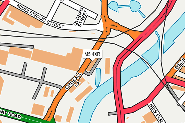
M5 4XR is located in the Ordsall electoral ward, within the metropolitan district of Salford and the English Parliamentary constituency of Salford and Eccles. The Sub Integrated Care Board (ICB) Location is NHS Greater Manchester ICB - 01G and the police force is Greater Manchester. This postcode has been in use since April 2017.


GetTheData
Source: OS OpenMap – Local (Ordnance Survey)
Source: OS VectorMap District (Ordnance Survey)
Licence: Open Government Licence (requires attribution)
| Easting | 382656 |
| Northing | 397926 |
| Latitude | 53.477787 |
| Longitude | -2.262793 |
GetTheData
Source: Open Postcode Geo
Licence: Open Government Licence
| Country | England |
| Postcode District | M5 |
➜ See where M5 is on a map ➜ Where is Salford? | |
GetTheData
Source: Land Registry Price Paid Data
Licence: Open Government Licence
Elevation or altitude of M5 4XR as distance above sea level:
| Metres | Feet | |
|---|---|---|
| Elevation | 30m | 98ft |
Elevation is measured from the approximate centre of the postcode, to the nearest point on an OS contour line from OS Terrain 50, which has contour spacing of ten vertical metres.
➜ How high above sea level am I? Find the elevation of your current position using your device's GPS.
GetTheData
Source: Open Postcode Elevation
Licence: Open Government Licence
| Ward | Ordsall |
| Constituency | Salford And Eccles |
GetTheData
Source: ONS Postcode Database
Licence: Open Government Licence
| Water St/New Elm Rd (Water St) | Castlefield | 208m |
| Regent Rd/Regent Bridge (Regent Rd) | Castlefield | 224m |
| Regent Rd/Water St (Regent Rd) | Castlefield | 253m |
| Liverpool Rd/Science Museum (Liverpool Rd) | Castlefield | 302m |
| Regent Rd/Ordsall Ln (Regent Rd) | Ordsall | 306m |
| Deansgate-castlefield (Manchester Metrolink) (Whitworth Street West) | Manchester City Centre | 833m |
| Cornbrook (Manchester Metrolink) | Cornbrook | 928m |
| St Peters Square (Manchester Metrolink) (Peter Street) | Manchester City Centre | 1,307m |
| Exchange Square (Manchester Metrolink) (Corporation St) | Manchester City Centre | 1,528m |
| Salford Quays (Manchester Metrolink) (St Peters Quay) | Salford Quays | 1,638m |
| Salford Central Station | 0.8km |
| Deansgate Station | 0.9km |
| Salford Crescent Station | 1.3km |
GetTheData
Source: NaPTAN
Licence: Open Government Licence
| Percentage of properties with Next Generation Access | 100.0% |
| Percentage of properties with Superfast Broadband | 100.0% |
| Percentage of properties with Ultrafast Broadband | 100.0% |
| Percentage of properties with Full Fibre Broadband | 100.0% |
Superfast Broadband is between 30Mbps and 300Mbps
Ultrafast Broadband is > 300Mbps
| Median download speed | 100.0Mbps |
| Average download speed | 85.9Mbps |
| Maximum download speed | 200.00Mbps |
| Median upload speed | 1.1Mbps |
| Average upload speed | 1.0Mbps |
| Maximum upload speed | 1.14Mbps |
| Percentage of properties unable to receive 2Mbps | 0.0% |
| Percentage of properties unable to receive 5Mbps | 0.0% |
| Percentage of properties unable to receive 10Mbps | 0.0% |
| Percentage of properties unable to receive 30Mbps | 0.0% |
GetTheData
Source: Ofcom
Licence: Ofcom Terms of Use (requires attribution)
GetTheData
Source: ONS Postcode Database
Licence: Open Government Licence


➜ Get more ratings from the Food Standards Agency
GetTheData
Source: Food Standards Agency
Licence: FSA terms & conditions
| Last Collection | |||
|---|---|---|---|
| Location | Mon-Fri | Sat | Distance |
| Water Street | 19:00 | 12:00 | 243m |
| 18 Oldfield Road / Cow Lane | 17:30 | 11:45 | 367m |
| Slate Wharf Castlefield | 17:30 | 12:00 | 549m |
GetTheData
Source: Dracos
Licence: Creative Commons Attribution-ShareAlike
The below table lists the International Territorial Level (ITL) codes (formerly Nomenclature of Territorial Units for Statistics (NUTS) codes) and Local Administrative Units (LAU) codes for M5 4XR:
| ITL 1 Code | Name |
|---|---|
| TLD | North West (England) |
| ITL 2 Code | Name |
| TLD3 | Greater Manchester |
| ITL 3 Code | Name |
| TLD34 | Greater Manchester South West |
| LAU 1 Code | Name |
| E08000006 | Salford |
GetTheData
Source: ONS Postcode Directory
Licence: Open Government Licence
The below table lists the Census Output Area (OA), Lower Layer Super Output Area (LSOA), and Middle Layer Super Output Area (MSOA) for M5 4XR:
| Code | Name | |
|---|---|---|
| OA | E00028700 | |
| LSOA | E01032917 | Salford 028J |
| MSOA | E02001184 | Salford 028 |
GetTheData
Source: ONS Postcode Directory
Licence: Open Government Licence
| M5 4LW | Middlewood Street | 219m |
| M5 4LN | Middlewood Street | 278m |
| M5 4LH | Middlewood Street | 314m |
| M5 4TN | Asgard Drive | 315m |
| M3 4JJ | Woollam Place | 334m |
| M5 4LZ | Oldfield Road | 357m |
| M3 4NB | Potato Wharf | 363m |
| M3 4JA | Water Street | 369m |
| M5 4SS | Derwent Street | 370m |
| M3 4BB | Potato Wharf | 379m |
GetTheData
Source: Open Postcode Geo; Land Registry Price Paid Data
Licence: Open Government Licence