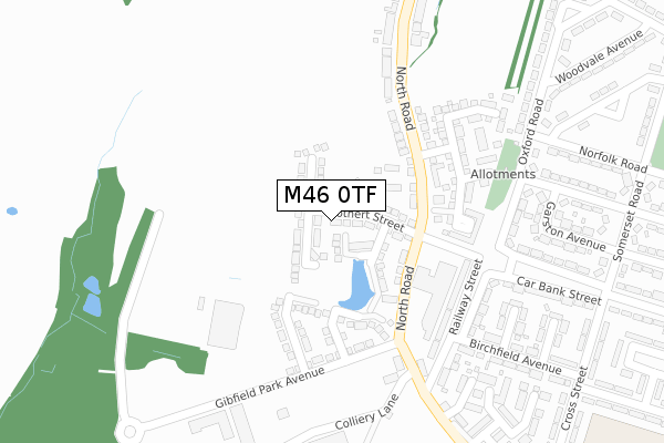
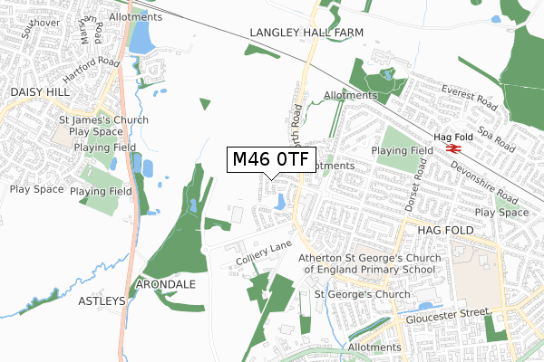
M46 0TF is located in the Atherton North electoral ward, within the metropolitan district of Wigan and the English Parliamentary constituency of Bolton West. The Sub Integrated Care Board (ICB) Location is NHS Greater Manchester ICB - 02H and the police force is Greater Manchester. This postcode has been in use since August 2017.


GetTheData
Source: OS Open Zoomstack (Ordnance Survey)
Licence: Open Government Licence (requires attribution)
Attribution: Contains OS data © Crown copyright and database right 2025
Source: Open Postcode Geo
Licence: Open Government Licence (requires attribution)
Attribution: Contains OS data © Crown copyright and database right 2025; Contains Royal Mail data © Royal Mail copyright and database right 2025; Source: Office for National Statistics licensed under the Open Government Licence v.3.0
| Easting | 366544 |
| Northing | 404052 |
| Latitude | 53.532067 |
| Longitude | -2.506206 |
GetTheData
Source: Open Postcode Geo
Licence: Open Government Licence
| Country | England |
| Postcode District | M46 |
➜ See where M46 is on a map ➜ Where is Atherton? | |
GetTheData
Source: Land Registry Price Paid Data
Licence: Open Government Licence
| Ward | Atherton North |
| Constituency | Bolton West |
GetTheData
Source: ONS Postcode Database
Licence: Open Government Licence
2023 18 AUG £361,000 |
58, STOTHERT STREET, ATHERTON, MANCHESTER, M46 0TF 2020 11 SEP £274,995 |
56, STOTHERT STREET, ATHERTON, MANCHESTER, M46 0TF 2020 4 SEP £194,995 |
60, STOTHERT STREET, ATHERTON, MANCHESTER, M46 0TF 2020 15 MAY £231,995 |
63, STOTHERT STREET, ATHERTON, MANCHESTER, M46 0TF 2020 9 APR £224,995 |
62, STOTHERT STREET, ATHERTON, MANCHESTER, M46 0TF 2020 28 FEB £192,995 |
65, STOTHERT STREET, ATHERTON, MANCHESTER, M46 0TF 2019 29 AUG £254,995 |
67, STOTHERT STREET, ATHERTON, MANCHESTER, M46 0TF 2019 15 AUG £272,995 |
2019 19 JUL £269,995 |
2019 12 JUL £252,995 |
GetTheData
Source: HM Land Registry Price Paid Data
Licence: Contains HM Land Registry data © Crown copyright and database right 2025. This data is licensed under the Open Government Licence v3.0.
| Oxford Rd/Norfolk Rd (Oxford Rd) | Hag Fold | 350m |
| Oxford Rd/Norfolk Rd (Oxford Rd) | Hag Fold | 360m |
| Warwick Rd/Somerset Rd (Warwick Rd) | Hag Fold | 400m |
| Warwick Rd/Somerset Rd (Warwick Rd) | Hag Fold | 402m |
| Devonshire Road (Nthbnd) (Devonshire Road) | Hag Fold | 408m |
| Hag Fold Station | 0.8km |
| Daisy Hill Station | 1km |
| Atherton Station | 1.8km |
GetTheData
Source: NaPTAN
Licence: Open Government Licence
| Percentage of properties with Next Generation Access | 100.0% |
| Percentage of properties with Superfast Broadband | 100.0% |
| Percentage of properties with Ultrafast Broadband | 81.8% |
| Percentage of properties with Full Fibre Broadband | 81.8% |
Superfast Broadband is between 30Mbps and 300Mbps
Ultrafast Broadband is > 300Mbps
| Median download speed | 29.9Mbps |
| Average download speed | 31.7Mbps |
| Maximum download speed | 55.00Mbps |
| Median upload speed | 5.5Mbps |
| Average upload speed | 6.6Mbps |
| Maximum upload speed | 16.94Mbps |
| Percentage of properties unable to receive 2Mbps | 0.0% |
| Percentage of properties unable to receive 5Mbps | 0.0% |
| Percentage of properties unable to receive 10Mbps | 0.0% |
| Percentage of properties unable to receive 30Mbps | 0.0% |
GetTheData
Source: Ofcom
Licence: Ofcom Terms of Use (requires attribution)
GetTheData
Source: ONS Postcode Database
Licence: Open Government Licence


➜ Get more ratings from the Food Standards Agency
GetTheData
Source: Food Standards Agency
Licence: FSA terms & conditions
| Last Collection | |||
|---|---|---|---|
| Location | Mon-Fri | Sat | Distance |
| Daisy Hill P O | 17:25 | 12:00 | 1,152m |
| Birch Avenue/ Furze Avenue | 16:50 | 11:25 | 1,458m |
| Tesco Crabtree M29 0ag | 17:30 | 11:30 | 1,531m |
GetTheData
Source: Dracos
Licence: Creative Commons Attribution-ShareAlike
The below table lists the International Territorial Level (ITL) codes (formerly Nomenclature of Territorial Units for Statistics (NUTS) codes) and Local Administrative Units (LAU) codes for M46 0TF:
| ITL 1 Code | Name |
|---|---|
| TLD | North West (England) |
| ITL 2 Code | Name |
| TLD3 | Greater Manchester |
| ITL 3 Code | Name |
| TLD36 | Greater Manchester North West |
| LAU 1 Code | Name |
| E08000010 | Wigan |
GetTheData
Source: ONS Postcode Directory
Licence: Open Government Licence
The below table lists the Census Output Area (OA), Lower Layer Super Output Area (LSOA), and Middle Layer Super Output Area (MSOA) for M46 0TF:
| Code | Name | |
|---|---|---|
| OA | E00168483 | |
| LSOA | E01006241 | Wigan 017C |
| MSOA | E02001303 | Wigan 017 |
GetTheData
Source: ONS Postcode Directory
Licence: Open Government Licence
| M46 0SU | Gibfield Park Avenue | 204m |
| M46 0RF | North Road | 212m |
| M46 0SW | North Croft | 219m |
| M46 0HG | Railway Street | 226m |
| M46 0FS | Cedar Avenue | 293m |
| M46 0HQ | Collard Street | 313m |
| M46 9GF | Garston Avenue | 350m |
| M46 9GE | Warwick Road | 373m |
| M46 0HR | Birchfield Avenue | 379m |
| M46 0FR | Maple Avenue | 385m |
GetTheData
Source: Open Postcode Geo; Land Registry Price Paid Data
Licence: Open Government Licence