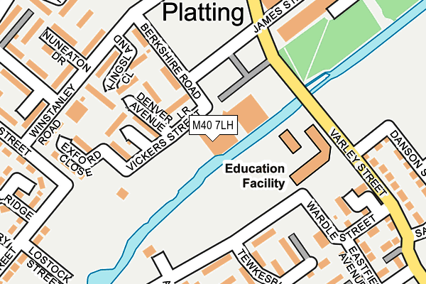
M40 7LH is located in the Miles Platting & Newton Heath electoral ward, within the metropolitan district of Manchester and the English Parliamentary constituency of Manchester Central. The Sub Integrated Care Board (ICB) Location is NHS Greater Manchester ICB - 14L and the police force is Greater Manchester. This postcode has been in use since December 1997.


GetTheData
Source: OS OpenMap – Local (Ordnance Survey)
Source: OS VectorMap District (Ordnance Survey)
Licence: Open Government Licence (requires attribution)
| Easting | 385879 |
| Northing | 399235 |
| Latitude | 53.489633 |
| Longitude | -2.214292 |
GetTheData
Source: Open Postcode Geo
Licence: Open Government Licence
| Country | England |
| Postcode District | M40 |
➜ See where M40 is on a map ➜ Where is Manchester? | |
GetTheData
Source: Land Registry Price Paid Data
Licence: Open Government Licence
Elevation or altitude of M40 7LH as distance above sea level:
| Metres | Feet | |
|---|---|---|
| Elevation | 50m | 164ft |
Elevation is measured from the approximate centre of the postcode, to the nearest point on an OS contour line from OS Terrain 50, which has contour spacing of ten vertical metres.
➜ How high above sea level am I? Find the elevation of your current position using your device's GPS.
GetTheData
Source: Open Postcode Elevation
Licence: Open Government Licence
| Ward | Miles Platting & Newton Heath |
| Constituency | Manchester Central |
GetTheData
Source: ONS Postcode Database
Licence: Open Government Licence
| Berkshire Road (Berkshire Rd) | Miles Platting | 111m |
| Mellor Street (Mellor St) | Miles Platting | 227m |
| Varley Street (Varley St) | Miles Platting | 291m |
| Bradford Rd/Cambrian St (Bradford Rd) | Holt Town | 375m |
| Bradford Rd/Bradford Inn (Bradford Rd) | Holt Town | 386m |
| Holt Town (Manchester Metrolink) (Holt Town) | Holt Town | 729m |
| Etihad Campus (Manchester Metrolink) (Joe Mercer Way) | Sportcity | 982m |
| New Islington (Manchester Metrolink) (Pollard Street) | New Islington | 1,020m |
| Monsall (Manchester Metrolink) (Ruislip Avenue) | Monsall | 1,294m |
| Queens Road (Manchester Metrolink) (Queens Road) | Smedley | 1,572m |
| Manchester Piccadilly Station | 1.8km |
| Manchester Victoria Station | 1.9km |
| Ardwick Station | 2km |
GetTheData
Source: NaPTAN
Licence: Open Government Licence
GetTheData
Source: ONS Postcode Database
Licence: Open Government Licence


➜ Get more ratings from the Food Standards Agency
GetTheData
Source: Food Standards Agency
Licence: FSA terms & conditions
| Last Collection | |||
|---|---|---|---|
| Location | Mon-Fri | Sat | Distance |
| Blandford Drive | 17:30 | 12:00 | 524m |
| Ashton New Road P.o. | 19:00 | 12:00 | 708m |
| Piercy Street | 17:30 | 12:00 | 762m |
GetTheData
Source: Dracos
Licence: Creative Commons Attribution-ShareAlike
The below table lists the International Territorial Level (ITL) codes (formerly Nomenclature of Territorial Units for Statistics (NUTS) codes) and Local Administrative Units (LAU) codes for M40 7LH:
| ITL 1 Code | Name |
|---|---|
| TLD | North West (England) |
| ITL 2 Code | Name |
| TLD3 | Greater Manchester |
| ITL 3 Code | Name |
| TLD33 | Manchester |
| LAU 1 Code | Name |
| E08000003 | Manchester |
GetTheData
Source: ONS Postcode Directory
Licence: Open Government Licence
The below table lists the Census Output Area (OA), Lower Layer Super Output Area (LSOA), and Middle Layer Super Output Area (MSOA) for M40 7LH:
| Code | Name | |
|---|---|---|
| OA | E00025951 | |
| LSOA | E01005129 | Manchester 013B |
| MSOA | E02001057 | Manchester 013 |
GetTheData
Source: ONS Postcode Directory
Licence: Open Government Licence
| M40 7LJ | Lower Vickers Street | 0m |
| M40 7LL | Lower Vickers Street | 0m |
| M40 7WG | Blackford Walk | 114m |
| M40 7DA | Holland Street | 114m |
| M40 7DE | Holland Street | 152m |
| M40 7WA | Berkshire Road | 168m |
| M40 7WD | Tideswell Avenue | 178m |
| M40 7DL | Darton Avenue | 200m |
| M40 7LS | Carmody Close | 211m |
| M40 7DH | Tewkesbury Road | 228m |
GetTheData
Source: Open Postcode Geo; Land Registry Price Paid Data
Licence: Open Government Licence