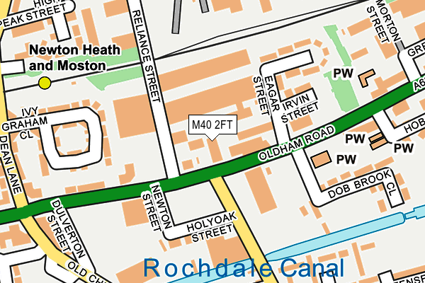
M40 2FT is located in the Miles Platting & Newton Heath electoral ward, within the metropolitan district of Manchester and the English Parliamentary constituency of Manchester Central. The Sub Integrated Care Board (ICB) Location is NHS Greater Manchester ICB - 14L and the police force is Greater Manchester. This postcode has been in use since December 2022.


GetTheData
Source: OS OpenMap – Local (Ordnance Survey)
Source: OS VectorMap District (Ordnance Survey)
Licence: Open Government Licence (requires attribution)
| Easting | 388179 |
| Northing | 400760 |
| Latitude | 53.503414 |
| Longitude | -2.179685 |
GetTheData
Source: Open Postcode Geo
Licence: Open Government Licence
| Country | England |
| Postcode District | M40 |
➜ See where M40 is on a map ➜ Where is Manchester? | |
GetTheData
Source: Land Registry Price Paid Data
Licence: Open Government Licence
Elevation or altitude of M40 2FT as distance above sea level:
| Metres | Feet | |
|---|---|---|
| Elevation | 90m | 295ft |
Elevation is measured from the approximate centre of the postcode, to the nearest point on an OS contour line from OS Terrain 50, which has contour spacing of ten vertical metres.
➜ How high above sea level am I? Find the elevation of your current position using your device's GPS.
GetTheData
Source: Open Postcode Elevation
Licence: Open Government Licence
| Ward | Miles Platting & Newton Heath |
| Constituency | Manchester Central |
GetTheData
Source: ONS Postcode Database
Licence: Open Government Licence
| Oldham Rd/Droylsden Rd (Oldham Rd) | Newton Heath | 38m |
| Oldham Rd/Droylsden Rd (Oldham Rd) | Newton Heath | 106m |
| Oldham Rd/Dean Ln (Oldham Rd) | Newton Heath | 174m |
| Old Church St/Newton Heath Shops (Old Church St) | Newton Heath | 268m |
| Old Church St/Oldham Rd (Old Church St) | Newton Heath | 288m |
| Newton Heath & Moston (Manchester Metrolink) (Dean Lane) | Newton Heath | 339m |
| Central Park (Manchester Metrolink) (The Gateway) | Newton Heath | 1,308m |
| Failsworth (Manchester Metrolink) (Hardman Lane) | Failsworth | 1,370m |
| Moston Station | 2.3km |
| Ashburys Station | 3.7km |
| Gorton Station | 3.9km |
GetTheData
Source: NaPTAN
Licence: Open Government Licence
GetTheData
Source: ONS Postcode Database
Licence: Open Government Licence


➜ Get more ratings from the Food Standards Agency
GetTheData
Source: Food Standards Agency
Licence: FSA terms & conditions
| Last Collection | |||
|---|---|---|---|
| Location | Mon-Fri | Sat | Distance |
| New Moston | 17:30 | 12:00 | 806m |
| Delmahoy Close | 17:30 | 12:00 | 996m |
| Scotland Hall Road | 17:30 | 12:00 | 1,098m |
GetTheData
Source: Dracos
Licence: Creative Commons Attribution-ShareAlike
The below table lists the International Territorial Level (ITL) codes (formerly Nomenclature of Territorial Units for Statistics (NUTS) codes) and Local Administrative Units (LAU) codes for M40 2FT:
| ITL 1 Code | Name |
|---|---|
| TLD | North West (England) |
| ITL 2 Code | Name |
| TLD3 | Greater Manchester |
| ITL 3 Code | Name |
| TLD33 | Manchester |
| LAU 1 Code | Name |
| E08000003 | Manchester |
GetTheData
Source: ONS Postcode Directory
Licence: Open Government Licence
The below table lists the Census Output Area (OA), Lower Layer Super Output Area (LSOA), and Middle Layer Super Output Area (MSOA) for M40 2FT:
| Code | Name | |
|---|---|---|
| OA | E00026633 | |
| LSOA | E01005256 | Manchester 011A |
| MSOA | E02001055 | Manchester 011 |
GetTheData
Source: ONS Postcode Directory
Licence: Open Government Licence
| M40 2FU | Oldham Road | 12m |
| M40 1EP | Eagar Street | 80m |
| M40 3AG | Reliance Trading Estate | 83m |
| M40 1EN | Irvin Street | 124m |
| M40 3AX | Ivy Graham Close | 148m |
| M40 1EY | Lilmore Avenue | 165m |
| M40 1EZ | Oldham Road | 170m |
| M40 1HX | Brimfield Walk | 192m |
| M40 1DB | Dob Brook Close | 193m |
| M40 1HN | Risbury Walk | 211m |
GetTheData
Source: Open Postcode Geo; Land Registry Price Paid Data
Licence: Open Government Licence