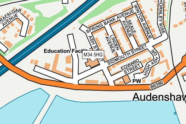
M34 5HG is located in the Audenshaw electoral ward, within the metropolitan district of Tameside and the English Parliamentary constituency of Denton and Reddish. The Sub Integrated Care Board (ICB) Location is NHS Greater Manchester ICB - 01Y and the police force is Greater Manchester. This postcode has been in use since January 1980.


GetTheData
Source: OS OpenMap – Local (Ordnance Survey)
Source: OS VectorMap District (Ordnance Survey)
Licence: Open Government Licence (requires attribution)
| Easting | 391524 |
| Northing | 397255 |
| Latitude | 53.471958 |
| Longitude | -2.129160 |
GetTheData
Source: Open Postcode Geo
Licence: Open Government Licence
| Country | England |
| Postcode District | M34 |
➜ See where M34 is on a map ➜ Where is Audenshaw? | |
GetTheData
Source: Land Registry Price Paid Data
Licence: Open Government Licence
Elevation or altitude of M34 5HG as distance above sea level:
| Metres | Feet | |
|---|---|---|
| Elevation | 100m | 328ft |
Elevation is measured from the approximate centre of the postcode, to the nearest point on an OS contour line from OS Terrain 50, which has contour spacing of ten vertical metres.
➜ How high above sea level am I? Find the elevation of your current position using your device's GPS.
GetTheData
Source: Open Postcode Elevation
Licence: Open Government Licence
| Ward | Audenshaw |
| Constituency | Denton And Reddish |
GetTheData
Source: ONS Postcode Database
Licence: Open Government Licence
| Audenshaw Rd/Lumb Ln (Audenshaw Rd) | Audenshaw | 92m |
| Audenshaw Rd/Lumb Ln (Audenshaw Rd) | Audenshaw | 134m |
| Audenshaw Rd/Stamford Rd (Audenshaw Rd) | Audenshaw | 328m |
| Audenshaw Rd/Trafalgar Ave (Audenshaw Rd) | Audenshaw | 333m |
| Stamford Rd/Audenshaw Rd (Stamford Rd) | Audenshaw | 344m |
| Audenshaw (Manchester Metrolink) (Droylesden Rd) | Audenshaw | 706m |
| Droylsden (Manchester Metrolink) (Ashton Road) | Droylsden | 1,324m |
| Ashton Moss (Manchester Metrolink) (Lord Sheldon Way) | Ashton Moss | 1,379m |
| Guide Bridge Station | 1.1km |
| Fairfield Station | 1.1km |
| Denton Station | 1.7km |
GetTheData
Source: NaPTAN
Licence: Open Government Licence
GetTheData
Source: ONS Postcode Database
Licence: Open Government Licence


➜ Get more ratings from the Food Standards Agency
GetTheData
Source: Food Standards Agency
Licence: FSA terms & conditions
| Last Collection | |||
|---|---|---|---|
| Location | Mon-Fri | Sat | Distance |
| Dean Head | 17:30 | 12:00 | 589m |
| Junction P.o. | 17:30 | 12:00 | 702m |
| Stamford Road | 17:30 | 12:00 | 734m |
GetTheData
Source: Dracos
Licence: Creative Commons Attribution-ShareAlike
The below table lists the International Territorial Level (ITL) codes (formerly Nomenclature of Territorial Units for Statistics (NUTS) codes) and Local Administrative Units (LAU) codes for M34 5HG:
| ITL 1 Code | Name |
|---|---|
| TLD | North West (England) |
| ITL 2 Code | Name |
| TLD3 | Greater Manchester |
| ITL 3 Code | Name |
| TLD35 | Greater Manchester South East |
| LAU 1 Code | Name |
| E08000008 | Tameside |
GetTheData
Source: ONS Postcode Directory
Licence: Open Government Licence
The below table lists the Census Output Area (OA), Lower Layer Super Output Area (LSOA), and Middle Layer Super Output Area (MSOA) for M34 5HG:
| Code | Name | |
|---|---|---|
| OA | E00030212 | |
| LSOA | E01005961 | Tameside 014A |
| MSOA | E02001242 | Tameside 014 |
GetTheData
Source: ONS Postcode Directory
Licence: Open Government Licence
| M34 5WQ | Ash Street | 52m |
| M34 5WD | Ash Street | 60m |
| M34 5PH | Springbank Terrace | 81m |
| M34 5NR | Linden Avenue | 82m |
| M34 5WH | Lumb Lane | 87m |
| M34 5NQ | Edward Street | 104m |
| M34 5WP | Audenshaw Road | 108m |
| M34 5NG | Sidmouth Street | 149m |
| M34 5WG | Springbank Avenue | 156m |
| M34 5WR | Seale Avenue | 159m |
GetTheData
Source: Open Postcode Geo; Land Registry Price Paid Data
Licence: Open Government Licence