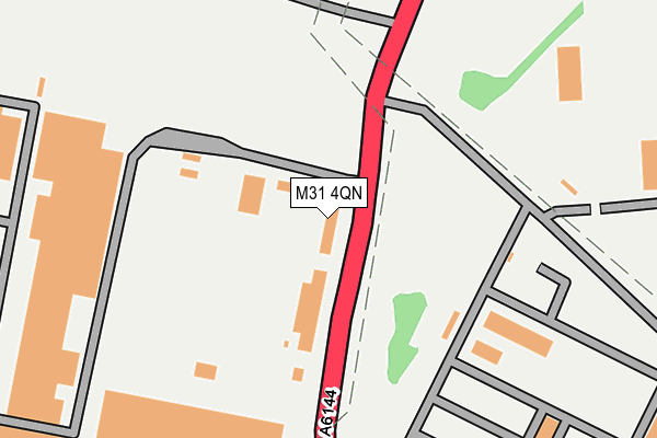
M31 4QN is located in the Bucklow-St Martins electoral ward, within the metropolitan district of Trafford and the English Parliamentary constituency of Stretford and Urmston. The Sub Integrated Care Board (ICB) Location is NHS Greater Manchester ICB - 02A and the police force is Greater Manchester. This postcode has been in use since November 2007.


GetTheData
Source: OS OpenMap – Local (Ordnance Survey)
Source: OS VectorMap District (Ordnance Survey)
Licence: Open Government Licence (requires attribution)
| Easting | 372237 |
| Northing | 392132 |
| Latitude | 53.425260 |
| Longitude | -2.419262 |
GetTheData
Source: Open Postcode Geo
Licence: Open Government Licence
| Country | England |
| Postcode District | M31 |
➜ See where M31 is on a map ➜ Where is Partington? | |
GetTheData
Source: Land Registry Price Paid Data
Licence: Open Government Licence
Elevation or altitude of M31 4QN as distance above sea level:
| Metres | Feet | |
|---|---|---|
| Elevation | 20m | 66ft |
Elevation is measured from the approximate centre of the postcode, to the nearest point on an OS contour line from OS Terrain 50, which has contour spacing of ten vertical metres.
➜ How high above sea level am I? Find the elevation of your current position using your device's GPS.
GetTheData
Source: Open Postcode Elevation
Licence: Open Government Licence
| Ward | Bucklow-st Martins |
| Constituency | Stretford And Urmston |
GetTheData
Source: ONS Postcode Database
Licence: Open Government Licence
| Manchester Road/Common Lane (Manchester Road) | Carrington | 300m |
| Manchester Road/Common Lane (Manchester Road) | Carrington | 319m |
| Manchester Road/Broadway (Manchester Road) | Partington | 432m |
| Broadway/Manchester Rd (Sebnd) (Broadway) | Partington | 466m |
| Manchester Road/Broadway (Manchester Road) | Partington | 476m |
| Irlam Station | 1.4km |
| Glazebrook Station | 2.7km |
| Flixton Station | 3.1km |
GetTheData
Source: NaPTAN
Licence: Open Government Licence
GetTheData
Source: ONS Postcode Database
Licence: Open Government Licence


➜ Get more ratings from the Food Standards Agency
GetTheData
Source: Food Standards Agency
Licence: FSA terms & conditions
| Last Collection | |||
|---|---|---|---|
| Location | Mon-Fri | Sat | Distance |
| Broadway | 17:30 | 11:30 | 446m |
| Partington P.o. | 17:30 | 12:00 | 778m |
| Outside Library Central Road | 17:30 | 11:30 | 876m |
GetTheData
Source: Dracos
Licence: Creative Commons Attribution-ShareAlike
The below table lists the International Territorial Level (ITL) codes (formerly Nomenclature of Territorial Units for Statistics (NUTS) codes) and Local Administrative Units (LAU) codes for M31 4QN:
| ITL 1 Code | Name |
|---|---|
| TLD | North West (England) |
| ITL 2 Code | Name |
| TLD3 | Greater Manchester |
| ITL 3 Code | Name |
| TLD34 | Greater Manchester South West |
| LAU 1 Code | Name |
| E08000009 | Trafford |
GetTheData
Source: ONS Postcode Directory
Licence: Open Government Licence
The below table lists the Census Output Area (OA), Lower Layer Super Output Area (LSOA), and Middle Layer Super Output Area (MSOA) for M31 4QN:
| Code | Name | |
|---|---|---|
| OA | E00030929 | |
| LSOA | E01006107 | Trafford 017D |
| MSOA | E02001275 | Trafford 017 |
GetTheData
Source: ONS Postcode Directory
Licence: Open Government Licence
| M31 4BW | Manchester Road | 432m |
| M31 4DL | Orchard Avenue | 476m |
| M31 4GA | Mersey Drive | 483m |
| M31 4GB | Dane Avenue | 540m |
| M31 4DJ | Manchester Road | 552m |
| M31 4GD | Wooding Close | 556m |
| M31 4DF | Hardwick Road | 563m |
| M31 4DE | Queensway | 574m |
| M31 4DB | River Lane | 595m |
| M31 4BQ | Dean Close | 596m |
GetTheData
Source: Open Postcode Geo; Land Registry Price Paid Data
Licence: Open Government Licence