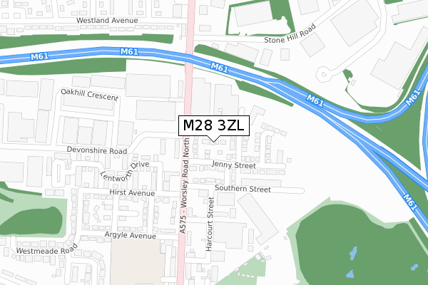
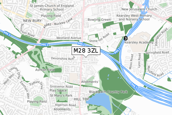
M28 3ZL is located in the Walkden North electoral ward, within the metropolitan district of Salford and the English Parliamentary constituency of Worsley and Eccles South. The Sub Integrated Care Board (ICB) Location is NHS Greater Manchester ICB - 01G and the police force is Greater Manchester. This postcode has been in use since September 2019.


GetTheData
Source: OS Open Zoomstack (Ordnance Survey)
Licence: Open Government Licence (requires attribution)
Attribution: Contains OS data © Crown copyright and database right 2025
Source: Open Postcode Geo
Licence: Open Government Licence (requires attribution)
Attribution: Contains OS data © Crown copyright and database right 2025; Contains Royal Mail data © Royal Mail copyright and database right 2025; Source: Office for National Statistics licensed under the Open Government Licence v.3.0
| Easting | 373642 |
| Northing | 404555 |
| Latitude | 53.536993 |
| Longitude | -2.399165 |
GetTheData
Source: Open Postcode Geo
Licence: Open Government Licence
| Country | England |
| Postcode District | M28 |
➜ See where M28 is on a map ➜ Where is Little Hulton? | |
GetTheData
Source: Land Registry Price Paid Data
Licence: Open Government Licence
| Ward | Walkden North |
| Constituency | Worsley And Eccles South |
GetTheData
Source: ONS Postcode Database
Licence: Open Government Licence
11, CHENILLE CLOSE, WORSLEY, MANCHESTER, M28 3ZL 2021 26 MAR £329,995 |
7, CHENILLE CLOSE, WORSLEY, MANCHESTER, M28 3ZL 2019 31 OCT £284,995 |
10, CHENILLE CLOSE, WORSLEY, MANCHESTER, M28 3ZL 2019 31 OCT £259,995 |
2, CHENILLE CLOSE, WORSLEY, MANCHESTER, M28 3ZL 2019 30 SEP £259,995 |
1, CHENILLE CLOSE, WORSLEY, MANCHESTER, M28 3ZL 2019 30 SEP £289,995 |
GetTheData
Source: HM Land Registry Price Paid Data
Licence: Contains HM Land Registry data © Crown copyright and database right 2025. This data is licensed under the Open Government Licence v3.0.
| Worsley Rd Nth/Martial Arts Ctr (Worsley Rd Nth) | Hill Top | 104m |
| Worsley Rd Nth/Hirst Ave (Worsley Rd Nth) | Hill Top | 109m |
| Worsley Rd Nth/Hirst Ave (Worsley Rd Nth) | Hill Top | 151m |
| Worsley Rd Nth/Martial Arts Ctr (Worsley Rd Nth) | Hill Top | 153m |
| Westland Avenue/Waverley Square (Westland Ave) | New Bury | 355m |
| Farnworth Station | 1.6km |
| Kearsley Station | 1.8km |
| Walkden Station | 1.9km |
GetTheData
Source: NaPTAN
Licence: Open Government Licence
GetTheData
Source: ONS Postcode Database
Licence: Open Government Licence


➜ Get more ratings from the Food Standards Agency
GetTheData
Source: Food Standards Agency
Licence: FSA terms & conditions
| Last Collection | |||
|---|---|---|---|
| Location | Mon-Fri | Sat | Distance |
| Bridgeman Street/Fletcher St | 17:40 | 11:20 | 464m |
| Manchester Road Kearsley | 17:30 | 11:20 | 828m |
| Eastham Way | 17:30 | 12:00 | 971m |
GetTheData
Source: Dracos
Licence: Creative Commons Attribution-ShareAlike
The below table lists the International Territorial Level (ITL) codes (formerly Nomenclature of Territorial Units for Statistics (NUTS) codes) and Local Administrative Units (LAU) codes for M28 3ZL:
| ITL 1 Code | Name |
|---|---|
| TLD | North West (England) |
| ITL 2 Code | Name |
| TLD3 | Greater Manchester |
| ITL 3 Code | Name |
| TLD34 | Greater Manchester South West |
| LAU 1 Code | Name |
| E08000006 | Salford |
GetTheData
Source: ONS Postcode Directory
Licence: Open Government Licence
The below table lists the Census Output Area (OA), Lower Layer Super Output Area (LSOA), and Middle Layer Super Output Area (MSOA) for M28 3ZL:
| Code | Name | |
|---|---|---|
| OA | E00172960 | |
| LSOA | E01005702 | Salford 003A |
| MSOA | E02001159 | Salford 003 |
GetTheData
Source: ONS Postcode Directory
Licence: Open Government Licence
| M28 3EU | Worsley Road North | 89m |
| M28 3QN | Southern Street | 119m |
| M28 3ER | Hatherton Court | 137m |
| M28 3QJ | Worsley Road North | 151m |
| M28 3QW | Worsley Road North | 166m |
| M28 3GN | Harcourt Street | 167m |
| M28 3EX | Lentworth Drive | 224m |
| M28 3GE | Albert Avenue | 239m |
| M28 3QH | Hirst Avenue | 249m |
| M28 3FF | Kellets Row | 278m |
GetTheData
Source: Open Postcode Geo; Land Registry Price Paid Data
Licence: Open Government Licence