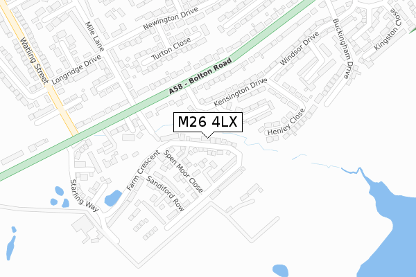
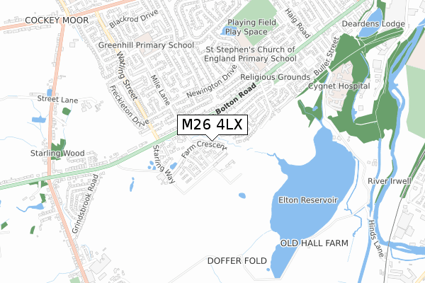
M26 4LX is located in the Bury West electoral ward, within the metropolitan district of Bury and the English Parliamentary constituency of Bury South. The Sub Integrated Care Board (ICB) Location is NHS Greater Manchester ICB - 00V and the police force is Greater Manchester. This postcode has been in use since February 2019.


GetTheData
Source: OS Open Zoomstack (Ordnance Survey)
Licence: Open Government Licence (requires attribution)
Attribution: Contains OS data © Crown copyright and database right 2025
Source: Open Postcode Geo
Licence: Open Government Licence (requires attribution)
Attribution: Contains OS data © Crown copyright and database right 2025; Contains Royal Mail data © Royal Mail copyright and database right 2025; Source: Office for National Statistics licensed under the Open Government Licence v.3.0
| Easting | 378367 |
| Northing | 409537 |
| Latitude | 53.581988 |
| Longitude | -2.328222 |
GetTheData
Source: Open Postcode Geo
Licence: Open Government Licence
| Country | England |
| Postcode District | M26 |
➜ See where M26 is on a map ➜ Where is Bury? | |
GetTheData
Source: Land Registry Price Paid Data
Licence: Open Government Licence
| Ward | Bury West |
| Constituency | Bury South |
GetTheData
Source: ONS Postcode Database
Licence: Open Government Licence
58, FARM CRESCENT, RADCLIFFE, MANCHESTER, M26 4LX 2025 21 JAN £430,000 |
2023 20 OCT £387,500 |
58, FARM CRESCENT, RADCLIFFE, MANCHESTER, M26 4LX 2022 31 MAR £387,500 |
2, FARM CRESCENT, RADCLIFFE, MANCHESTER, M26 4LX 2021 27 AUG £209,260 |
14, FARM CRESCENT, RADCLIFFE, MANCHESTER, M26 4LX 2021 28 MAY £293,985 |
2021 7 MAY £332,500 |
6, FARM CRESCENT, RADCLIFFE, MANCHESTER, M26 4LX 2021 30 APR £220,650 |
8, FARM CRESCENT, RADCLIFFE, MANCHESTER, M26 4LX 2021 25 MAR £375,105 |
10, FARM CRESCENT, RADCLIFFE, MANCHESTER, M26 4LX 2021 19 MAR £304,125 |
12, FARM CRESCENT, RADCLIFFE, MANCHESTER, M26 4LX 2021 26 FEB £364,965 |
GetTheData
Source: HM Land Registry Price Paid Data
Licence: Contains HM Land Registry data © Crown copyright and database right 2025. This data is licensed under the Open Government Licence v3.0.
| Bolton Rd/Mile Ln (Bolton Rd) | Seddons Farm Estate | 280m |
| Bolton Rd/Mile Ln (Bolton Rd) | Seddons Farm Estate | 285m |
| Bolton Rd/Kensington Dr (Bolton Rd) | Seddons Farm Estate | 321m |
| Bolton Rd/Kensington Dr (Bolton Rd) | Seddons Farm Estate | 359m |
| Bury & Bolton Rd/Watling St (Bury & Boltn Rd) | Seddons Farm Estate | 373m |
| Kearsley Station | 5.2km |
| Farnworth Station | 5.3km |
| Moses Gate Station | 5.6km |
GetTheData
Source: NaPTAN
Licence: Open Government Licence
| Percentage of properties with Next Generation Access | 100.0% |
| Percentage of properties with Superfast Broadband | 100.0% |
| Percentage of properties with Ultrafast Broadband | 0.0% |
| Percentage of properties with Full Fibre Broadband | 0.0% |
Superfast Broadband is between 30Mbps and 300Mbps
Ultrafast Broadband is > 300Mbps
| Median download speed | 53.0Mbps |
| Average download speed | 52.2Mbps |
| Maximum download speed | 67.02Mbps |
| Median upload speed | 13.9Mbps |
| Average upload speed | 13.1Mbps |
| Maximum upload speed | 15.15Mbps |
| Percentage of properties unable to receive 2Mbps | 0.0% |
| Percentage of properties unable to receive 5Mbps | 0.0% |
| Percentage of properties unable to receive 10Mbps | 0.0% |
| Percentage of properties unable to receive 30Mbps | 0.0% |
GetTheData
Source: Ofcom
Licence: Ofcom Terms of Use (requires attribution)
GetTheData
Source: ONS Postcode Database
Licence: Open Government Licence


➜ Get more ratings from the Food Standards Agency
GetTheData
Source: Food Standards Agency
Licence: FSA terms & conditions
| Last Collection | |||
|---|---|---|---|
| Location | Mon-Fri | Sat | Distance |
| Black Lane P.o. | 17:30 | 12:00 | 1,138m |
| Owlerbarrow Road | 17:35 | 11:05 | 1,936m |
| Rectory Lane | 17:30 | 12:00 | 2,176m |
GetTheData
Source: Dracos
Licence: Creative Commons Attribution-ShareAlike
The below table lists the International Territorial Level (ITL) codes (formerly Nomenclature of Territorial Units for Statistics (NUTS) codes) and Local Administrative Units (LAU) codes for M26 4LX:
| ITL 1 Code | Name |
|---|---|
| TLD | North West (England) |
| ITL 2 Code | Name |
| TLD3 | Greater Manchester |
| ITL 3 Code | Name |
| TLD37 | Greater Manchester North East |
| LAU 1 Code | Name |
| E08000002 | Bury |
GetTheData
Source: ONS Postcode Directory
Licence: Open Government Licence
The below table lists the Census Output Area (OA), Lower Layer Super Output Area (LSOA), and Middle Layer Super Output Area (MSOA) for M26 4LX:
| Code | Name | |
|---|---|---|
| OA | E00025308 | |
| LSOA | E01005006 | Bury 012D |
| MSOA | E02001030 | Bury 012 |
GetTheData
Source: ONS Postcode Directory
Licence: Open Government Licence
| BL8 2DN | Spen Fold | 231m |
| BL8 2DG | Sunningdale Close | 231m |
| BL8 2DW | Bolton Road | 249m |
| BL8 2DF | Henley Close | 249m |
| BL8 2DE | Kensington Drive | 269m |
| M26 4LB | Bury And Bolton Road | 283m |
| M26 4LA | Bury And Bolton Road | 292m |
| BL8 2DR | Bolton Road | 335m |
| BL8 2EE | Turton Close | 353m |
| BL8 2DU | Bolton Road | 356m |
GetTheData
Source: Open Postcode Geo; Land Registry Price Paid Data
Licence: Open Government Licence