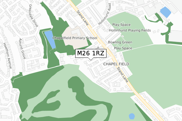
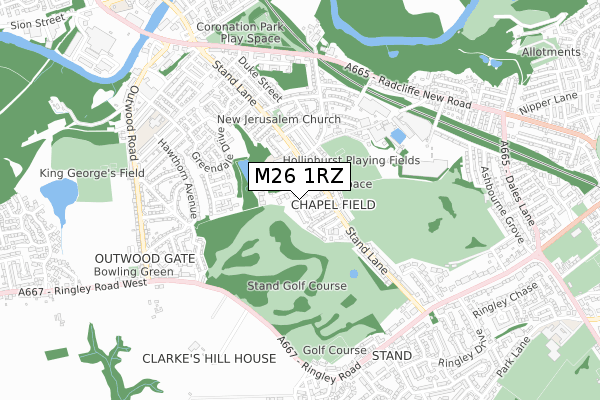
M26 1RZ is located in the Radcliffe West electoral ward, within the metropolitan district of Bury and the English Parliamentary constituency of Bury South. The Sub Integrated Care Board (ICB) Location is NHS Greater Manchester ICB - 00V and the police force is Greater Manchester. This postcode has been in use since April 2020.


GetTheData
Source: OS Open Zoomstack (Ordnance Survey)
Licence: Open Government Licence (requires attribution)
Attribution: Contains OS data © Crown copyright and database right 2025
Source: Open Postcode Geo
Licence: Open Government Licence (requires attribution)
Attribution: Contains OS data © Crown copyright and database right 2025; Contains Royal Mail data © Royal Mail copyright and database right 2025; Source: Office for National Statistics licensed under the Open Government Licence v.3.0
| Easting | 378505 |
| Northing | 405751 |
| Latitude | 53.547965 |
| Longitude | -2.325874 |
GetTheData
Source: Open Postcode Geo
Licence: Open Government Licence
| Country | England |
| Postcode District | M26 |
➜ See where M26 is on a map ➜ Where is Radcliffe? | |
GetTheData
Source: Land Registry Price Paid Data
Licence: Open Government Licence
| Ward | Radcliffe West |
| Constituency | Bury South |
GetTheData
Source: ONS Postcode Database
Licence: Open Government Licence
4, MEADOW VIEW, RADCLIFFE, MANCHESTER, M26 1RZ 2021 22 DEC £487,950 |
2, MEADOW VIEW, RADCLIFFE, MANCHESTER, M26 1RZ 2021 15 NOV £490,000 |
3, MEADOW VIEW, RADCLIFFE, MANCHESTER, M26 1RZ 2021 30 SEP £475,000 |
1, MEADOW VIEW, RADCLIFFE, MANCHESTER, M26 1RZ 2021 30 SEP £500,001 |
5, MEADOW VIEW, RADCLIFFE, MANCHESTER, M26 1RZ 2021 29 JUN £510,000 |
GetTheData
Source: HM Land Registry Price Paid Data
Licence: Contains HM Land Registry data © Crown copyright and database right 2025. This data is licensed under the Open Government Licence v3.0.
| Outwood Rd/Hare & Hounds (Outwood Rd) | Chapel Field | 74m |
| Ringley Rd West/Outwood Rd (Ringley Rd West) | Chapel Field | 76m |
| Outwood Rd/Hare & Hounds (Outwood Rd) | Chapel Field | 99m |
| Ringley Rd West/Outwood Rd (Ringley Rd West) | Chapel Field | 148m |
| Ringley Rd West/Ringley Mews (Ringley Rd West) | Chapel Field | 218m |
| Clifton (Manchester) Station | 2.9km |
| Kearsley Station | 3.3km |
| Swinton (Manchester) Station | 3.8km |
GetTheData
Source: NaPTAN
Licence: Open Government Licence
GetTheData
Source: ONS Postcode Database
Licence: Open Government Licence


➜ Get more ratings from the Food Standards Agency
GetTheData
Source: Food Standards Agency
Licence: FSA terms & conditions
| Last Collection | |||
|---|---|---|---|
| Location | Mon-Fri | Sat | Distance |
| Ringley Road / Ten Acre Drive | 17:30 | 11:45 | 1,048m |
| Asda | 17:30 | 12:00 | 1,062m |
| Radcliffe P.o. | 17:30 | 12:00 | 1,210m |
GetTheData
Source: Dracos
Licence: Creative Commons Attribution-ShareAlike
The below table lists the International Territorial Level (ITL) codes (formerly Nomenclature of Territorial Units for Statistics (NUTS) codes) and Local Administrative Units (LAU) codes for M26 1RZ:
| ITL 1 Code | Name |
|---|---|
| TLD | North West (England) |
| ITL 2 Code | Name |
| TLD3 | Greater Manchester |
| ITL 3 Code | Name |
| TLD37 | Greater Manchester North East |
| LAU 1 Code | Name |
| E08000002 | Bury |
GetTheData
Source: ONS Postcode Directory
Licence: Open Government Licence
The below table lists the Census Output Area (OA), Lower Layer Super Output Area (LSOA), and Middle Layer Super Output Area (MSOA) for M26 1RZ:
| Code | Name | |
|---|---|---|
| OA | E00171715 | |
| LSOA | E01005013 | Bury 018D |
| MSOA | E02001036 | Bury 018 |
GetTheData
Source: ONS Postcode Directory
Licence: Open Government Licence
| M26 1DL | Ringley Road West | 65m |
| M26 1DJ | Ringley Road West | 94m |
| M26 1BS | Lund Avenue | 136m |
| M26 1BF | Woodgreen Drive | 147m |
| M26 1BQ | Outwood Road | 186m |
| M26 1BG | Outwood Road | 209m |
| M26 1BT | Stand Rise | 212m |
| M26 1BR | Bull Hill Crescent | 224m |
| M26 1RN | Ringley Mews | 260m |
| M26 1BU | Crompton Close | 282m |
GetTheData
Source: Open Postcode Geo; Land Registry Price Paid Data
Licence: Open Government Licence