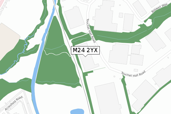
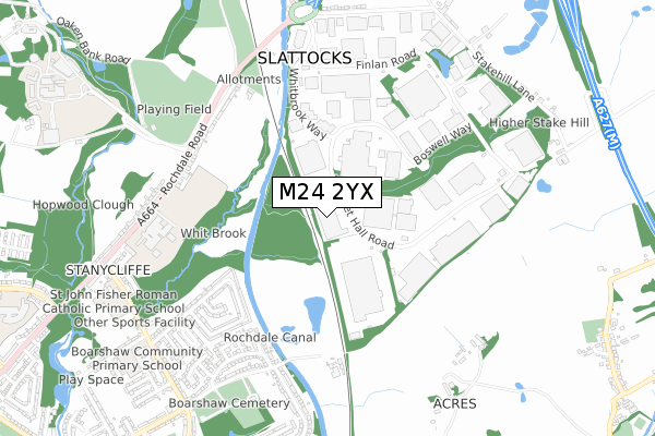
M24 2YX is located in the North Middleton electoral ward, within the metropolitan district of Rochdale and the English Parliamentary constituency of Heywood and Middleton. The Sub Integrated Care Board (ICB) Location is NHS Greater Manchester ICB - 01D and the police force is Greater Manchester. This postcode has been in use since November 2018.


GetTheData
Source: OS Open Zoomstack (Ordnance Survey)
Licence: Open Government Licence (requires attribution)
Attribution: Contains OS data © Crown copyright and database right 2025
Source: Open Postcode Geo
Licence: Open Government Licence (requires attribution)
Attribution: Contains OS data © Crown copyright and database right 2025; Contains Royal Mail data © Royal Mail copyright and database right 2025; Source: Office for National Statistics licensed under the Open Government Licence v.3.0
| Easting | 388628 |
| Northing | 407579 |
| Latitude | 53.564715 |
| Longitude | -2.173165 |
GetTheData
Source: Open Postcode Geo
Licence: Open Government Licence
| Country | England |
| Postcode District | M24 |
➜ See where M24 is on a map ➜ Where is Slattocks? | |
GetTheData
Source: Land Registry Price Paid Data
Licence: Open Government Licence
| Ward | North Middleton |
| Constituency | Heywood And Middleton |
GetTheData
Source: ONS Postcode Database
Licence: Open Government Licence
| Touchet Hall Rd/Stake Hill Ind Est (Touchet Hall Rd) | Stakehill | 150m |
| Touchet Hall Rd/Stake Hill Ind Est (Touchet Hall Rd) | Stakehill | 261m |
| Touchet Hall Rd/Whitbrook Way (Touchet Hall Rd) | Stakehill | 308m |
| Acresfield Rd/Guildford Gr (Acresfield Road) | Stanycliffe | 446m |
| Guildford Grove (Sw Bnd) (Guildford Grove) | Stanycliffe | 509m |
| Mills Hill (Manchester) Station | 1.5km |
| Castleton (Manchester) Station | 3km |
| Moston Station | 4.6km |
GetTheData
Source: NaPTAN
Licence: Open Government Licence
GetTheData
Source: ONS Postcode Database
Licence: Open Government Licence


➜ Get more ratings from the Food Standards Agency
GetTheData
Source: Food Standards Agency
Licence: FSA terms & conditions
| Last Collection | |||
|---|---|---|---|
| Location | Mon-Fri | Sat | Distance |
| Hereford Way / Boarshaw Road | 17:30 | 12:00 | 634m |
| Acresfield Road/ Stancliffe La | 17:30 | 12:00 | 802m |
| Stanycliffe Lane | 17:30 | 12:00 | 854m |
GetTheData
Source: Dracos
Licence: Creative Commons Attribution-ShareAlike
The below table lists the International Territorial Level (ITL) codes (formerly Nomenclature of Territorial Units for Statistics (NUTS) codes) and Local Administrative Units (LAU) codes for M24 2YX:
| ITL 1 Code | Name |
|---|---|
| TLD | North West (England) |
| ITL 2 Code | Name |
| TLD3 | Greater Manchester |
| ITL 3 Code | Name |
| TLD37 | Greater Manchester North East |
| LAU 1 Code | Name |
| E08000005 | Rochdale |
GetTheData
Source: ONS Postcode Directory
Licence: Open Government Licence
The below table lists the Census Output Area (OA), Lower Layer Super Output Area (LSOA), and Middle Layer Super Output Area (MSOA) for M24 2YX:
| Code | Name | |
|---|---|---|
| OA | E00028030 | |
| LSOA | E01005543 | Rochdale 021F |
| MSOA | E02001152 | Rochdale 021 |
GetTheData
Source: ONS Postcode Directory
Licence: Open Government Licence
| M24 2SJ | Stakehill Industrial Estate | 479m |
| M24 2PH | Arnold Drive | 524m |
| M24 2NR | Acresfield Road | 528m |
| M24 2NZ | Ashbourne Avenue | 548m |
| M24 2QW | Rochdale Road | 561m |
| M24 2NY | Guildford Grove | 564m |
| M24 2WX | Guildford Grove | 566m |
| M24 2GW | Whitegates Road | 576m |
| M24 2PQ | Eliot Walk | 593m |
| M24 2WT | Acresfield Road | 605m |
GetTheData
Source: Open Postcode Geo; Land Registry Price Paid Data
Licence: Open Government Licence