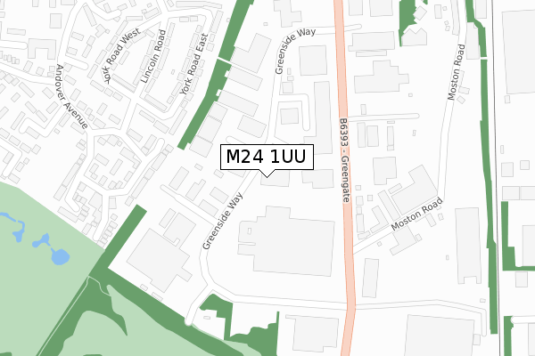
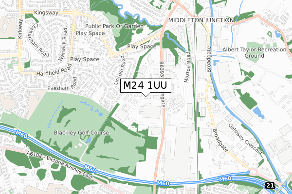
M24 1UU is located in the Chadderton South electoral ward, within the metropolitan district of Oldham and the English Parliamentary constituency of Oldham West and Royton. The Sub Integrated Care Board (ICB) Location is NHS Greater Manchester ICB - 00Y and the police force is Greater Manchester. This postcode has been in use since February 2020.


GetTheData
Source: OS Open Zoomstack (Ordnance Survey)
Licence: Open Government Licence (requires attribution)
Attribution: Contains OS data © Crown copyright and database right 2025
Source: Open Postcode Geo
Licence: Open Government Licence (requires attribution)
Attribution: Contains OS data © Crown copyright and database right 2025; Contains Royal Mail data © Royal Mail copyright and database right 2025; Source: Office for National Statistics licensed under the Open Government Licence v.3.0
| Easting | 388349 |
| Northing | 404181 |
| Latitude | 53.534167 |
| Longitude | -2.177250 |
GetTheData
Source: Open Postcode Geo
Licence: Open Government Licence
| Country | England |
| Postcode District | M24 |
➜ See where M24 is on a map ➜ Where is Chadderton? | |
GetTheData
Source: Land Registry Price Paid Data
Licence: Open Government Licence
| Ward | Chadderton South |
| Constituency | Oldham West And Royton |
GetTheData
Source: ONS Postcode Database
Licence: Open Government Licence
| Greengate/Moston Rd (Greengate) | Greengate | 178m |
| Greengate/Stagecoach Depot (Greengate) | Greengate | 219m |
| Greengate/Moston Rd (Greengate) | Greengate | 222m |
| Andover Avenue (N Bnd) (Andover Avenue) | Alkrington | 260m |
| Andover Ave (S Bnd) (Andover Ave) | Alkrington | 267m |
| Moston Station | 1.3km |
| Mills Hill (Manchester) Station | 1.9km |
GetTheData
Source: NaPTAN
Licence: Open Government Licence
GetTheData
Source: ONS Postcode Database
Licence: Open Government Licence


➜ Get more ratings from the Food Standards Agency
GetTheData
Source: Food Standards Agency
Licence: FSA terms & conditions
| Last Collection | |||
|---|---|---|---|
| Location | Mon-Fri | Sat | Distance |
| Brookside Cresent | 17:30 | 12:00 | 377m |
| Greengate | 649m | ||
| Middleton Junction P.o. | 17:30 | 12:00 | 859m |
GetTheData
Source: Dracos
Licence: Creative Commons Attribution-ShareAlike
The below table lists the International Territorial Level (ITL) codes (formerly Nomenclature of Territorial Units for Statistics (NUTS) codes) and Local Administrative Units (LAU) codes for M24 1UU:
| ITL 1 Code | Name |
|---|---|
| TLD | North West (England) |
| ITL 2 Code | Name |
| TLD3 | Greater Manchester |
| ITL 3 Code | Name |
| TLD37 | Greater Manchester North East |
| LAU 1 Code | Name |
| E08000004 | Oldham |
GetTheData
Source: ONS Postcode Directory
Licence: Open Government Licence
The below table lists the Census Output Area (OA), Lower Layer Super Output Area (LSOA), and Middle Layer Super Output Area (MSOA) for M24 1UU:
| Code | Name | |
|---|---|---|
| OA | E00026994 | |
| LSOA | E01005330 | Oldham 015B |
| MSOA | E02001112 | Oldham 015 |
GetTheData
Source: ONS Postcode Directory
Licence: Open Government Licence
| M24 1SW | Greengate Industrial Estate | 93m |
| M24 1UN | Greengate Industrial Estate | 143m |
| M24 1RU | Greengate | 218m |
| M24 1JQ | Andover Avenue | 224m |
| M24 1SE | Moston Road | 226m |
| M24 1RJ | York Road East | 237m |
| M24 1RL | York Road East | 262m |
| M24 1JW | Andover Avenue | 279m |
| M24 1RH | Lincoln Road | 297m |
| M24 1JL | Lowlands Close | 327m |
GetTheData
Source: Open Postcode Geo; Land Registry Price Paid Data
Licence: Open Government Licence