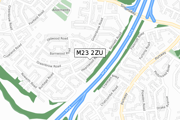
M23 2ZU is located in the Baguley electoral ward, within the metropolitan district of Manchester and the English Parliamentary constituency of Wythenshawe and Sale East. The Sub Integrated Care Board (ICB) Location is NHS Greater Manchester ICB - 14L and the police force is Greater Manchester. This postcode has been in use since October 2017.


GetTheData
Source: OS Open Zoomstack (Ordnance Survey)
Licence: Open Government Licence (requires attribution)
Attribution: Contains OS data © Crown copyright and database right 2025
Source: Open Postcode Geo
Licence: Open Government Licence (requires attribution)
Attribution: Contains OS data © Crown copyright and database right 2025; Contains Royal Mail data © Royal Mail copyright and database right 2025; Source: Office for National Statistics licensed under the Open Government Licence v.3.0
| Easting | 381322 |
| Northing | 386982 |
| Latitude | 53.379371 |
| Longitude | -2.282240 |
GetTheData
Source: Open Postcode Geo
Licence: Open Government Licence
| Country | England |
| Postcode District | M23 |
➜ See where M23 is on a map ➜ Where is Wythenshawe? | |
GetTheData
Source: Land Registry Price Paid Data
Licence: Open Government Licence
| Ward | Baguley |
| Constituency | Wythenshawe And Sale East |
GetTheData
Source: ONS Postcode Database
Licence: Open Government Licence
| Greenbrow Rd/Burbage Rd (Greenbrow Rd) | Newall Green | 132m |
| Greenbrow Rd/Dunbar Ave (Greenbrow Rd) | Newall Green | 186m |
| Greenbrow Rd/Burbage Rd (Greenbrow Rd) | Newall Green | 242m |
| Portway/Plowden R (Portway) | Woodhouse Park | 268m |
| Portway/Plowden Rd (Portway) | Woodhouse Park | 274m |
| Wythenshawe Town Centre (Manchester Metrolink) (Ainley Road) | Wythenshawe | 1,232m |
| Martinscroft (Manchester Metrolink) (Hollyhedge Road) | Newall Green | 1,401m |
| Roundthorn (Manchester Metrolink) (Southmoor Road) | Roundthorn | 1,542m |
| Manchester Airport Station | 1.7km |
| Heald Green Station | 3.2km |
| Gatley Station | 3.7km |
GetTheData
Source: NaPTAN
Licence: Open Government Licence
| Percentage of properties with Next Generation Access | 100.0% |
| Percentage of properties with Superfast Broadband | 100.0% |
| Percentage of properties with Ultrafast Broadband | 100.0% |
| Percentage of properties with Full Fibre Broadband | 0.0% |
Superfast Broadband is between 30Mbps and 300Mbps
Ultrafast Broadband is > 300Mbps
| Median download speed | 100.0Mbps |
| Average download speed | 107.4Mbps |
| Maximum download speed | 350.00Mbps |
| Median upload speed | 0.6Mbps |
| Average upload speed | 0.6Mbps |
| Maximum upload speed | 0.78Mbps |
| Percentage of properties unable to receive 2Mbps | 0.0% |
| Percentage of properties unable to receive 5Mbps | 0.0% |
| Percentage of properties unable to receive 10Mbps | 0.0% |
| Percentage of properties unable to receive 30Mbps | 0.0% |
GetTheData
Source: Ofcom
Licence: Ofcom Terms of Use (requires attribution)
GetTheData
Source: ONS Postcode Database
Licence: Open Government Licence


➜ Get more ratings from the Food Standards Agency
GetTheData
Source: Food Standards Agency
Licence: FSA terms & conditions
| Last Collection | |||
|---|---|---|---|
| Location | Mon-Fri | Sat | Distance |
| Furlong Road | 17:30 | 12:00 | 312m |
| Burnsall P.o. | 17:30 | 12:00 | 327m |
| New Hall Green | 17:30 | 12:00 | 719m |
GetTheData
Source: Dracos
Licence: Creative Commons Attribution-ShareAlike
The below table lists the International Territorial Level (ITL) codes (formerly Nomenclature of Territorial Units for Statistics (NUTS) codes) and Local Administrative Units (LAU) codes for M23 2ZU:
| ITL 1 Code | Name |
|---|---|
| TLD | North West (England) |
| ITL 2 Code | Name |
| TLD3 | Greater Manchester |
| ITL 3 Code | Name |
| TLD33 | Manchester |
| LAU 1 Code | Name |
| E08000003 | Manchester |
GetTheData
Source: ONS Postcode Directory
Licence: Open Government Licence
The below table lists the Census Output Area (OA), Lower Layer Super Output Area (LSOA), and Middle Layer Super Output Area (MSOA) for M23 2ZU:
| Code | Name | |
|---|---|---|
| OA | E00025654 | |
| LSOA | E01005068 | Manchester 051A |
| MSOA | E02001095 | Manchester 051 |
GetTheData
Source: ONS Postcode Directory
Licence: Open Government Licence
| M23 2YA | Greenbrow Road | 53m |
| M23 2ZA | Greenbrow Road | 79m |
| M23 2YE | Foxton Walk | 91m |
| M23 2YX | Hucklow Avenue | 98m |
| M23 2ZE | Oldwood Road | 117m |
| M23 2YB | Barnwood Road | 121m |
| M23 2XS | Kennett Road | 122m |
| M23 2XZ | Compton Drive | 146m |
| M23 2UY | Burbage Road | 166m |
| M22 1RL | Hurst Walk | 168m |
GetTheData
Source: Open Postcode Geo; Land Registry Price Paid Data
Licence: Open Government Licence