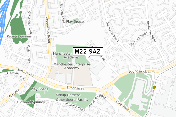
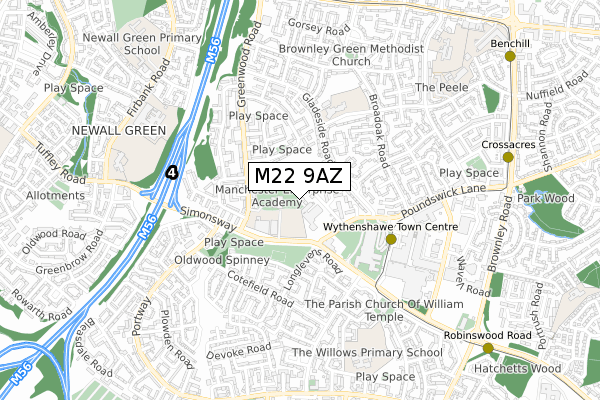
M22 9AZ is located in the Woodhouse Park electoral ward, within the metropolitan district of Manchester and the English Parliamentary constituency of Wythenshawe and Sale East. The Sub Integrated Care Board (ICB) Location is NHS Greater Manchester ICB - 14L and the police force is Greater Manchester. This postcode has been in use since September 2019.


GetTheData
Source: OS Open Zoomstack (Ordnance Survey)
Licence: Open Government Licence (requires attribution)
Attribution: Contains OS data © Crown copyright and database right 2024
Source: Open Postcode Geo
Licence: Open Government Licence (requires attribution)
Attribution: Contains OS data © Crown copyright and database right 2024; Contains Royal Mail data © Royal Mail copyright and database right 2024; Source: Office for National Statistics licensed under the Open Government Licence v.3.0
| Easting | 382190 |
| Northing | 387245 |
| Latitude | 53.381766 |
| Longitude | -2.269207 |
GetTheData
Source: Open Postcode Geo
Licence: Open Government Licence
| Country | England |
| Postcode District | M22 |
➜ See where M22 is on a map ➜ Where is Wythenshawe? | |
GetTheData
Source: Land Registry Price Paid Data
Licence: Open Government Licence
| Ward | Woodhouse Park |
| Constituency | Wythenshawe And Sale East |
GetTheData
Source: ONS Postcode Database
Licence: Open Government Licence
| Gladeside Rd/Wynyard Rd (Gladeside Rd) | Wythenshawe | 191m |
| Gladeside Rd/Wynyard Rd (Gladeside Rd) | Wythenshawe | 215m |
| Greenwood Rd/Simonsway (Greenwood Rd) | Wythenshawe | 250m |
| Greenwood Rd/Simonsway (Greenwood Rd) | Wythenshawe | 262m |
| Simonsway/Police Station (Simonsway) | Wythenshawe | 274m |
| Wythenshawe Town Centre (Manchester Metrolink) (Ainley Road) | Wythenshawe | 411m |
| Crossacres (Manchester Metrolink) (Brownley Road) | Wythenshawe | 880m |
| Robinswood Road (Manchester Metrolink) (Simonsway) | Wythenshawe | 934m |
| Benchill (Manchester Metrolink) (Brownley Road) | Benchill | 1,047m |
| Martinscroft (Manchester Metrolink) (Hollyhedge Road) | Newall Green | 1,329m |
| Manchester Airport Station | 1.9km |
| Heald Green Station | 2.6km |
| Gatley Station | 2.8km |
GetTheData
Source: NaPTAN
Licence: Open Government Licence
GetTheData
Source: ONS Postcode Database
Licence: Open Government Licence


➜ Get more ratings from the Food Standards Agency
GetTheData
Source: Food Standards Agency
Licence: FSA terms & conditions
| Last Collection | |||
|---|---|---|---|
| Location | Mon-Fri | Sat | Distance |
| Peartree Walk | 17:30 | 12:00 | 342m |
| Longlevens Road | 17:30 | 12:00 | 415m |
| Benchill P.o. | 17:30 | 12:00 | 461m |
GetTheData
Source: Dracos
Licence: Creative Commons Attribution-ShareAlike
The below table lists the International Territorial Level (ITL) codes (formerly Nomenclature of Territorial Units for Statistics (NUTS) codes) and Local Administrative Units (LAU) codes for M22 9AZ:
| ITL 1 Code | Name |
|---|---|
| TLD | North West (England) |
| ITL 2 Code | Name |
| TLD3 | Greater Manchester |
| ITL 3 Code | Name |
| TLD33 | Manchester |
| LAU 1 Code | Name |
| E08000003 | Manchester |
GetTheData
Source: ONS Postcode Directory
Licence: Open Government Licence
The below table lists the Census Output Area (OA), Lower Layer Super Output Area (LSOA), and Middle Layer Super Output Area (MSOA) for M22 9AZ:
| Code | Name | |
|---|---|---|
| OA | E00025727 | |
| LSOA | E01005090 | Manchester 050C |
| MSOA | E02001094 | Manchester 050 |
GetTheData
Source: ONS Postcode Directory
Licence: Open Government Licence
| M22 9QX | Cornfield Drive | 167m |
| M22 9GP | Mottershead Road | 192m |
| M22 9GT | Gladeside Road | 208m |
| M22 9GF | Gladeside Road | 211m |
| M22 9RE | Greenwood Road | 215m |
| M22 9GS | Gladeside Road | 220m |
| M22 9GW | Mottershead Road | 226m |
| M22 9RF | Greenwood Road | 243m |
| M22 9QP | Mottershead Road | 258m |
| M22 1AY | Bramble Walk | 264m |
GetTheData
Source: Open Postcode Geo; Land Registry Price Paid Data
Licence: Open Government Licence