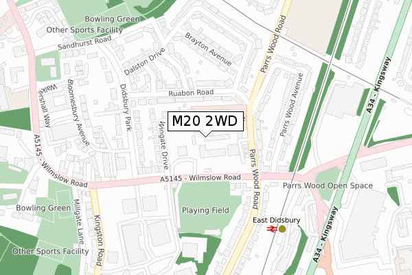
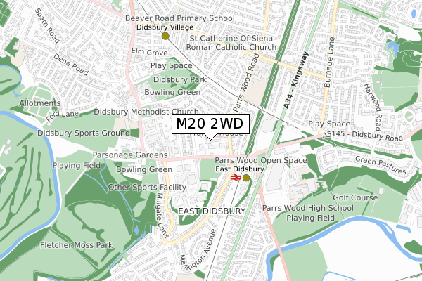
M20 2WD is located in the Didsbury East electoral ward, within the metropolitan district of Manchester and the English Parliamentary constituency of Manchester, Withington. The Sub Integrated Care Board (ICB) Location is NHS Greater Manchester ICB - 14L and the police force is Greater Manchester. This postcode has been in use since April 2020.


GetTheData
Source: OS Open Zoomstack (Ordnance Survey)
Licence: Open Government Licence (requires attribution)
Attribution: Contains OS data © Crown copyright and database right 2025
Source: Open Postcode Geo
Licence: Open Government Licence (requires attribution)
Attribution: Contains OS data © Crown copyright and database right 2025; Contains Royal Mail data © Royal Mail copyright and database right 2025; Source: Office for National Statistics licensed under the Open Government Licence v.3.0
| Easting | 385190 |
| Northing | 390518 |
| Latitude | 53.411278 |
| Longitude | -2.224262 |
GetTheData
Source: Open Postcode Geo
Licence: Open Government Licence
| Country | England |
| Postcode District | M20 |
➜ See where M20 is on a map ➜ Where is Manchester? | |
GetTheData
Source: Land Registry Price Paid Data
Licence: Open Government Licence
| Ward | Didsbury East |
| Constituency | Manchester, Withington |
GetTheData
Source: ONS Postcode Database
Licence: Open Government Licence
1, BEMPTON DRIVE, MANCHESTER, M20 2WD 2022 1 JUL £499,950 |
GetTheData
Source: HM Land Registry Price Paid Data
Licence: Contains HM Land Registry data © Crown copyright and database right 2025. This data is licensed under the Open Government Licence v3.0.
| Wilmslow Rd/Didsbury Cricket Club (Wilmslow Rd) | East Didsbury | 87m |
| Wilmslow Rd/Didsbury Cricket Club (Wilmslow Rd) | East Didsbury | 101m |
| Parrs Wood Rd/Wilmslow Rd (Parrs Wood Rd) | East Didsbury | 106m |
| Parrs Wood Rd/Ruabon Rd (Parrs Wood Rd) | East Didsbury | 149m |
| Parrs Wood Rd/Wilmslow Rd (Parrs Wood Rd) | East Didsbury | 175m |
| East Didsbury (Manchester Metrolink) (Kingsway) | East Didsbury | 474m |
| Didsbury Village (Manchester Metrolink) (Olive Shapley Avenue) | Didsbury | 672m |
| West Didsbury (Manchester Metrolink) (Lapwing Lane) | West Didsbury | 1,664m |
| East Didsbury Station | 0.3km |
| Burnage Station | 1.2km |
| Gatley Station | 2.1km |
GetTheData
Source: NaPTAN
Licence: Open Government Licence
GetTheData
Source: ONS Postcode Database
Licence: Open Government Licence


➜ Get more ratings from the Food Standards Agency
GetTheData
Source: Food Standards Agency
Licence: FSA terms & conditions
| Last Collection | |||
|---|---|---|---|
| Location | Mon-Fri | Sat | Distance |
| Parrs Wood P.o. | 17:30 | 12:00 | 171m |
| Didsbury Park | 17:30 | 12:00 | 222m |
| 10 Gawsworth Ave | 17:30 | 12:00 | 416m |
GetTheData
Source: Dracos
Licence: Creative Commons Attribution-ShareAlike
The below table lists the International Territorial Level (ITL) codes (formerly Nomenclature of Territorial Units for Statistics (NUTS) codes) and Local Administrative Units (LAU) codes for M20 2WD:
| ITL 1 Code | Name |
|---|---|
| TLD | North West (England) |
| ITL 2 Code | Name |
| TLD3 | Greater Manchester |
| ITL 3 Code | Name |
| TLD33 | Manchester |
| LAU 1 Code | Name |
| E08000003 | Manchester |
GetTheData
Source: ONS Postcode Directory
Licence: Open Government Licence
The below table lists the Census Output Area (OA), Lower Layer Super Output Area (LSOA), and Middle Layer Super Output Area (MSOA) for M20 2WD:
| Code | Name | |
|---|---|---|
| OA | E00026204 | |
| LSOA | E01005169 | Manchester 045C |
| MSOA | E02001089 | Manchester 045 |
GetTheData
Source: ONS Postcode Directory
Licence: Open Government Licence
| M20 2SN | Wilmslow Road | 39m |
| M20 5GT | Parrs Wood Road | 59m |
| M20 5WA | Parrs Wood Road | 106m |
| M20 5LW | Ruabon Road | 114m |
| M20 5QP | Wilmslow Road | 132m |
| M20 5LB | Ruabon Road | 136m |
| M20 2RT | Wingate Drive | 153m |
| M20 5WB | Parrs Wood Avenue | 168m |
| M20 5WD | Wilmslow Road | 172m |
| M20 5NL | Wilmslow Road | 184m |
GetTheData
Source: Open Postcode Geo; Land Registry Price Paid Data
Licence: Open Government Licence