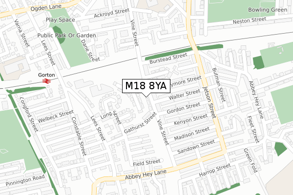
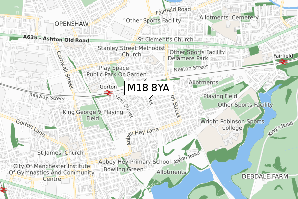
M18 8YA is located in the Gorton & Abbey Hey electoral ward, within the metropolitan district of Manchester and the English Parliamentary constituency of Manchester, Gorton. The Sub Integrated Care Board (ICB) Location is NHS Greater Manchester ICB - 14L and the police force is Greater Manchester. This postcode has been in use since December 2018.


GetTheData
Source: OS Open Zoomstack (Ordnance Survey)
Licence: Open Government Licence (requires attribution)
Attribution: Contains OS data © Crown copyright and database right 2025
Source: Open Postcode Geo
Licence: Open Government Licence (requires attribution)
Attribution: Contains OS data © Crown copyright and database right 2025; Contains Royal Mail data © Royal Mail copyright and database right 2025; Source: Office for National Statistics licensed under the Open Government Licence v.3.0
| Easting | 389362 |
| Northing | 396878 |
| Latitude | 53.468546 |
| Longitude | -2.161717 |
GetTheData
Source: Open Postcode Geo
Licence: Open Government Licence
| Country | England |
| Postcode District | M18 |
➜ See where M18 is on a map ➜ Where is Manchester? | |
GetTheData
Source: Land Registry Price Paid Data
Licence: Open Government Licence
| Ward | Gorton & Abbey Hey |
| Constituency | Manchester, Gorton |
GetTheData
Source: ONS Postcode Database
Licence: Open Government Licence
| Jetson St/Courier St (Jetson St) | Abbey Hey | 206m |
| Jetson St/Courier St (Jetson St) | Abbey Hey | 223m |
| Abbey Hey Ln/Vine St (Abbey Hey Ln) | Abbey Hey | 260m |
| Abbey Hey Ln/Vine St (Abbey Hey Ln) | Abbey Hey | 265m |
| Jetson St/Sandown St (Jetson St) | Abbey Hey | 278m |
| Cemetery Road (Manchester Metrolink) (Manchester Road) | Droylsden | 1,335m |
| Edge Lane (Manchester Metrolink) (Manchester Road) | Droylsden | 1,390m |
| Droylsden (Manchester Metrolink) (Ashton Road) | Droylsden | 1,659m |
| Gorton Station | 0.3km |
| Fairfield Station | 1.1km |
| Belle Vue Station | 1.4km |
GetTheData
Source: NaPTAN
Licence: Open Government Licence
| Percentage of properties with Next Generation Access | 100.0% |
| Percentage of properties with Superfast Broadband | 100.0% |
| Percentage of properties with Ultrafast Broadband | 100.0% |
| Percentage of properties with Full Fibre Broadband | 100.0% |
Superfast Broadband is between 30Mbps and 300Mbps
Ultrafast Broadband is > 300Mbps
| Percentage of properties unable to receive 2Mbps | 0.0% |
| Percentage of properties unable to receive 5Mbps | 0.0% |
| Percentage of properties unable to receive 10Mbps | 0.0% |
| Percentage of properties unable to receive 30Mbps | 0.0% |
GetTheData
Source: Ofcom
Licence: Ofcom Terms of Use (requires attribution)
GetTheData
Source: ONS Postcode Database
Licence: Open Government Licence


➜ Get more ratings from the Food Standards Agency
GetTheData
Source: Food Standards Agency
Licence: FSA terms & conditions
| Last Collection | |||
|---|---|---|---|
| Location | Mon-Fri | Sat | Distance |
| Constable Street | 17:30 | 12:00 | 142m |
| Abbey Hey P.o. | 17:30 | 12:00 | 202m |
| 428 Abbey Hey Lane | 17:30 | 12:00 | 242m |
GetTheData
Source: Dracos
Licence: Creative Commons Attribution-ShareAlike
The below table lists the International Territorial Level (ITL) codes (formerly Nomenclature of Territorial Units for Statistics (NUTS) codes) and Local Administrative Units (LAU) codes for M18 8YA:
| ITL 1 Code | Name |
|---|---|
| TLD | North West (England) |
| ITL 2 Code | Name |
| TLD3 | Greater Manchester |
| ITL 3 Code | Name |
| TLD33 | Manchester |
| LAU 1 Code | Name |
| E08000003 | Manchester |
GetTheData
Source: ONS Postcode Directory
Licence: Open Government Licence
The below table lists the Census Output Area (OA), Lower Layer Super Output Area (LSOA), and Middle Layer Super Output Area (MSOA) for M18 8YA:
| Code | Name | |
|---|---|---|
| OA | E00026263 | |
| LSOA | E01005187 | Manchester 021A |
| MSOA | E02001065 | Manchester 021 |
GetTheData
Source: ONS Postcode Directory
Licence: Open Government Licence
| M18 8SR | Vine Street | 39m |
| M18 8GR | Gathurst Street | 98m |
| M18 8QX | Franklyn Road | 102m |
| M18 8SS | Wycombe Avenue | 106m |
| M18 8SP | Claymore Street | 107m |
| M18 8SW | Walter Street | 107m |
| M18 8SQ | Claymore Street | 115m |
| M18 8SN | Walter Street | 118m |
| M18 8SG | Vine Street | 123m |
| M18 8SL | Gordon Street | 127m |
GetTheData
Source: Open Postcode Geo; Land Registry Price Paid Data
Licence: Open Government Licence